
To track drones effectively, start by understanding the basics like GPS, IMUs, and barometers. Next, choose the right tracking method—whether GPS, RF, or visual tracking—based on your environment and needs. Implement smartphone apps for real-time monitoring, or utilize ground stations for advanced functionality. Employ visual techniques and analyze flight data for insights into patterns and anomalies. Finally, guarantee compliance with local regulations to avoid fines. Continue exploring to uncover advanced tracking strategies and technologies.
Understanding Drone Tracking Basics
How do drones maintain accurate positioning and navigation in real-time? They utilize a combination of GPS, inertial measurement units (IMUs), and barometers to guarantee precision. Understanding drone tracking terminology is vital; terms like “geofencing” and “waypoint navigation” highlight the technology’s capabilities. The evolution of tracking technology has greatly advanced drone autonomy, enabling them to navigate complex environments with minimal human intervention. Real-time data processing allows drones to adapt to dynamic conditions, enhancing their reliability. Additionally, integration with communication systems guarantees robust data transmission, essential for effective operation. This synergy of technologies is what empowers you, the operator, to harness the full potential of drones, facilitating freedom in aerial exploration and data collection while maintaining safety and compliance. Furthermore, advanced sensor integration in drones, such as real-time obstacle detection, enhances their operational efficiency and safety during navigation. Moreover, understanding battery capacity is crucial, as it significantly influences a drone’s flight time and overall range.
Choosing the Right Tracking Method
With a solid grasp of drone tracking basics, selecting the right tracking method becomes a pivotal step in optimizing your drone’s performance. You’ll want to take into account your specific needs and the environments you’ll be flying in. Traditional GPS is reliable, but don’t overlook alternative tracking methods like RF or visual tracking. Sensor integration can enhance your tracking capabilities, providing real-time data and improving accuracy. Additionally, understanding flight time and battery performance can significantly influence your tracking method choice, especially in demanding operational scenarios. Professional drones, which typically have longer battery life, can further enhance tracking reliability in extensive flight operations.
| Tracking Method | Pros |
|---|---|
| GPS | Wide coverage, high accuracy |
| RF (Radio Frequency) | Less interference, longer range |
| Visual Tracking | No reliance on signals |
Evaluate these options carefully to guarantee you choose a method that aligns with your operational goals and enhances your freedom in the skies.
Using GPS for Drone Tracking
When it comes to drone tracking, GPS technology serves as a fundamental component, offering precise location data. You can leverage this technology for various applications, enhancing both operational efficiency and safety. Understanding the benefits of GPS tracking will enable you to maximize your drone’s capabilities in diverse environments.
GPS Technology Overview
While GPS technology is often associated with navigation, its application in drone tracking has revolutionized the way we monitor and control unmanned aerial vehicles (UAVs). By leveraging satellite communication, you can achieve precise positioning and real-time navigation, essential for effective drone operations. GPS enables you to track your drone’s location with remarkable accuracy, ensuring that you stay informed about its flight path and altitude. This technology also allows for the integration of geofencing capabilities, which can prevent drones from entering restricted airspace, enhancing safety. Additionally, the real-time data GPS provides can facilitate rapid decision-making during operations. Ultimately, understanding GPS technology can empower you to maximize your drone’s potential while maintaining control and security in the airspace.
Tracking Applications and Benefits
As you explore the myriad applications of GPS in drone tracking, you’ll quickly realize its transformative impact on various sectors. The benefits of drone tracking via GPS are substantial, enhancing operational efficiency and safety. Here’s a concise overview of its applications:
| Application | Benefits | Sector |
|---|---|---|
| Agriculture | Precision farming | Farming |
| Delivery Services | Real-time tracking | Logistics |
| Search and Rescue | Enhanced coordination | Emergency Services |
Harnessing the power of GPS for drone tracking not only improves accuracy but also provides real-time data, allowing you to make informed decisions swiftly. By integrating these systems, you can guarantee operational freedom and optimize resource allocation effectively.
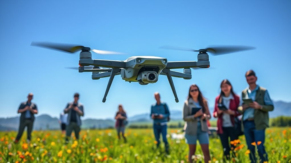
Implementing Smartphone Apps for Tracking
Implementing smartphone apps for tracking drones offers a streamlined approach to real-time monitoring and data collection. With smartphone integration, you can access critical information directly from your device, enhancing mobility and convenience. Many apps feature live GPS tracking, flight path visualization, and notifications for restricted airspace. These app features empower you to maintain control and make informed decisions, ensuring safe operations. Additionally, user-friendly interfaces allow you to quickly adapt and respond to changing conditions, maximizing your drone’s potential. By leveraging these innovative tools, you gain the freedom to explore various applications—be it for recreational use or commercial purposes. Ultimately, smartphone apps revolutionize drone tracking, providing essential capabilities at your fingertips.
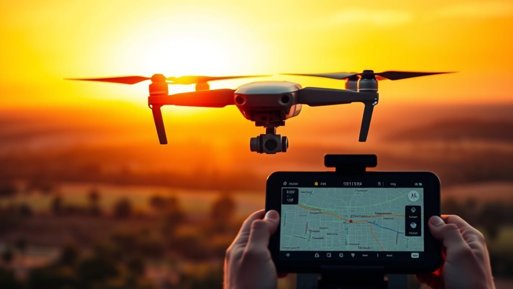
Utilizing Ground Stations for Monitoring
Smartphone apps provide a convenient way to monitor drones, but utilizing ground stations offers a more robust solution for thorough tracking and control. Ground stations come equipped with advanced features like real-time telemetry, geofencing, and customizable flight paths, enhancing your ability to manage drones effectively. They typically support multiple drone models, ensuring broad ground station compatibility. By using dedicated hardware and software, you gain access to superior signal strength and extended range, which are vital for long-distance operations. Ground stations also allow for seamless integration with other technologies, ensuring you can monitor multiple drones simultaneously. This level of control not only improves operational efficiency but also empowers you to make informed decisions swiftly, maximizing your freedom in drone management. Furthermore, the integration of advanced threat intelligence enhances your ability to respond to potential risks during drone operations, ensuring a proactive approach to safety. Additionally, the use of AI-driven analytics in ground stations can help optimize drone flight paths and resource utilization, further enhancing operational effectiveness.
Employing Visual Tracking Techniques
When tracking drones, you need to identify their flight patterns effectively. Utilizing optical devices can enhance your ability to capture accurate visual data. Analyzing this data allows you to make informed decisions about drone movements and behaviors.
Identifying Drone Flight Patterns
How can you effectively identify drone flight patterns using visual tracking techniques? Start by observing the drone’s behavior, noting its flight altitude and movement trajectory. Look for consistent patterns, such as circular paths or linear routes, which can indicate the operator’s intent or mission. Pay attention to how altitude changes correlate with certain flight phases; for instance, drones often ascend rapidly during takeoff and descend gradually when landing. Use landmarks or distinct features in the environment to assist in tracking. Documenting these observations helps establish a thorough understanding of the drone’s operational patterns. This knowledge not only enhances your tracking skills but also empowers you to anticipate the drone’s next moves, fostering a sense of autonomy in monitoring airspace.
Utilizing Optical Devices
While many enthusiasts rely on their own eyes for tracking drones, employing optical devices can greatly enhance your ability to monitor their movements with precision. Optical sensors, such as high-resolution cameras and telescopic lenses, allow for detailed observation from a distance, ensuring you capture every flight maneuver. These devices improve tracking precision by minimizing human error and extending your visual range. By integrating advanced technologies like infrared or thermal imaging, you can effectively track drones even in low visibility conditions. Ultimately, utilizing optical devices not only amplifies your tracking capabilities but also empowers you with the freedom to explore drone activity without compromising accuracy. Embrace these tools to elevate your drone tracking experience.
Analyzing Visual Data
Effective analysis of visual data is essential for successful drone tracking, and there are several key techniques you can employ. Start by leveraging image recognition algorithms to identify and classify drones in real-time. These algorithms can distinguish drones from other objects, enhancing your tracking accuracy. Next, focus on data interpretation to analyze movement patterns and trajectories. By employing optical flow methods, you can assess the direction and speed of the drone, providing critical insights for monitoring. Additionally, integrating machine learning can refine your analysis, allowing for adaptive responses to changing environments. Ultimately, mastering these techniques empowers you to maintain control and oversight, ensuring that your tracking efforts align with your desire for freedom and autonomy in drone operations.
Analyzing Flight Data and Patterns
As you explore analyzing flight data and patterns, understanding the various metrics is essential for extracting meaningful insights. Start with flight path analysis, focusing on the trajectory of the drone. By mapping its route, you can identify anomalies or deviations from expected behavior. Utilize data visualization tools to create visual representations of this data, making it easier to interpret trends and patterns. Pay attention to metrics like altitude, speed, and duration, as they reveal vital operational details. Furthermore, consider how signal strength affects communication reliability, which is key to maintaining control during flights. Examine the frequency of flights in specific areas, as this can indicate preferred routes or potential congestion. Additionally, understanding battery capacity helps in determining how long the drone can sustain its flight, which is critical for effective planning. By synthesizing this information, you enhance your ability to make informed decisions about drone operations, ensuring you harness the freedom that drone technology offers.
Ensuring Compliance With Regulations
To operate drones safely and responsibly, it is crucial to understand and adhere to the myriad regulations governing their use. Regulatory compliance isn’t just a legal obligation; it is important for maintaining public trust and ensuring your freedom to fly. Familiarize yourself with local drone laws, which can vary greatly by region. This includes understanding altitude restrictions, no-fly zones, and registration requirements, including the need for an identification number to be affixed to your drone. Always check for updates, as regulations can change swiftly in response to technological advancements and public safety concerns. Maintaining compliance not only protects you from potential fines but also contributes to a safer airspace for everyone. By respecting these guidelines, you can enjoy the benefits of drone operation while safeguarding your rights as a pilot. Additionally, understanding airspace classifications is essential for determining where you can legally fly your drone.
Troubleshooting Common Tracking Issues
While tracking drones can enhance operational efficiency, various issues can arise that hinder their effectiveness. One common problem is signal interference, often caused by physical obstructions or competing frequencies. To mitigate this, verify your tracking system operates on a clear channel and reposition the receiver if necessary. Another frequent issue is software glitches, which can disrupt data accuracy. Regular updates and maintenance of your tracking software are critical; check for patches or improvements from the manufacturer. If glitches persist, consider reinstalling the software to reset its functionality. By addressing these areas, you can greatly improve your tracking capabilities and maintain the freedom and reliability that effective drone tracking offers. Additionally, being aware of signal attenuation caused by physical barriers can help you strategize the placement of your tracking equipment for optimal performance. Understanding detection technologies can also provide insights into enhancing tracking efficiency and minimizing interference.
Frequently Asked Questions
What Are the Best Drones for Tracking Purposes?
For effective tracking, consider the DJI Mavic 3, which boasts advanced tracking technology and features like obstacle avoidance. Its reliability guarantees you can maintain freedom in your aerial endeavors without losing sight of your objectives.
How Do Weather Conditions Affect Drone Tracking?
Weather conditions greatly impact drone tracking. Wind interference can disrupt stability and accuracy, while temperature effects may alter battery performance and sensor functionality. Understanding these factors is essential for ideal drone operation and reliable tracking outcomes.
Can Drone Tracking Be Used for Wildlife Monitoring?
Imagine silently soaring above vast forests, observing wildlife behavior with precision. Drone tracking technology enables you to monitor animal movements, providing invaluable data for conservation efforts and enhancing your understanding of ecosystems while promoting freedom in wildlife observation.
What Are the Privacy Concerns With Drone Tracking?
Drone tracking raises significant privacy concerns, particularly regarding data security and ethical implications. You should consider how surveillance can infringe on personal freedoms, leading to potential misuse of collected data without adequate oversight or regulation.
How Can I Improve My Drone’s Tracking Accuracy?
To improve your drone’s tracking accuracy, focus on GPS calibration and sensor optimization. Regularly calibrate your GPS, and fine-tune your sensors to enhance data collection, ensuring precise navigation and greater freedom in your aerial operations.
