
Drones without cameras are designed for various applications, like agricultural monitoring, logistics, land surveying, infrastructure inspection, emergency response, and environmental research. For instance, agricultural drones leverage sensors to assess crop health, while surveying drones facilitate accurate land measurement. Inspection drones optimize infrastructure evaluations. Additionally, research drones gather essential ecological data without imaging devices. These specialized drones enhance operational efficiency and provide important insights across multiple fields. Discover more about their functionalities and applications for a thorough understanding.
Agricultural Drones for Crop Monitoring and Management
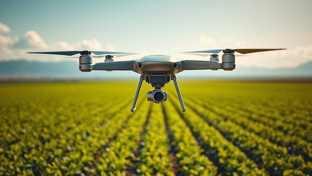
While you might think of drones primarily as tools for aerial photography, agricultural drones without cameras play an essential role in crop monitoring and management. These drones utilize sensors to gather critical data on crop health and soil analysis. By measuring factors like temperature, moisture levels, and nutrient content, they provide farmers with actionable insights. This data allows for precise interventions, optimizing resource use and enhancing yields. Additionally, drones can cover vast areas quickly, greatly improving efficiency compared to traditional methods. They enable real-time monitoring, allowing you to respond swiftly to potential issues, such as pest infestations or nutrient deficiencies. Essentially, these advanced tools empower farmers, promoting sustainable practices and maximizing productivity while ensuring freedom in agricultural decision-making. Moreover, advanced collision avoidance features ensure safety during operations, allowing farmers to focus on their crops without concerns about drone mishaps. Furthermore, the integration of precision farming techniques enhances the effectiveness of these drones by providing detailed insights that inform sustainable agricultural practices.
Delivery Drones for Logistics and Supply Chain
As agricultural drones optimize crop management through data collection, delivery drones are revolutionizing logistics and supply chains. These unmanned aerial vehicles enhance delivery efficiency by streamlining operations and reducing transit times. With advancements in technology, businesses can adapt to consumer needs while maneuvering through drone regulations.
- Faster delivery times enhance customer satisfaction.
- Cost reduction in traditional logistics methods.
- Sustainable delivery options reduce carbon footprints.
- Increased accessibility to remote locations, similar to how drones automate crop monitoring for enhanced productivity.
Moreover, the integration of AI-powered navigation systems allows for precise delivery and obstacle avoidance, further improving operational efficiency. However, to realize their full potential, companies must stay informed about evolving drone regulations, ensuring compliance while maximizing operational capabilities. Embracing delivery drones not only transforms logistics but also grants businesses the freedom to innovate and meet demands efficiently.
Surveying Drones for Land Measurement and Mapping
When considering surveying drones for land measurement and mapping, you’ll encounter various types designed for specific applications. These drones can enhance accuracy and efficiency in data collection, while non-camera models offer distinct advantages such as reduced privacy concerns and lower data processing requirements. Understanding these elements is essential for optimizing your surveying projects.
Types of Surveying Drones
Surveying drones come in various types, each tailored for specific land measurement and mapping tasks. Understanding these types is essential for choosing the right drone based on your needs and the required surveying techniques. Here are some common types you might consider:
- Fixed-Wing Drones: Ideal for covering large areas quickly, with extended flight times.
- Multirotor Drones: Excellent for detailed, high-resolution mapping, offering vertical takeoff and landing.
- Hybrid Drones: Combine fixed-wing and multirotor features for versatility in various terrains.
- Surveying Drones with RTK: Equipped with Real-Time Kinematic technology for precise positioning, enhancing accuracy in measurements.
Applications in Land Measurement
In land measurement and mapping, surveying drones offer significant advantages that enhance accuracy and efficiency. By employing advanced land survey techniques, you can gather precise topographical data without the limitations of traditional methods. Utilizing drone navigation, these unmanned aerial vehicles can quickly cover vast areas, capturing essential information on terrain contours and property boundaries. Their ability to operate autonomously reduces human error, ensuring reliable results. Furthermore, drones can access difficult-to-reach locations, providing insights that would otherwise require extensive ground surveying. This not only saves time but also minimizes disruption to the environment. As you explore the applications of surveying drones, you’ll find they fundamentally transform how land measurement is conducted, promoting greater freedom in project execution and planning.
Advantages of Non-Camera Drones
While many drones are equipped with cameras for capturing visual data, non-camera drones offer unique advantages specifically tailored for land measurement and mapping. These drones enhance operational efficiency and provide precise data without the distractions of imaging technology. Here are some key non-camera benefits you might consider:
- Enhanced Accuracy: Non-camera drones often utilize LIDAR and GPS systems for high-precision data collection.
- Cost-Effectiveness: They generally require less maintenance and can be more affordable regarding initial investment and operational costs.
- Increased Versatility: These drones can adapt to various surveying tasks beyond imaging, such as soil analysis and topographical mapping.
- Greater Signal Integrity: Non-camera drones experience fewer interferences, ensuring more reliable data transmission during surveys.
With these advantages, you can maximize your surveying capabilities.
Inspection Drones for Infrastructure and Maintenance
As infrastructure demands grow, utilizing inspection drones for maintenance tasks has become increasingly essential. These maintenance drones can efficiently assess structural integrity, reducing the need for manual inspections that can be time-consuming and risky. They’re equipped with various sensors to perform infrastructure inspections, offering real-time data for better decision-making. This capability aligns with real-time data collection practices, allowing for timely interventions that enhance safety and efficiency. Additionally, drones like the Flyability Elios 4 excel in navigating complex structures, making them invaluable for inspections in hazardous environments.
| Drone Type | Primary Use | Advantages |
|---|---|---|
| Fixed-Wing Drones | Large area inspection | Longer flight times |
| Multi-Rotor Drones | Detailed inspections | Maneuverability in tight spots |
| Hybrid Drones | Versatile applications | Combines benefits of both |
Search and Rescue Drones for Emergency Response
In emergency response scenarios, search and rescue drones equipped with thermal imaging technology can detect heat signatures, greatly enhancing victim location efforts. In addition, integrating ground penetrating radar allows for the identification of individuals trapped beneath debris or in difficult-to-reach areas. These advanced capabilities make drones an invaluable asset in critical situations, optimizing response times and increasing the likelihood of successful rescues. Furthermore, the integration of thermal imaging technology allows for swift detection of heat signatures, enabling rapid identification of individuals and threats even in low-visibility environments. Additionally, the use of AI-driven algorithms in these drones improves their ability to adapt to changing environments and enhances decision-making during rescue operations.
Thermal Imaging Technology
Thermal imaging technology has revolutionized search and rescue operations, enabling responders to locate individuals in challenging environments with remarkable efficiency. By utilizing thermal sensors, these drones excel in heat detection, even in complete darkness or adverse weather conditions. This capability considerably enhances the chances of survival for those in distress.
- Identifies heat signatures from a distance
- Aids in locating missing persons quickly
- Operates effectively in low-visibility situations
- Reduces time and resources required for searches
Incorporating thermal imaging into drone technology not only streamlines rescue missions but also empowers responders with the tools necessary to act swiftly and decisively. This innovative approach embodies a commitment to saving lives and maximizing operational effectiveness.
Ground Penetrating Radar
Ground Penetrating Radar (GPR) has emerged as an indispensable tool in the arsenal of search and rescue drones, greatly enhancing their ability to locate individuals or objects buried beneath the surface. By utilizing advanced ground radar technology, these drones can perform subsurface imaging, revealing detailed information about what lies below. This capability is vital during emergency response operations, where timely and accurate data can mean the difference between life and death. With GPR, you’re not just relying on surface-level indicators; instead, you’re harnessing a powerful method to visualize underground conditions. As a result, search and rescue teams can respond more effectively to incidents, ensuring their operations are grounded in reliable data that facilitates ideal decision-making in critical situations.
Research Drones for Environmental and Scientific Studies
While many people associate drones with aerial photography, research drones equipped without cameras play an essential role in environmental and scientific studies. These drones are designed to gather critical data that can inform our understanding of ecological systems and their environmental impact. They’re often equipped with specialized sensors and tools that enhance data collection capabilities.
- Soil moisture analysis
- Air quality monitoring
- Wildlife tracking
- Thermal imaging for climate studies
Frequently Asked Questions
What Are the Benefits of Drones Without Cameras?
Drones without cameras excel in applications like delivery or surveying, enhancing flying efficiency and reducing weight. They offer freedom from privacy concerns, allowing you to focus on operational effectiveness while maintaining compliance with regulations.
Can Non-Camera Drones Be Used for Entertainment?
When it comes to non-camera drones, you can really have your cake and eat it too. They’re perfect for drone racing and aerial shows, offering thrilling experiences without the need for capturing footage.
How Do Drones Without Cameras Navigate and Operate?
Drones without cameras navigate using advanced navigation systems and various drone sensors. These components allow them to detect obstacles, maintain altitude, and follow programmed flight paths, ensuring efficient operation while providing you with freedom in aerial exploration.
Are There Specific Regulations for Non-Camera Drones?
Yes, there are specific regulations for non-camera drones. The regulatory framework categorizes drones based on classifications, ensuring compliance with safety standards while allowing you the freedom to operate them responsibly within designated airspace.
What Is the Typical Range of Drones Lacking Cameras?
The typical range of drones lacking cameras can vary like a bird’s flight path, influenced by drone specifications and flight capabilities. Generally, these drones can reach distances between 1 to 10 kilometers, depending on design and purpose.
