
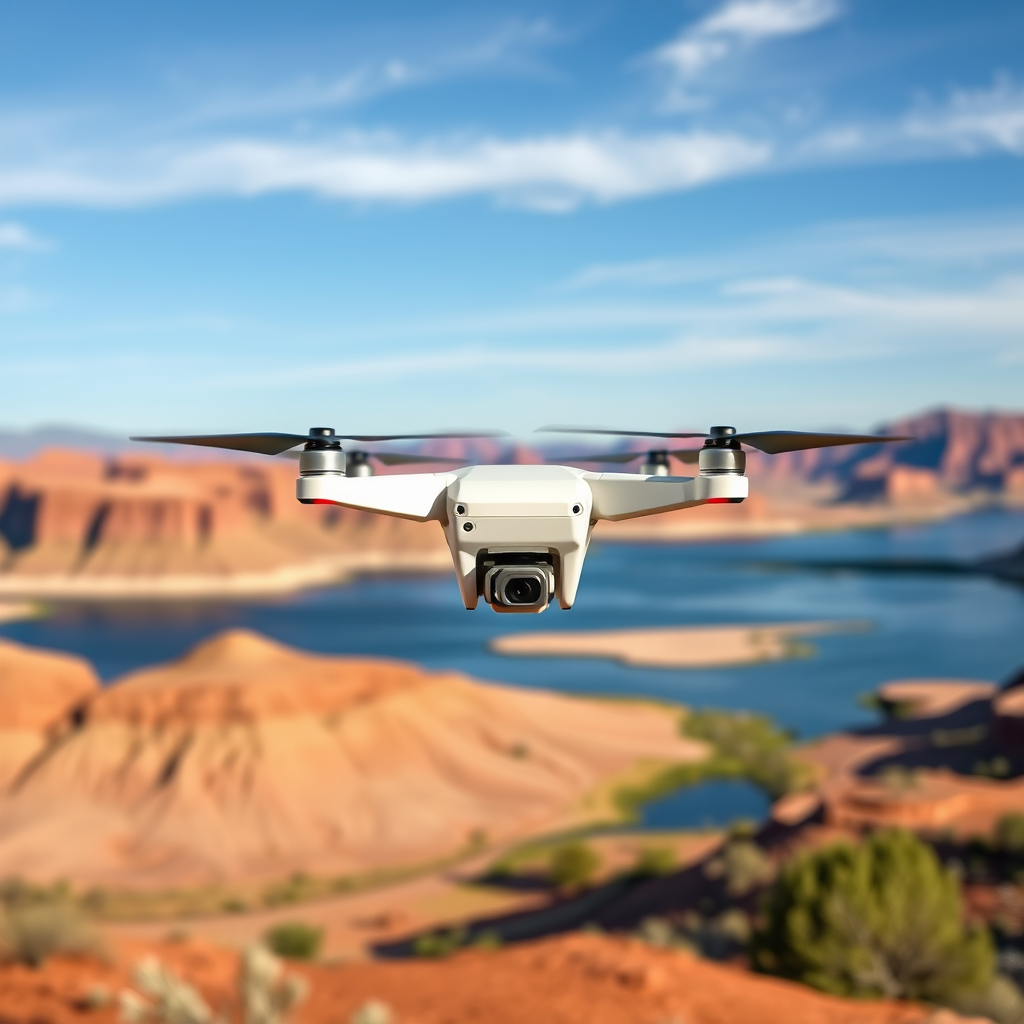
Yes, you can fly a drone at Lake Powell, but there are specific regulations and guidelines you must follow to ensure compliance and safety. Nestled between Utah and Arizona, Lake Powell is a breathtaking destination for both tourists and drone enthusiasts. However, to capture the stunning landscapes without running afoul of the law, it’s essential to understand the regulations governing drone use in this iconic area. In this article, we will explore the key points regarding drone usage at Lake Powell, including regulations, best practices, and tips for capturing stunning aerial footage.
Understanding Drone Regulations at Lake Powell

The National Park Service (NPS) regulates drone use in national parks, including Lake Powell, as part of its mission to protect natural resources and ensure visitor safety. The use of drones is generally prohibited in all national parks unless specifically authorized by a special permit. This prohibition is designed to protect wildlife, preserve the tranquility of the natural environment, and minimize disturbances to other visitors. The NPS has established these regulations to maintain the integrity of the park’s ecosystems and to ensure that all visitors can enjoy the park without the disruptive noise and presence of drones. Violating these regulations can lead to fines and the possible revocation of your drone flying privileges.
For those considering flying a drone at Lake Powell, it’s crucial to familiarize yourself with the specific regulations that apply to the surrounding areas, particularly if you plan to venture into the Glen Canyon National Recreation Area, which may have different rules than those in designated national parks.
Permits and Permissions
Before flying your drone at Lake Powell, checking whether you need a special permit for drone activities is essential, especially for commercial use. The NPS requires that any commercial drone operation be conducted under a special use permit, which may involve an application process that outlines your intended use of the drone, flight plans, and insurance coverage. It is advisable to start this process well in advance of your planned visit, as approvals can take time.
In addition to obtaining necessary permits, always notify the park authorities about your drone usage plans. This proactive approach not only ensures compliance but also helps park staff manage visitor safety and minimize disturbances to wildlife. Failure to adhere to these guidelines can result in fines or other penalties, so it is crucial to approach drone flying at Lake Powell with diligence and respect for the regulations in place.
Best Times to Fly Your Drone
Timing is everything when it comes to drone photography, and Lake Powell is no exception. Early mornings or late afternoons provide optimal lighting for photography and typically feature fewer crowds. During these times, the sunlight is softer, creating ideal conditions for capturing vibrant colors and stunning contrasts in the landscape. The golden hour, just after sunrise and just before sunset, is particularly renowned for producing breathtaking aerial shots.
In addition to considering the time of day, it’s also essential to monitor weather conditions. Windy days can significantly affect drone stability and flight safety, making it challenging to achieve smooth footage. Check local weather forecasts prior to your flight and avoid flying during adverse conditions, such as storms or high winds, to ensure a safe and successful drone operation.
Recommended Drone Flight Areas
Identifying specific zones within Lake Powell where drone flying is allowed is crucial for compliance and enjoyment. While the majority of Lake Powell is governed by strict regulations, some areas within the Glen Canyon National Recreation Area may allow drone flying. However, it is vital to respect boundaries and avoid sensitive ecological areas, such as nesting sites for birds or areas with endangered species.
Additionally, keeping a safe distance from congested visitor spots is essential to minimize disturbances and ensure the safety of fellow park-goers. When planning your flight, utilize maps and resources provided by the NPS or local guides to identify permissible zones, ensuring you enjoy the beauty of Lake Powell while remaining respectful of its natural and social environments.
Safety Considerations While Flying
Safety should always be a top priority when operating a drone, especially in busy outdoor environments like Lake Powell. One of the fundamental safety regulations is to maintain a visual line of sight with your drone at all times. This practice not only helps you avoid collisions with other aircraft or natural obstacles but also allows you to keep track of your drone’s status and battery life.
Additionally, keeping your drone at least 400 feet above ground level is required to comply with FAA regulations. This height helps ensure that you remain within the legal flying limits and reduces the risk of interference with other air traffic. Always be aware of your surroundings and any potential hazards, such as wildlife or other visitors, to ensure a safe and enjoyable flying experience.
Tips for Capturing Stunning Footage
Capturing fantastic aerial footage at Lake Powell requires careful planning and creativity. Start by mapping out your shots in advance, utilizing waypoints to create smoother flight paths and ensure you don’t miss out on key perspectives. Consider the unique geological features of Lake Powell, such as its dramatic cliffs and expansive canyons, and plan your routes accordingly.
Experimenting with different angles and heights can lead to dynamic and captivating footage. Aerial views of the iconic glacially-carved landscapes can highlight the park’s stunning beauty, while close-up shots of rock formations can reveal intricate details often missed from the ground. Don’t hesitate to try various settings on your drone, such as different speeds and camera angles, to discover the best combinations for your desired outcome.
Post-Flight Responsibilities
After your drone flight, take time to review and edit your footage while adhering to copyright and privacy laws. Respect the rights of individuals captured in your footage, as well as any sensitive content that may be found in your recordings. If you plan to share your experiences on social media or other platforms, consider crediting the location and discussing the importance of responsible drone use in natural spaces.
Additionally, sharing your insights and experiences can help other drone enthusiasts navigate the complexities of flying at Lake Powell. Engaging with the community can foster a greater understanding of the regulations and best practices essential for preserving the park’s natural beauty for future generations.
In conclusion, flying a drone at Lake Powell is possible but requires adherence to specific regulations and safety guidelines. By understanding the regulations, obtaining necessary permits, choosing the best times to fly, and being mindful of safety considerations, you can enjoy a fantastic drone flying experience. Moreover, by capturing the breathtaking beauty of this stunning location through stunning aerial footage, you can contribute to the appreciation and preservation of Lake Powell’s natural wonders. Always remember to respect the environment and fellow visitors, ensuring that drone flying remains a positive and enriching experience for everyone.
Frequently Asked Questions
Can you fly a drone at Lake Powell?
Yes, you can fly a drone at Lake Powell, but there are specific regulations and guidelines you must follow. Since Lake Powell is located within the Glen Canyon National Recreation Area, you will need to adhere to the Federal Aviation Administration (FAA) rules as well as any local regulations put forth by the National Park Service. It’s crucial to check for restrictions related to certain areas, such as near marinas or residential zones, where drone use may be prohibited.
What are the regulations for flying a drone at Lake Powell?
When flying a drone at Lake Powell, you must comply with the FAA regulations, which require you to keep your drone within visual line of sight and below 400 feet. Additionally, drones are not allowed to be flown over crowds, and commercial drone pilots must obtain a special permit. It’s also important to check for any temporary flight restrictions that may be in place due to events or wildlife considerations.
How can I ensure that I fly my drone safely at Lake Powell?
To fly your drone safely at Lake Powell, first familiarize yourself with the local airspace and any no-fly zones designated by the FAA or the National Park Service. Conduct a pre-flight check of your drone to ensure it’s in good working condition, and always be aware of your surroundings to avoid other aircraft, wildlife, and people. Respect the natural environment and avoid disturbing wildlife, especially nesting birds, by maintaining an appropriate distance.
What are the best places to fly a drone at Lake Powell?
Some of the best places to fly a drone at Lake Powell include remote areas away from crowded beaches and marinas, like the Rainbow Bridge and the various slot canyons. These locations provide stunning landscapes and unique geological formations that make for breathtaking aerial photography. However, always verify local regulations for specific sites, as drone access may vary based on proximity to sensitive areas or park facilities.
Why should I check local rules before flying my drone at Lake Powell?
Checking local rules before flying your drone at Lake Powell is essential to ensure compliance with both federal and park-specific regulations. Not only can ignoring these rules lead to fines or confiscation of your drone, but it also helps protect the natural environment and wildlife in the area. Understanding the regulations beforehand allows you to enjoy your drone experience fully while being responsible and respectful of the park’s regulations and other visitors.
References
- https://www.nps.gov/glca/planyourvisit/drone-use.htm
- https://www.faa.gov/uas/getting_started/part_107/
- https://www.lakepowell.com/faq/
- https://www.usbr.gov/recmanagement/faq.html
- https://www.nps.gov/subjects/drones/index.htm
- https://www.azgfd.com/hunting/faq/
- https://www.abcnews.go.com/US/drone-use-national-parks-raises-concerns/story?id=66810081
