

If you lose your drone, first check its last known GPS location through your controller or app. Retrace your exact flight path, focusing on where the signal was lost. Search the area systematically on foot, using a grid pattern to cover ground efficiently. Use drone finder apps or manufacturer tools for live tracking. Don’t hesitate to involve local authorities and drone communities for assistance. Following these steps increases your chances of recovery. Further guidance can help you optimize your search effectively.
Check Your Drone’s Last Known Location
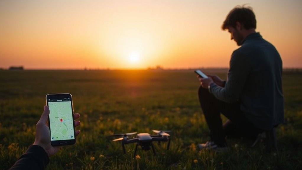
Before you begin searching broadly, pinpoint your drone’s last known location using the GPS data from the controller or the drone’s app. This initial step is critical for efficient lost drone recovery. Access the tracking technology embedded in your device to retrieve precise coordinates. Confirm these details carefully—accuracy here narrows your search area dramatically. By methodically analyzing this data, you avoid wasting time and resources. Remember, your drone’s last known location is your strongest lead; it empowers you to act decisively and regain control. Stay focused on this exact point before expanding your search, ensuring every move you make is strategic. This disciplined approach aligns with the freedom you seek, letting you recover your drone swiftly and continue exploring without unnecessary delay.
Use the Drone’s Built-In GPS Tracking Features
You should activate your drone’s GPS tracking before each flight to guarantee accurate location data. Access the flight logs through your drone’s app to pinpoint its last recorded position. Additionally, enable geofencing alerts to receive immediate notifications if your drone leaves a designated area.
Activate GPS Tracking
Although activating GPS tracking may seem straightforward, it requires confirming your drone’s built-in GPS features are properly enabled before takeoff. GPS technology integrated into your drone acts as a crucial tracking device, allowing you to pinpoint its location if it goes astray. Before launching, verify the GPS signal strength and activate tracking through the drone’s control app or remote. This proactive step is fundamental for maintaining freedom in the skies without risking loss.
| Step | Action |
|---|---|
| 1. Verify GPS Signal | Check signal bars on controller |
| 2. Enable Tracking | Activate GPS tracking in app |
| 3. Confirm Status | Confirm system shows “Active” |
Access Flight Logs
When your drone goes missing, accessing the flight logs through its built-in GPS tracking features becomes essential for locating it. Start by connecting your controller or app to retrieve the stored flight data. Carefully analyze the flight data, focusing on GPS coordinates, altitude, and timestamps. This information helps you identify the drone’s last known position. Next, review flight patterns to understand its route and potential drift caused by wind or signal loss. This methodical approach narrows your search area considerably. Remember, precise analysis of these logs is your best tool for reclaiming freedom in the skies. Don’t overlook any detail—each data point brings you closer to your drone, empowering you to recover it efficiently and confidently.
Use Geofencing Alerts
One of the most effective tools for locating a lost drone is geofencing alerts, which leverage the drone’s built-in GPS tracking capabilities. Geofencing technology sets virtual boundaries, triggering alert notifications if your drone crosses them. These alerts help you quickly pinpoint its location and recover your device without unnecessary searching.
| Feature | Purpose | Benefit |
|---|---|---|
| Geofencing Setup | Define flight boundaries | Prevents drone from straying |
| Alert Notifications | Immediate breach alerts | Enables rapid response |
| GPS Tracking | Real-time location updates | Facilitates precise recovery |
| Mobile App | Centralized control | Easy access to geofencing data |
| Battery Monitoring | Status updates | Guarantees drone endurance during search |
Use these tools methodically to maintain control and freedom in your drone flights.
Retrace Your Flight Path Methodically
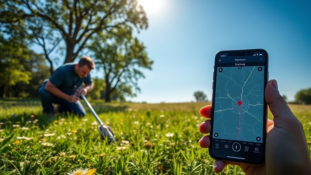
Start by mapping your entire flight route to establish a clear search area. Focus on key landmarks you passed and note where the drone’s signal weakened or was lost. This methodical approach narrows down potential locations and increases your chances of recovery.
Map Your Flight Route
Although it might seem straightforward, mapping your flight route requires careful attention to detail and a systematic approach. Start by reviewing your flight planning notes or app logs to reconstruct the exact path your drone took. Use route optimization techniques to streamline this process, focusing on key waypoints and turns. Chart the route methodically on a map, marking each segment clearly to avoid missing any section. This precise mapping helps you visualize potential areas where the drone could have deviated or crashed. By committing to a structured route mapping, you’ll narrow your search area effectively, conserving time and resources. Taking these methodical steps guarantees you maintain control over the search, empowering you to recover your drone and reclaim your freedom to explore.
Identify Key Landmarks
Landmarks serve as essential reference points when retracing your drone’s flight path. Begin by pinpointing notable features such as buildings, trees, or terrain changes that stood out during your flight. Effective landmark recognition sharpens your visual navigation skills, allowing you to methodically reconstruct the drone’s route. Focus on distinct, immovable objects visible from the ground to maintain orientation. By systematically identifying and following these key points, you create a mental map linking your departure location to the drone’s last known position. This approach minimizes guesswork and maximizes search efficiency. Remember, your ability to recognize and use landmarks is critical to narrowing the search area and reclaiming your drone, ensuring you regain control and freedom over your aerial exploration.
Track Signal Loss Points
When your drone goes missing, tracking the points where you lost signal is essential to narrowing down its location. Start by methodically retracing your flight path and pinpointing each spot where signal interference occurred. This step helps you identify areas with potential obstacles like dense trees, buildings, or electromagnetic interference that may have disrupted communication. Use your drone’s tracking technologies, such as GPS logs or flight telemetry, to map these critical points accurately. By correlating signal loss with terrain features, you can focus your search on zones where the drone likely dropped connection and landed or hovered. Staying systematic prevents wasted effort and maximizes your chances of recovery. Remember, understanding signal interference patterns is key to regaining control and freedom with your drone.
Search the Surrounding Area on Foot
Since drones often land or crash within a short distance of their last signal, you should methodically search the surrounding area on foot. Begin by establishing a grid pattern to cover the terrain efficiently, ensuring you don’t miss any spots. Use systematic search techniques, such as walking parallel lines spaced a few meters apart, adapting foot strategies to the environment—whether it’s dense brush or open fields. Stay observant for any unusual debris or drone parts, scanning both the ground and nearby trees or bushes. Move deliberately and mark searched areas to avoid overlap. This disciplined approach maximizes your chances of finding your drone quickly, giving you the freedom to recover your device without unnecessary frustration or wasted time.
Utilize Drone Finder Apps and Online Tools
Although searching on foot is essential, leveraging drone finder apps and online tools can greatly enhance your recovery efforts. These resources harness GPS data and community networks, helping you pinpoint your drone’s last known location with greater accuracy. To maximize their effectiveness, follow these steps:
Utilize drone finder apps and online tools to accurately track your drone’s last location and improve recovery chances.
- Download reliable drone finder apps compatible with your drone model to access live GPS tracking.
- Use online tracking tools provided by the drone manufacturer or third-party services to monitor flight paths and detect signal loss.
- Enable geofencing and alert features within these tools to receive instant notifications if your drone leaves a designated area.
Ask for Help From Local Communities and Authorities
If your drone remains missing despite your initial efforts, reaching out to local communities and authorities can greatly increase your chances of recovery. Start by contacting local law enforcement to report the loss; they can advise on any found drone reports and patrol areas. Tap into local resources such as community forums, social media groups, and neighborhood apps where residents share updates. Posting detailed information, including your drone’s description and last known location, invites community support and vigilance. Engage with drone enthusiast clubs or local hobbyist groups—they often have experience in locating lost drones and can assist with search efforts. By leveraging these local networks and official channels, you create a coordinated search approach, enhancing your drone’s recovery prospects while fostering community collaboration.
Prevent Future Losses With Proper Drone Maintenance and Safety Practices
Connecting with local communities and authorities can improve your chances of recovering a lost drone, but the best strategy is to minimize the risk of loss in the first place. Proper drone maintenance and safety practices are essential to protect your investment and maintain your freedom to fly. Follow these three critical steps:
- Conduct routine pre-flight inspections to check battery health, propeller integrity, and firmware updates.
- Follow established safety practices, like flying within line of sight and avoiding adverse weather or restricted zones.
- Store your drone securely and transport it carefully to prevent physical damage.
