
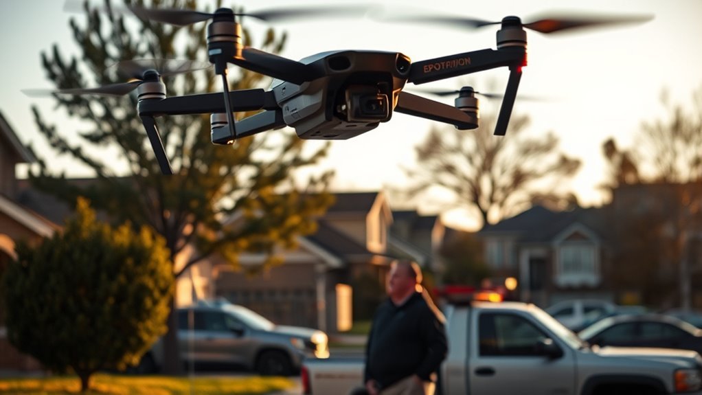
Drones play a pivotal role in repossession by enhancing aerial surveillance and improving asset locating accuracy. They provide real-time data collection, allowing for quick assessments of hard-to-reach areas while ensuring increased safety for agents through proactive situation analysis. Cost-effective operations are achieved through automation and remote monitoring, streamlining the recovery process. By integrating with GPS and mapping technologies, drones optimize decision-making. Explore how these innovations shape the future of asset recovery beyond traditional methods.
Enhanced Aerial Surveillance Capabilities
As technology evolves, drones have emerged as pivotal tools in enhancing aerial surveillance capabilities for repossession efforts. You can leverage aerial imagery analysis to identify and track valuable assets efficiently. By utilizing advanced drone flight patterns, you can cover expansive areas quickly, minimizing the time spent on site visits. This approach not only optimizes resources but also provides real-time data, allowing for informed decision-making. The integration of high-resolution cameras and sensors enables you to gather critical information on asset locations and conditions. With drones, you can achieve unprecedented levels of situational awareness, ensuring that repossession efforts are executed with precision. This innovative solution empowers you to reclaim assets while maintaining operational effectiveness and freedom in your strategic choices. Additionally, the incorporation of advanced collision-avoidance sensors enhances safety during inspections in complex environments. Drones equipped with high-resolution cameras can capture detailed imagery, further aiding in the evaluation of asset conditions.
Improved Locating Accuracy
In repo operations, the accuracy of locating assets is essential, and drones greatly enhance this capability. With real-time location tracking and advanced mapping technology, you’ll find that identifying and monitoring collateral becomes far more efficient. This precision not only streamlines the recovery process but also minimizes risks associated with asset retrieval.
Enhanced Surveillance Capabilities
While traditional methods of locating repossessed vehicles often rely on ground-based techniques, drones offer a revolutionary enhancement in surveillance capabilities. You’ll find that these aerial solutions improve locating accuracy through:
- Advanced imaging technology, providing high-resolution visuals
- Real-time data analysis, allowing for quick decision-making
- Increased coverage area, enabling access to hard-to-reach locations
These factors streamline the repossession process, but it’s essential to reflect on drone regulations and ethical considerations. Balancing surveillance efficiency with privacy rights guarantees you’re operating within legal frameworks while maintaining your freedom to utilize innovative solutions. By embracing drones, you’re not just enhancing your operational capabilities; you’re also paving the way for a more effective and responsible repossession industry.
Real-Time Location Tracking
Real-time location tracking through drones greatly enhances the accuracy of repossession efforts, allowing you to pinpoint vehicle locations with unprecedented precision. Utilizing advanced drone technology, you can access location analytics that deliver real-time data on vehicle movements and status. This capability not only streamlines the repossession process but also empowers you to make informed decisions swiftly. By leveraging GPS and high-resolution imaging, drones provide an all-encompassing view of potential repossession targets, reducing the time spent on traditional search methods. Furthermore, the ability to track vehicles in real-time guarantees you’re always one step ahead, enhancing operational efficiency and maximizing recovery rates. Embracing this innovative solution places you at the forefront of technological advancements in the repo industry.
Advanced Mapping Technology
As technology evolves, advanced mapping solutions are revolutionizing the repossession landscape by greatly improving locating accuracy. With the integration of drone technology and mapping innovations, you can pinpoint assets with unprecedented precision while adhering to drone regulations.
- Enhanced GPS capabilities allow for real-time tracking of vehicles, minimizing search time.
- High-resolution aerial imagery provides detailed overviews of locations, facilitating better planning.
- 3D mapping models enable thorough analysis of terrain and potential obstacles.
These advanced techniques not only streamline the repossession process but also empower you to operate within legal boundaries. By embracing these mapping innovations, you’re not just reclaiming assets but also asserting your freedom to utilize technology responsibly and effectively in an ever-evolving landscape.
Reduced Time for Asset Recovery
Given the rapid advancements in drone technology, asset recovery operations are witnessing a significant reduction in timeframes. You’ll find that drone efficiency dramatically accelerates asset retrieval processes. With the ability to quickly survey expansive areas, drones can identify and locate vehicles in real-time, minimizing the time agents spend searching. This technology enables you to gather critical data swiftly, allowing for informed decision-making on the spot. Furthermore, drones can operate in challenging environments where traditional methods falter, further enhancing speed and effectiveness. Embracing these innovations not only streamlines your operations but also optimizes resource allocation. In an industry that demands quick, decisive action, leveraging drone capabilities is essential for maximizing recovery efficiency and achieving success in asset retrieval. Notably, the longer flight times of some drones, like the Amazon MK30, provide a significant advantage in covering larger areas without interruption. Additionally, the integration of advanced AI into drone technology can further enhance operational efficiency by automating routine monitoring tasks.
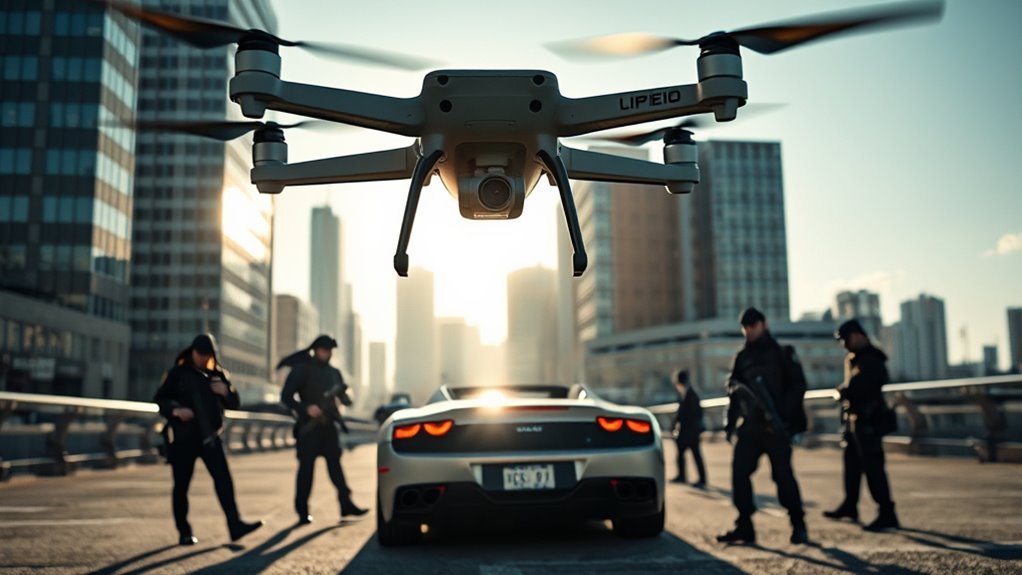
Increased Safety for Repossession Agents
Using drones enhances surveillance capabilities, allowing you to monitor areas from a safe distance before engaging in repossession. This technology supports risk mitigation strategies by providing real-time data analysis, enabling you to assess situations more accurately and make informed decisions. Consequently, you can markedly increase safety for repossession agents in potentially volatile environments.
Enhanced Surveillance Capabilities
While traditional surveillance methods often place repossession agents in precarious situations, drones offer a revolutionary alternative that enhances safety. With advanced drone capabilities, you can gather vital intelligence without exposing yourself to risk. This innovative surveillance technology allows you to:
- Monitor hard-to-reach areas and identify potential threats.
- Track vehicles in real-time, ensuring accurate location data.
- Capture high-resolution imagery for thorough assessments.
Risk Mitigation Strategies
Although repossession can often involve high-stress situations, implementing risk mitigation strategies greatly enhances the safety of repossession agents. By prioritizing legal compliance and ethical considerations, you can navigate regulatory challenges effectively. Adopting advanced technology, like drones, not only monitors assets but also minimizes direct confrontations, addressing public perception concerns. Operational training focused on new tools guarantees agents are prepared, while thorough cost analysis and insurance implications bolster your business’s viability amidst market competition. Additionally, you must remain vigilant about data privacy, safeguarding sensitive information during operations. These strategies create a safer environment for agents, ultimately fostering a more secure and efficient repossession process.
Real-Time Data Analysis
In today’s repossession landscape, harnessing real-time data analysis is vital for enhancing the safety of agents on the ground. By utilizing drones, you gain access to critical information that translates into actionable insights.
Consider these advantages:
- Data visualization techniques allow you to interpret complex datasets quickly, revealing patterns that enhance situational awareness.
- Predictive analytics applications forecast potential risks, enabling you to take proactive measures before heading into uncertain environments.
- Real-time monitoring of locations guarantees you’re always informed, minimizing exposure to hazardous situations.
Embracing these innovations not only empowers you but also increases your operational efficiency, guaranteeing that repossession is conducted with both safety and effectiveness in mind.
Cost-Effective Operations
Drones can markedly enhance cost-effective operations in the repo industry by streamlining processes and reducing labor expenses. By automating asset retrieval and monitoring, they facilitate significant cost reduction, allowing you to allocate resources more effectively. This shift not only minimizes the need for extensive manpower but also accelerates the entire repo process, leading to improved operational efficiency. With drones, you can cover vast areas quickly, ensuring that repossessions occur without the delays often associated with traditional methods. Additionally, integrating drone technology can result in lower maintenance costs over time, enhancing your bottom line. Embracing these innovations empowers you to operate more freely and responsively within the competitive landscape of the repo industry. Furthermore, the use of drones for automated monitoring can lead to even greater resource efficiency and cost savings in the long run.
Real-Time Data Collection and Analysis
As the repo industry becomes increasingly data-driven, harnessing real-time data collection and analysis through drone technology offers a transformative advantage. By integrating drones, you can enhance efficiency and decision-making with:
- Immediate data acquisition: Capture high-resolution images and videos for instant assessment.
- Data visualization techniques: Present complex data in intuitive formats, facilitating better understanding. Additionally, leveraging AI-driven analytics can streamline workflows and foster autonomous decision-making.
- Predictive analytics applications: Analyze trends to forecast potential outcomes, enabling proactive strategies.
These capabilities empower you to make informed decisions quickly, optimizing repossession processes. With drones, you’re not just collecting data; you’re creating actionable insights that drive your operations forward. Embracing this technology means you’ll stay ahead in a competitive landscape, enjoying the freedom to innovate while maintaining control over your data-driven strategies. Moreover, real-time data collection allows for seamless integration with existing platforms, maximizing efficiency and minimizing risks.
Remote Monitoring of Hard-to-Reach Areas
While traditional methods often struggle with accessing hard-to-reach areas, employing drone technology provides a reliable solution for remote monitoring. Drones excel in conducting remote area inspections, allowing you to gather critical data without the constraints of terrain or accessibility challenges. With advanced aerial capabilities, they can effortlessly navigate rugged landscapes, delivering high-resolution imagery and real-time insights. Additionally, drones equipped with obstacle avoidance technology enhance safety by preventing collisions while operating in complex environments. This innovative approach enhances aerial asset verification, ensuring you maintain accurate oversight of valuable properties. By integrating drones into your repo strategy, you can greatly reduce time and costs associated with manual inspections. Ultimately, this technology empowers you to achieve efficiency and precision in monitoring assets while providing the freedom to operate in previously inaccessible locations. Furthermore, using drones with advanced algorithms can enhance the detection of subtle issues, ensuring comprehensive evaluations of remote areas. Embrace the future of repo with drones as your strategic partner.
Documentation and Evidence Gathering
To guarantee accuracy in documentation and evidence gathering, integrating drones into your repo processes is a game-changer. Drones provide unparalleled access to hard-to-reach areas, capturing critical data effectively. You can leverage their capabilities for:
Integrating drones revolutionizes repo processes by enhancing documentation accuracy and providing access to difficult locations.
- Photographic evidence: High-resolution images can document asset conditions and locations. Additionally, the use of advanced algorithms ensures that the captured imagery is sharp and clear, facilitating quicker identification of assets.
- Video documentation: Real-time footage offers a dynamic view of repossession events, ensuring transparency.
- Comprehensive coverage: Drones can survey large areas quickly, minimizing oversight and maximizing efficiency. Additionally, the use of drones enhances aerial oversight in repo processes, ensuring thorough inspections and efficient operations.
Integration With GPS and Mapping Technologies
Integrating drones with GPS and mapping technologies greatly enhances location accuracy, allowing you to pinpoint assets with precision. This real-time data transmission capability guarantees that you receive up-to-date information, streamlining decision-making processes. Additionally, mapping software integration facilitates the visualization of data, making it easier to analyze and act on critical insights. This technology is essential for ensuring crop geofencing accuracy, which helps prevent collisions and optimizes operational zones. Furthermore, advanced sensors in drones like the Wingtra One Gen II significantly improve mapping precision, ensuring high-quality data collection for effective asset management.
Enhanced Location Accuracy
Drones equipped with advanced GPS and mapping technologies can achieve remarkable levels of location accuracy, greatly enhancing the efficiency of repossession operations. With precise asset tracking, these drones guarantee repossession teams can quickly locate vehicles and other valuable items.
Consider the benefits:
- Real-time positioning: Drones provide instant updates on asset locations, minimizing search times.
- Geofencing capabilities: They can define boundaries, alerting teams when assets cross designated lines.
- 3D mapping: Advanced drone technology allows for detailed topographic maps, improving strategic planning.
Real-Time Data Transmission
Real-time data transmission is essential for enhancing the effectiveness of repossession operations. By integrating drone technology with GPS capabilities, you gain immediate access to critical information, improving decision-making and operational efficiency. This seamless connectivity allows repossession agents to track assets in real-time, ensuring timely and accurate responses.
| Feature | Benefits | Impact on Repo Operations |
|---|---|---|
| GPS Integration | Precise location tracking | Enhanced asset recovery |
| Live Video Feed | Visual confirmation of status | Informed decision-making |
| Data Analytics | Insights into patterns | Strategic planning |
| Remote Monitoring | Constant oversight | Increased operational safety |
With this technology, you harness the freedom to act swiftly, transforming traditional repossession methods into innovative solutions.
Mapping Software Integration
While you may be familiar with GPS capabilities, the integration of advanced mapping software takes repossession operations to the next level. This powerful combination of drone mapping and software integration enhances accuracy and efficiency. You can now pinpoint asset locations with remarkable precision, saving time and resources.
Key benefits include:
- Enhanced Visualization: 3D models provide a thorough view of the repossession area.
- Real-Time Updates: Immediate data adjustments keep you informed of any changes in the field.
- Optimized Routes: Advanced algorithms calculate the most efficient paths for retrieval.
Embracing these technologies not only streamlines your operations but empowers you with the freedom to make informed decisions swiftly. Drones equipped with cutting-edge mapping software are revolutionizing the repossession landscape.
Future Trends in Drone Technology for Repossession
As technology advances, the integration of drones into the repossession process is set to revolutionize the industry. Future trends suggest that increased industry adoption will drive market growth, with drones becoming standard tools for asset recovery. Enhanced technology advancements, such as AI integration, will allow for real-time data analysis, optimizing retrieval strategies. Furthermore, AI-driven solutions will boost operational efficiency, making the repossession process more seamless and effective. However, drone regulations and ethical considerations will play an essential role in shaping this landscape. You’ll need to navigate these frameworks to guarantee compliance and maintain public trust. Additionally, cost implications will decrease as drone technology becomes more accessible, making repossession more efficient. By staying ahead of these trends, you’ll harness the potential of drones to enhance operational success and maintain your freedom in the repossession market. Furthermore, AI algorithms utilized in drones will enhance precision in navigation and obstacle detection, further improving the efficiency of the repossession process.
Frequently Asked Questions
Are There Legal Restrictions on Drone Usage for Repossession?
In the wild skies of drone technology, you’ll find legal compliance isn’t just a suggestion; it’s a necessity. Regulatory challenges loom large, demanding innovative solutions to navigate the complex web of repossession laws.
How Do Drones Enhance Traditional Repossession Methods?
Drones enhance traditional repossession methods through advanced surveillance capabilities, allowing you to locate assets efficiently. Their cost efficiency reduces operational expenses, enabling more effective management of resources while maintaining a strategic advantage in asset recovery.
What Types of Drones Are Best for Repossession Tasks?
Did you know that surveillance drones can reduce search times by 30%? For repossession, delivery drones offer efficient transport, while surveillance drones provide critical real-time data, making them ideal for innovative, tech-driven repossession strategies.
How Can Drones Be Used in Difficult Weather Conditions?
In difficult weather, you can enhance drone resilience through weather adaptation technologies. By utilizing advanced sensors and stabilization techniques, drones can efficiently navigate harsh conditions, ensuring operational effectiveness while maintaining safety and precision in challenging environments.
What Privacy Concerns Exist With Drone Repossession?
“Curiosity killed the cat,” but in drone repossession, privacy concerns around surveillance ethics and data protection are paramount. You must weigh the benefits against potential invasions of personal space and the implications of intrusive technology.
