
To become a drone surveyor, start by mastering UAV operation and aeronautical principles. Choose a drone with suitable sensors, GPS accuracy, and flight time for your surveys. Obtain required certifications by completing training and passing regulatory tests. Learn precise flight planning, image capture, and data processing techniques. Develop expertise in surveying software to analyze geospatial data accurately. Follow safety protocols and legal regulations rigorously. These foundational steps prepare you to advance confidently as a professional drone surveyor.
Understanding the Role of a Drone Surveyor

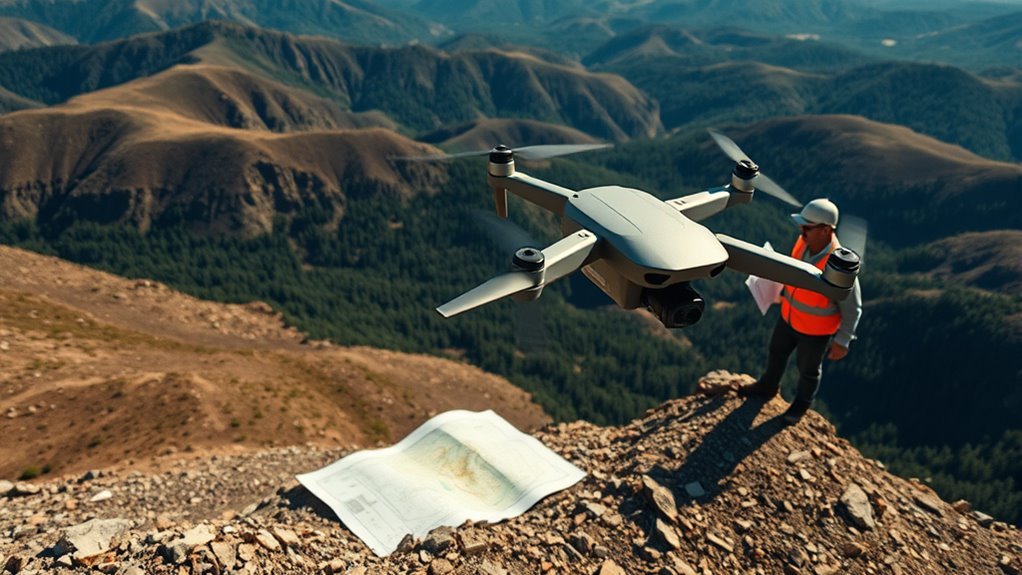
Although drone surveying integrates advanced technology, your role as a drone surveyor centers on capturing accurate aerial data to support mapping, construction, and environmental analysis. You’ll operate drones equipped with sensors and cameras to gather geospatial information efficiently. Understanding drone applications across various sectors helps you adapt to evolving industry trends, ensuring your work remains relevant and valuable. Precision in flight planning, data acquisition, and processing is critical, demanding methodical attention to detail. You’ll interpret complex datasets to produce actionable insights, enabling clients to make informed decisions. Embracing this role offers you the freedom to work outdoors and engage with cutting-edge technology while contributing to essential infrastructure and environmental projects. Mastery of your responsibilities positions you as a crucial contributor in the expanding drone surveying landscape.
Essential Skills Needed for Drone Surveying

To excel as a drone surveyor, you’ll need strong technical proficiency to operate and maintain sophisticated UAV systems effectively. Analytical thinking is equally critical for interpreting complex data and identifying patterns that inform accurate mapping. Mastering these skills guarantees precise data collection and reliable survey outcomes.
Technical Proficiency
When operating drones for surveying purposes, you’ll need a solid grasp of aeronautical principles, GPS technology, and data processing software. Mastering drone technology means understanding the hardware components, sensor integration, and firmware updates that guarantee precise data capture. Flight mechanics knowledge is essential; you must control stability, altitude, and trajectory under varying environmental conditions to maintain accurate survey paths. You’ll also need proficiency in GPS wayfinding systems, which underpin georeferencing and positional accuracy. Familiarity with software tools for processing LiDAR, photogrammetry, and multispectral data allows you to convert raw inputs into actionable survey maps. Developing these technical skills empowers you to operate independently in complex environments, assuring reliable data collection while steering through legal and safety requirements. This foundation grants you the freedom to execute surveying missions with confidence and precision.
Analytical Thinking
Mastering technical skills sets the groundwork, but applying analytical thinking sharpens your ability to interpret complex data gathered during drone surveys. You’ll rely heavily on critical reasoning to evaluate inconsistencies and validate results, ensuring accuracy. Effective problem solving enables you to troubleshoot unexpected issues, like data gaps or environmental interferences, optimizing survey outcomes. Developing these cognitive skills grants you the freedom to make autonomous decisions confidently.
| Skill | Application |
|---|---|
| Critical Reasoning | Evaluating data reliability |
| Problem Solving | Resolving flight or software errors |
| Data Interpretation | Extracting actionable insights |
| Decision Making | Adjusting survey parameters on-the-fly |
Choosing the Right Drone for Surveying Tasks

When selecting a drone for surveying, you need to focus on key features like sensor quality, flight time, and GPS accuracy. Budget constraints will influence your options, so balancing cost with required capabilities is vital. Additionally, consider the terrain where you’ll operate to guarantee the drone’s design and durability match environmental challenges.
Key Drone Features
Selecting the right drone for surveying tasks hinges on understanding specific technical features that directly impact data accuracy and operational efficiency. You’ll want to examine drone specifications closely, focusing on camera resolution to guarantee high-quality imagery. Battery life and flight time are critical for covering large areas without frequent interruptions. GPS accuracy affects positional data precision, essential for reliable mapping. Obstacle avoidance systems enhance safety during complex flights. Consider payload capacity, especially if you plan to use additional sensor types like LiDAR or multispectral cameras, which can expand your data collection capabilities. Balancing these elements lets you operate with greater freedom and confidence, achieving thorough, precise surveys tailored to your project’s demands. Prioritizing these features guarantees your drone meets professional surveying standards.
Budget Considerations
Although technical specifications are paramount, budget constraints often play an equally critical role in choosing the right drone for surveying tasks. You need to implement effective budgeting strategies to secure cost effective solutions without sacrificing essential capabilities. Prioritize drones that balance sensor quality, flight time, and durability within your financial limits. Consider total ownership costs, including maintenance, software licenses, and training fees. Research models that offer modular upgrades to extend lifespan and adaptability. Use a methodical approach to evaluate return on investment by estimating project frequency and required precision. By aligning your budget with operational demands, you gain freedom to select equipment that meets current needs and scales efficiently. This disciplined financial planning guarantees you invest smartly, avoiding overspending while maintaining surveying accuracy and reliability.
Terrain Compatibility
Budgeting effectively sets the foundation, but guaranteeing your drone performs reliably across different landscapes is equally important. When selecting a drone, consider terrain analysis techniques and land use considerations to match its capabilities with the survey environment. For instance, dense forests require drones with obstacle avoidance, while open fields demand longer flight times and stability in wind.
| Terrain Type | Drone Feature Needed |
|---|---|
| Mountains | High-altitude performance |
| Forests | Obstacle avoidance systems |
| Urban Areas | Compact size, GPS accuracy |
| Coastal Regions | Corrosion-resistant parts |
| Agricultural Land | Multispectral sensors |
Matching your drone’s specs to these factors guarantees efficient, accurate data collection and freedom to operate in varied conditions.
Obtaining Necessary Certifications and Licenses
Before you can operate drones commercially for surveying purposes, you’ll need to obtain specific certifications and licenses mandated by aviation authorities. Start by understanding the certification requirements, which typically include passing a knowledge test covering airspace regulations, weather, and operational procedures. Next, complete any required training programs to demonstrate proficiency in drone handling and safety protocols. The licensing process often involves submitting an application, providing proof of training, and undergoing a background check. Once you hold the appropriate remote pilot certificate or license, you can legally fly drones for commercial surveying. Staying current with regulatory updates and renewing your certifications on time guarantees uninterrupted freedom to operate. This structured approach assures compliance while empowering you to conduct precise, authorized drone surveys.
Learning Flight Planning and Navigation Techniques
Mastering flight planning and navigation techniques is vital for conducting efficient and accurate drone surveys. You’ll need to focus on flight path optimization to maximize coverage while minimizing battery use and flight time. This involves analyzing the survey area, setting precise boundaries, and determining the most effective altitude and speed for data collection. Waypoint navigation plays an important role here; by programming specific GPS coordinates, you guarantee the drone follows a predetermined route accurately without manual intervention. This methodical approach reduces errors and increases repeatability across multiple survey missions. By honing these skills, you gain the freedom to operate confidently in diverse environments, making sure each flight meets your project’s requirements with precision and reliability.
Mastering Data Collection and Image Capture
When capturing data with your drone, guaranteeing consistent image quality and accurate sensor readings is essential for reliable survey results. You’ll want to focus on optimizing image resolution to capture fine details, which directly impacts data accuracy. Here’s how to master data collection:
Ensuring consistent image quality and precise sensor data is key to accurate drone survey results.
- Calibrate sensors before every flight to maintain precision.
- Set your camera to the highest practical image resolution, balancing file size and detail.
- Plan overlaps between images (typically 70% front and 60% side) to guarantee thorough coverage and facilitate accurate stitching.
Processing and Analyzing Survey Data
Although capturing high-quality data is essential, the true value of drone surveying lies in accurately processing and analyzing that data to produce actionable insights. You’ll begin by applying rigorous processing techniques to enhance data accuracy, such as georeferencing and noise reduction. Carefully calibrate your datasets to align with ground control points, ensuring spatial precision. Next, you’ll methodically analyze the processed data, extracting relevant metrics like elevation models or volumetric calculations. Maintaining data integrity throughout this phase is vital, as errors can propagate and compromise results. By mastering these steps, you gain the freedom to transform raw survey data into reliable, precise information that supports decision-making in diverse applications. Your disciplined approach to processing and analysis forms the backbone of effective drone surveying.
Utilizing Surveying Software and Tools
Since processing and analyzing your data requires specialized capabilities, utilizing the right surveying software and tools is essential for efficient workflow and accurate results. You’ll want to master surveying software that supports precise measurements and advanced data visualization. These tools convert raw drone data into actionable insights, freeing you from manual calculations.
Focus on these three core functionalities:
- Geospatial data integration – Import and align drone-captured coordinates with existing maps.
- 3D modeling and surface generation – Construct accurate terrain models for detailed analysis.
- Automated report generation – Produce standardized outputs for client presentation or regulatory compliance.
Safety Protocols and Legal Considerations
Before operating drones for surveying, you need to thoroughly understand and adhere to safety protocols and legal regulations to guarantee compliant and risk-free flights. Begin by familiarizing yourself with current drone regulations in your jurisdiction, including altitude limits, no-fly zones, and registration requirements. Completing thorough safety training is essential; it equips you with knowledge on pre-flight inspections, emergency procedures, and situational awareness. Employ methodical flight planning to minimize hazards while respecting privacy laws and airspace restrictions. Consistently document your compliance measures and maintenance records to demonstrate adherence. By rigorously following these safety protocols and legal considerations, you maintain operational freedom without compromising safety or legality, ensuring your drone surveying activities remain efficient and lawful.
Building a Career and Finding Job Opportunities
Understanding and applying safety protocols and legal requirements sets a solid foundation for your work as a drone surveyor. To build a career and find job opportunities, you must strategically leverage your skills and connections. Focus on these three steps:
- Engage actively in industry networking opportunities—join professional groups and online forums to connect with potential clients and employers.
- Continuously update your technical expertise and certifications to position yourself for career advancement in specialized niches like topographic or agricultural surveying.
- Develop a strong portfolio showcasing your precision and methodical approach, which will differentiate you in a competitive market.