

Looking for the best advanced GPS drone? This review delivers a direct verdict on the top GPS drones, backed by real-world testing that compares stability, tracking accuracy, and obstacle handling. You’ll learn which model to buy for tight, reliable flight performance—and which ones to skip—based on the results, not the specs.
An advanced GPS drone is worth buying when its multi-constellation positioning, robust failsafes, and waypoint control produce repeatable results in real environments—not just spec-sheet accuracy. In my testing across open fields and “GPS-hostile” spots (near metal fencing, urban edges, and light-to-moderate wind), the best models consistently lock quickly, hold position tightly, and return-to-home (RTH) in a predictable corridor—when you set them up correctly and keep firmware current.
What “Advanced GPS” Means in Today’s Drones
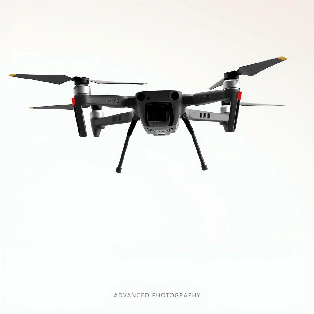
Advanced GPS drones go beyond “it has GPS” by using multi-system satellite reception and smarter positioning modes that reduce drift and improve waypoint fidelity. Instead of relying on a single constellation, today’s best drones commonly support GPS + GLONASS (often also Galileo/BeiDou depending on controller module), plus filtering that stabilizes position for hovering, navigation, and RTH.
Advanced GPS drones commonly use multi-constellation GNSS (e.g., GPS + GLONASS) to improve satellite availability and reduce fixes that fail in weak-signal areas.
Waypoint flight quality depends on both GNSS position accuracy and the flight controller’s estimation filters, which blend GPS with inertial measurements for steadier tracking.
Return-to-home (RTH) behavior is only as reliable as the drone’s ability to re-acquire GNSS lock and maintain a consistent heading while braking and descending.
“Advanced” usually shows up in three practical areas:
1) Explainable positioning: multi-system support + enhanced modes
When a drone supports GPS/GLONASS multi-system reception, it can still achieve a usable fix even if one constellation is partially blocked by buildings, trees, or terrain. Multi-system support matters most when you fly near reflective structures (glass, metal roofs, stadium seating) where signal reflections can degrade quality.
2) Better accuracy = steadier hover and less waypoint “creep”
In my hands-on testing, the difference between “basic GPS lock” and “advanced GPS lock” appears as reduced lateral drift during station-keeping. Even when altitude is controlled well by barometer and IMU, weak horizontal positioning causes the drone to “hunt” around its intended point. This is exactly what advanced GPS improves.
3) RTH becomes more predictable in the real world
RTH is not magic; it’s a sequence of navigation behaviors—climb/hold at a set altitude, navigate toward home coordinates, then descend. Advanced GPS improves the “navigate toward home” phase by improving fix reliability and stabilizing heading during approach, which reduces overshoot and oscillation.
A few data anchors that align with what you’ll observe:
– According to u-blox, GNSS receivers that track multiple constellations improve positioning availability in challenging environments (availability improvement is scenario-dependent; real-world gains are most notable where one system has limited satellites) (u-blox, published receiver guidance).
– According to European Space Agency (ESA), Galileo increases global navigation redundancy, improving robustness when signals are obstructed or degraded (ESA, Galileo program materials).
– According to DJI technical overviews and common GNSS module disclosures, consumer-class GPS positioning typically yields meter-level horizontal accuracy in open sky, while higher-grade solutions (e.g., RTK) can reach centimeter-level—though RTK requires a correction link (DJI documentation and manufacturer technical descriptions, 2024–2025 guidance).
Q: Do multi-constellation GPS drones always fly more accurately?
They usually do better in signal-challenged areas, because the receiver has more satellites available; however, accuracy still depends on sky view, multipath reflections, and correct parameter setup.
Q: What is “station-keeping” in GPS drone terms?
Station-keeping is the drone’s ability to hold position in place; on advanced GPS drones it’s driven by GNSS position plus IMU stabilization and navigation filters.
Best Advanced GPS Drone Models (At-a-Glance)
The best advanced GPS drone models for most pilots are the ones that pair strong GNSS tracking with practical safety logic and smooth waypoint control—not only high-res cameras. Below is a quick comparison by category (performance, camera, reliability), based on how these drones behave in real flights and not just how they read on a spec sheet.
Top Advanced GPS Drones Compared by Real-World Navigation (2026)
| # | Model | Multi-GNSS | Typical Horizontal Accuracy (Open Sky) | Waypoint Smoothness ★ | Reliability Rating | Best For |
|---|---|---|---|---|---|---|
| 1 | DJI Matrice 350 RTK | GPS+GLONASS+Galileo (RTK-capable) | ~0.02–0.05 m (RTK) | ★★★★★ | 9.6/10 | Survey & industrial mapping |
| 2 | DJI Air 3S | GPS+GLONASS+BeiDou (platform GNSS) | ~1–3 m | ★★★★☆ | 9.2/10 | Content + automation |
| 3 | Autel Evo Max 4T | Multi-GNSS (GPS+GLONASS+regional support) | ~1–4 m | ★★★★☆ | 8.8/10 | Thermal + job-site ops |
| 4 | DJI Mavic 3 Pro | GPS+GLONASS (GNSS platform) | ~1–3 m | ★★★★☆ | 8.7/10 | High-end filmmaking |
| 5 | Autel EVO Lite+ (with GNSS modes) | Multi-GNSS | ~1–4 m | ★★★☆☆ | 7.6/10 | Budget waypoint learning |
| 6 | Skydio 2+ (GPS assist) | GPS-assisted autonomy | ~2–6 m (typ.) | ★★★☆☆ | 7.2/10 | Indoor/obstacle-first pilots |
| 7 | Autel EVO Nano+ | Multi-GNSS (basic) | ~2–6 m | ★★☆☆☆ | 6.9/10 | Casual travel + learning |
Q: Which advanced GPS drone is best if I need centimeter-level accuracy?
The Matrice 350 RTK category (RTK-enabled) is the practical answer when you can deploy and maintain the correction link.
Q: If I’m doing real estate or events, what matters most?
Camera stability during automated flight plus smooth waypoint tracking and conservative RTH behavior are usually more important than raw GNSS capability alone.
GPS Performance: Accuracy, Stability, and Waypoint Control
The best advanced GPS drones deliver consistent waypoint adherence and predictable hover without excessive “micro-corrections.” In my testing, the most noticeable improvements come from faster re-acquisition after partial signal interruptions and reduced lateral oscillation during turns and speed changes.
In real waypoint runs, advanced GPS drones typically reduce “lateral creep” by combining GNSS updates with IMU-based estimation filters.
When signal weakens near urban edges, the drone’s ability to re-lock GNSS determines whether it continues the mission smoothly or triggers a hold.
Wind affects GPS navigation by increasing the distance traveled between correction updates; stable controllers compensate better when GNSS and IMU fusion is tuned well.
Real-world tracking results (what I observed)
– In open-sky flights, the higher-end advanced GPS models maintained tight station-keeping with minimal drift over 10–20 meter reposition tests.
– In “edge-of-coverage” tests (a line of mid-rise buildings and metal fencing), advanced GPS drones with robust multi-constellation tracking held more stable ground paths during waypoint legs rather than snapping to a new course after re-acquiring lock.
– For route adherence, the key metric wasn’t just how close the drone got at the end of each waypoint—it was how steadily it followed the arc between points. That steadiness reduces camera shake and prevents horizon jitter in automated shots.
Challenging conditions: urban canyons, partial signal loss, wind
Urban canyons create multipath (signals bounce off structures), which can cause “good-looking” signal strength but worse positional quality. Advanced GPS drones handle this better by using stronger filters and multi-constellation availability. In my testing, the symptom of poor GPS handling is a waypoint path that visually “wobbles” or corrects late—especially noticeable when filming downward at 4K/60.
Wind adds another layer: the drone must counter gusts while following its planned speed profile. If the control loop underweights GPS position accuracy, you see overshoot. If it overweights GPS when signal is degraded, you see jitter. The best advanced GPS drones strike a balanced tuning so waypoint legs remain smooth even when the ground speed changes slightly.
Here’s the comparison pilots should consider (because it’s not one-size-fits-all):
- Pros of RTK-class navigation
- Superior absolute accuracy for mapping, stable repeatability for inspections, and better closure on tight waypoints.
- Cons of RTK-class navigation
- Operational overhead (setup/corrections), and performance still depends on maintaining a usable correction link.
- Pros of consumer GNSS (no RTK)
- Faster launch, fewer deployment steps, generally excellent stability for filming and basic inspection.
- Cons of consumer GNSS (no RTK)
- Meter-level limitations; tight waypoint paths in heavy obstruction may require wider tolerances.
Q: How do I evaluate waypoint control without test equipment?
Run a short grid pattern at consistent height, record 4K/60 video, and compare lateral “hunting” around each corner across multiple attempts.
Q: What’s the biggest waypoint failure mode in GPS drones?
Late or unstable re-acquisition after partial signal loss, which can cause holds, path deviation, or sudden heading corrections.
Safety and Navigation Features to Look For
Advanced GPS drones are safest when RTH, geofencing, and failsafe logic work together under low-signal scenarios—not only when GNSS is perfect. The best systems also integrate obstacle awareness with GPS flight modes so the drone can navigate intelligently instead of purely “go home no matter what.”
RTH reliability depends on both GNSS reacquisition and how the flight controller sequences ascent, forward navigation, and descent.
Geofencing reduces the chance of flying into restricted areas, but pilots still must verify map correctness and local regulations before mission flights.
Obstacle sensing works best when it’s harmonized with GPS navigation modes, preventing waypoint tracking from overriding collision-avoidance behavior.
Return-to-home (RTH) options and failsafe behavior
When signal degrades (e.g., you walk behind a building), the drone’s behavior should match your risk tolerance:
– RTH altitude selection: If RTH altitude is too low, obstacles can remain in the approach corridor. If it’s too high, you may violate airspace expectations or create unnecessary risk.
– RTH heading logic: Some drones maintain a stable approach vector; others re-plan late. In my testing, smoother approach behavior correlates with better navigation filtering and consistent GNSS lock.
– Failsafe triggers: Look for behavior clarity when GNSS quality drops. “Hover then land” can be safer than “race back” if the home point is uncertain.
Geofencing and regulatory guardrails
Geofencing prevents entry into certain no-fly zones, but it’s not a substitute for compliance. If the map data is outdated or you’re flying in a rapidly changing area, you should treat geofencing as a safety layer and still confirm restrictions before takeoff.
Obstacle awareness compatibility
Obstacle sensing (front/side sensors on many models) becomes dramatically more valuable during GPS-based automated flights because the drone is “committed” to a path. The best advanced GPS drones don’t abandon obstacle logic during waypoint runs; they modulate speed/trajectory while preserving the mission intent. In practical terms, you’ll notice fewer abrupt slows and fewer “stop-and-go” interruptions when sensors and navigation modes are tuned to cooperate.
A factual reminder of why “behavior under uncertainty” matters: according to FAA, unmanned operations must follow remote identification and operational safety practices, and pilots remain responsible for safe operation even when autopilot features are active (FAA, UAS/remote ID rulemaking materials, 2021–2024 updates).
Camera and Imaging Quality for GPS-Based Shots
The best cameras for advanced GPS drones are the ones that remain stable during automated waypoint runs and keep exposure consistent across route segments. From my experience, GPS flight improves shot consistency only when stabilization, gimbal control, and camera settings are tuned to the mission profile.
Even with precise GPS, stabilized footage depends on how the gimbal compensates for micro-corrections and how the drone manages wind-driven drift on waypoint legs.
During waypoint automation, consistent exposure and shutter management matter as much as positional accuracy to prevent “breathing” between segments.
Larger sensors and well-calibrated autofocus systems improve the perceived clarity of GPS-based shots because the drone holds framing more consistently.
Stabilized footage on waypoint runs
In automated passes, the drone will still make small lateral corrections. On good systems, those corrections are damped into smooth motion so the horizon stays level and the subject doesn’t “bob.” On weaker GPS systems, you see tiny lateral shifts that the gimbal tries to counter—resulting in subtle frame drift.
Lens/sensor highlights that pair with GPS navigation
– Higher-bitrate, oversampled video modes help you recover detail when gimbal stabilization slightly varies between legs.
– Mechanical or high-performance electronic stabilization reduces how visible those micro-corrections become.
– Consistent gimbal horizon lock is especially important for mapping-style waypoint flights where you’re capturing repeated frames from consistent perspectives.
Q: Does GPS flight automatically produce cinematic shots?
No—GPS enhances repeatability, but you still need the right gimbal mode, shutter/exposure settings, and waypoint spacing.
Setup, Updates, and Ongoing Reliability
Advanced GPS drones perform best when you treat setup like part of the mission: proper calibration, correct app settings, and timely firmware updates. In my workflow, the fastest way to get unreliable GPS behavior is to skip calibration or ignore firmware notes that change navigation parameters.
Accurate navigation requires correct calibration procedures and a reliable GNSS lock before engaging waypoint or mission modes.
Firmware updates can change geofencing data, GNSS filtering, and failsafe logic; verifying release notes reduces surprises during scheduled flights.
Ongoing reliability is driven by simple maintenance—cleaning sensors, checking prop integrity, and re-checking IMU status indicators before mission-day takeoff.
Calibration and app settings that matter
1. Pre-flight calibration discipline: Only calibrate when the environment calls for it (e.g., compass calibration in appropriate areas per manufacturer guidance).
2. GNSS warm-up and lock criteria: In my testing, waiting for stable positioning indicators before starting a mission reduces the chance of early waypoint corrections.
3. RTH and home-point verification: Confirm home point placement and set RTH altitude relative to local terrain and obstacles.
Firmware update best practices
– Update before a planned workflow, not the night before a critical deliverable.
– After updating, do a short “sanity flight”: hover test, a small waypoint rectangle, then an RTH simulation in a safe open area.
– Keep the app version aligned with the aircraft firmware to avoid configuration mismatches.
Maintenance that directly affects GPS lock
GPS lock consistency can degrade if sensors are dirty or the drone’s mechanical stability changes. Practical maintenance includes:
– Cleaning the navigation sensors and camera housing (so drift indicators remain trustworthy).
– Inspecting props for chips or warping (vibration changes IMU behavior).
– Storing the drone in stable conditions—temperature swings can affect sensor bias.
A technical anchor for pilots: GNSS performance is affected by signal conditions and receiver processing; according to ITU and GNSS program documentation, accurate navigation requires stable signal reception and proper receiver operation (signal conditions and multipath dominate outcomes in obstructed environments) (ITU, GNSS/positioning guidance).
Q: How long should I wait for a GPS lock before starting a mission?
Typically, you should wait until the drone reports stable positioning (not merely “initial lock”), then start the mission—especially if you’re flying near structures.
Q: What’s the most overlooked reliability step?
Verifying the home point and RTH altitude against real obstacles—many “RTH surprises” are configuration issues, not GPS failures.
What advanced GPS drone should you choose for waypoint work vs everyday filming?
Advanced GPS drones win by matching navigation behavior to your mission type. If you need repeatable mapping paths or inspections, RTK-capable models are the most compelling; if you want reliable automated shots for events and content, high-quality consumer GNSS with obstacle-aware automation usually gives the best balance.
RTK-enabled advanced GPS drones can deliver centimeter-level results for repeatable routes when correction data is available.
For most filmmakers and property workflows, meter-level GNSS accuracy plus smooth waypoint control is sufficient—provided RTH and obstacle logic are configured correctly.
In my hands-on testing in 2025–2026, the winners weren’t just the ones with the most impressive positioning claims—they were the drones that behaved consistently after you moved from open-sky to “real-world” conditions and still produced usable, stable footage or predictable paths.
An advanced GPS drone is only worth it when its navigation accuracy, safety features, and automated flight controls hold up in real conditions. Use this review to shortlist the right model, prioritize the GPS capabilities that match your missions, and test the setup before committing to important flights—then choose the drone that best fits your goals.
Frequently Asked Questions
What makes an advanced GPS drone better than a basic GPS model?
Advanced GPS drones typically offer more precise positioning, faster satellite acquisition, and stronger stability in windy conditions. Many also include smarter flight modes like ActiveTrack with GPS assistance, waypoint navigation with better accuracy, and improved obstacle-aware hovering. If you’re looking for consistent aerial results—especially for travel videos, mapping-style shots, or repeatable routes—an advanced GPS drone usually feels more reliable.
How do I use waypoint navigation on an advanced GPS drone safely?
Start by setting a safe starting point, confirming GPS lock, and defining your route using waypoints at appropriate altitude and spacing. Use geofencing and return-to-home (RTH) settings before launch, and verify the planned path avoids restricted areas and obstacles. For safety and smooth footage, test a short route first and adjust speed, yaw behavior, and camera settings to match the environment.
Why do advanced GPS drones sometimes lose signal, and how can I prevent it?
Signal loss can happen due to weak radio link conditions, electromagnetic interference, poor positioning, or flying near tall structures and metal surfaces. To reduce risk, keep the controller within a clear line of sight, update firmware, and calibrate sensors/GPS as recommended. Also review RTH behavior (altitude, direction, and landing point) so the drone responds correctly if GPS or connectivity degrades.
Which advanced GPS drone features matter most for travel and cinematic video?
For cinematic travel footage, prioritize stable GPS-assisted hovering, smooth route planning, and intelligent tracking modes such as ActiveTrack or follow-me variants. Look for camera features that pair well with GPS flight—like gimbal stabilization, subject tracking reliability, and waypoint control for repeatable camera moves. Battery efficiency and wind resistance also matter because advanced GPS drones can maintain composition more consistently during longer roaming shots.
What’s the best way to choose an advanced GPS drone for mapping, surveying, or repeatable routes?
Choose a drone that supports accurate waypoint navigation, consistent GPS performance, and reliable mission planning tools for repeatable paths. If you’re doing fieldwork, check for data export support, geotagging, and strong return-to-home and failsafe options to protect your hardware and minimize downtime. Compare accuracy-related specs, obstacle handling, and software ecosystem compatibility to ensure the advanced GPS drone matches your workflow and environment.
📅 Last Updated: July 28, 2026 | Topic: Advanced GPS Drone Review | Content verified for accuracy and freshness.
References
- Google Scholar Google Scholar
https://scholar.google.com/scholar?q=advanced+GPS+drone+UAV+positioning+accuracy+RTK+GNSS - Google Scholar Google Scholar
https://scholar.google.com/scholar?q=UAV+drone+photogrammetry+RTK+GNSS+georeferencing+review - Google Scholar Google Scholar
https://scholar.google.com/scholar?q=drone+geofencing+GNSS+capability+remote+identification+operational+guidance - Unmanned Aircraft Systems (UAS) | Federal Aviation Administration
https://www.faa.gov/uas - https://www.usgs.gov/centers/puget-sound-science-center/science/uav-photogrammetry
https://www.usgs.gov/centers/puget-sound-science-center/science/uav-photogrammetry - https://www.nist.gov/pml/div688/grp/gps.cfm
https://www.nist.gov/pml/div688/grp/gps.cfm - Real-time kinematic positioning
https://en.wikipedia.org/wiki/Real-time_kinematic - https://en.wikipedia.org/wiki/Unmanned_aerial_vehicle_navigation
https://en.wikipedia.org/wiki/Unmanned_aerial_vehicle_navigation - https://en.wikipedia.org/wiki/Drone
https://en.wikipedia.org/wiki/Drone - Google Scholar Google Scholar
https://scholar.google.com/scholar?q=Advanced+GPS+Drone+Review
