
Yes, you can fly your drone at Lake Powell, but there are specific regulations and guidelines you must follow to ensure safety and compliance. Familiarizing yourself with these rules not only enhances your flying experience but also helps protect the stunning natural environment and ensures respect for fellow visitors and wildlife. Lake Powell, with its breathtaking vistas and unique geological formations, offers a fantastic backdrop for aerial photography and exploration, provided that drone operators adhere to the prescribed regulations.
Understanding Drone Regulations

Before embarking on your drone-flying adventure at Lake Powell, it’s crucial to review the Federal Aviation Administration (FAA) regulations regarding drone use in national parks and recreational areas. The FAA mandates that all drone operators must register their drones if they weigh more than 0.55 pounds and must comply with altitude restrictions, which typically limit flights to a maximum of 400 feet above ground level. Additionally, flying over people or moving vehicles is prohibited, and operators must avoid restricted airspace.
In the case of Lake Powell, which is part of the Glen Canyon National Recreation Area, it is essential to check for any specific local regulations that may further restrict drone operations. The National Park Service (NPS) has strict rules concerning drone use within national park boundaries, often prohibiting it entirely unless special permits are obtained. Therefore, before planning your drone flight, consult the official NPS website or contact park officials to ensure compliance with all local and federal regulations.
Where You Can Fly

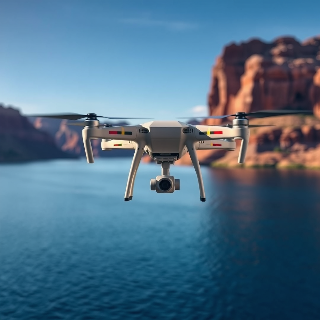
At Lake Powell, there are designated areas where drone flying is permitted, but awareness of restricted zones is equally important. Generally, drones can be flown in less populated areas of the lake that are away from marinas, campsites, and wildlife habitats. For instance, the open water away from popular tourist spots often provides ample space for drone enthusiasts.
However, the vicinity around marinas and campsites is typically off-limits to drone operations due to safety concerns and the potential for disturbing other visitors. Additionally, areas around wildlife nesting sites and sensitive ecosystems are restricted to protect local fauna. Before launching your drone, it’s advisable to study maps of the area, which are available on the Glen Canyon National Recreation Area’s website, to identify permissible flying zones and avoid restricted areas.
Safety Considerations
Safety should always be a top priority when flying your drone. One of the most critical safety guidelines is to always maintain a visual line of sight with your drone. This means you should be able to see your drone at all times without the aid of binoculars or other devices. Maintaining this line of sight allows you to react quickly to any potential hazards or changes in the environment.
Furthermore, avoid flying over crowds or near other people. Not only does this comply with FAA regulations, but it also minimizes the risk of injury or damage to property. If you are flying in a popular area, consider timing your flight for early morning or late evening when foot traffic is lower. Additionally, ensure that your drone has sufficient battery life for the planned flight duration, and always be prepared for emergency landings.
Environmental Impact
Drones can significantly impact wildlife and natural habitats, making it essential for operators to understand these effects. The noise generated by drones can disturb nesting birds and other sensitive wildlife, potentially causing stress or displacement. To minimize your drone’s environmental footprint, follow best practices such as flying at higher altitudes to reduce noise disturbance and avoiding areas known for high wildlife activity.
Moreover, consider the time of year when planning your flights. During breeding seasons, many species are particularly vulnerable, and drone use could exacerbate their stress levels. Engaging in responsible flying practices is not only beneficial for the environment but also enhances your experience as a conscientious drone operator.
Getting Your Drone Ready
Before heading out to Lake Powell, ensure your drone is in optimal working condition and compliant with local laws. This includes conducting pre-flight checks such as ensuring that the battery is fully charged, the firmware is up to date, and all components are functioning correctly. Familiarize yourself with your drone’s features and controls, especially if you are using it in a new environment. Practice flying in open areas before attempting complex maneuvers or capturing specific shots.
Additionally, review the weather conditions for the day of your flight. Wind speed, precipitation, and temperature can all affect your drone’s performance and safety. Flying in adverse weather can not only endanger your drone but also pose risks to others in the vicinity.
Community and Resources
Engaging with local drone flying communities can provide valuable insights and shared experiences that enhance your flying endeavors. Many areas, including those around Lake Powell, have dedicated groups or online forums where enthusiasts share tips, local regulations, and best flying locations. Participating in these communities can also help you stay updated on any changes in regulations or new flying opportunities.
Furthermore, utilize online resources and maps specific to Lake Powell to identify the best spots for flying. Websites dedicated to drone enthusiasts often provide user-generated reviews and recommendations, making it easier to discover hidden gems and avoid crowded areas.
In conclusion, while flying your drone at Lake Powell is permitted, it is essential to adhere to regulations and safety guidelines. By understanding and following these rules, you can enjoy stunning aerial views while preserving the beauty of the area. Engaging with local communities and utilizing available resources will further enhance your experience. Happy flying!
Frequently Asked Questions
Can I fly my drone at Lake Powell?
Yes, you can fly your drone at Lake Powell, but there are specific regulations and guidelines you must follow. The area is managed by the National Park Service, which prohibits drone use in many parts of the park to protect wildlife and natural resources. Always check local regulations and any temporary flight restrictions before your visit to ensure compliance.
What are the drone regulations for flying at Lake Powell?
The regulations for flying drones at Lake Powell are primarily dictated by the National Park Service. Generally, drone use is restricted in the park, including areas such as the Rainbow Bridge National Monument and other scenic locations. It’s crucial to review the official National Park Service website or contact park authorities for the most current rules and regulations regarding drone operations.
How can I find the best spots to fly my drone at Lake Powell?
To find the best spots for flying your drone at Lake Powell, consider researching online forums, drone communities, and local drone enthusiasts. Additionally, scouting locations that are outside of restricted areas can help. Popular scenic spots, such as the Antelope Canyon or certain viewpoints along the lake, may provide excellent aerial photography opportunities, but always ensure you’re adhering to local laws and guidelines.
Why is drone flying restricted in certain areas of Lake Powell?
Drone flying is restricted in certain areas of Lake Powell primarily to protect the park’s wildlife and natural landscapes. The noise and presence of drones can disturb animals and disrupt their habitats, while also affecting the experience of other park visitors seeking tranquility. These regulations help preserve the natural beauty and ecological integrity of the area.
Which drone models are best suited for flying at Lake Powell?
The best drone models for flying at Lake Powell are those that are lightweight, have good battery life, and can capture high-quality aerial footage. Popular models such as the DJI Mini 2 or the DJI Air 2S offer excellent portability and impressive camera capabilities, making them ideal for capturing the stunning landscapes of Lake Powell. Always ensure your drone complies with local regulations and is suitable for the flying conditions in the area.
References
- https://www.nps.gov/glca/planyourvisit/drone-use.htm
- https://www.faa.gov/uas
- https://www.blm.gov/programs/recreation/recreational-activities/drone-use
- https://www.utah.gov/
- https://www.lakepowell.com/faq/
- https://www.nps.gov/glca/index.htm
