
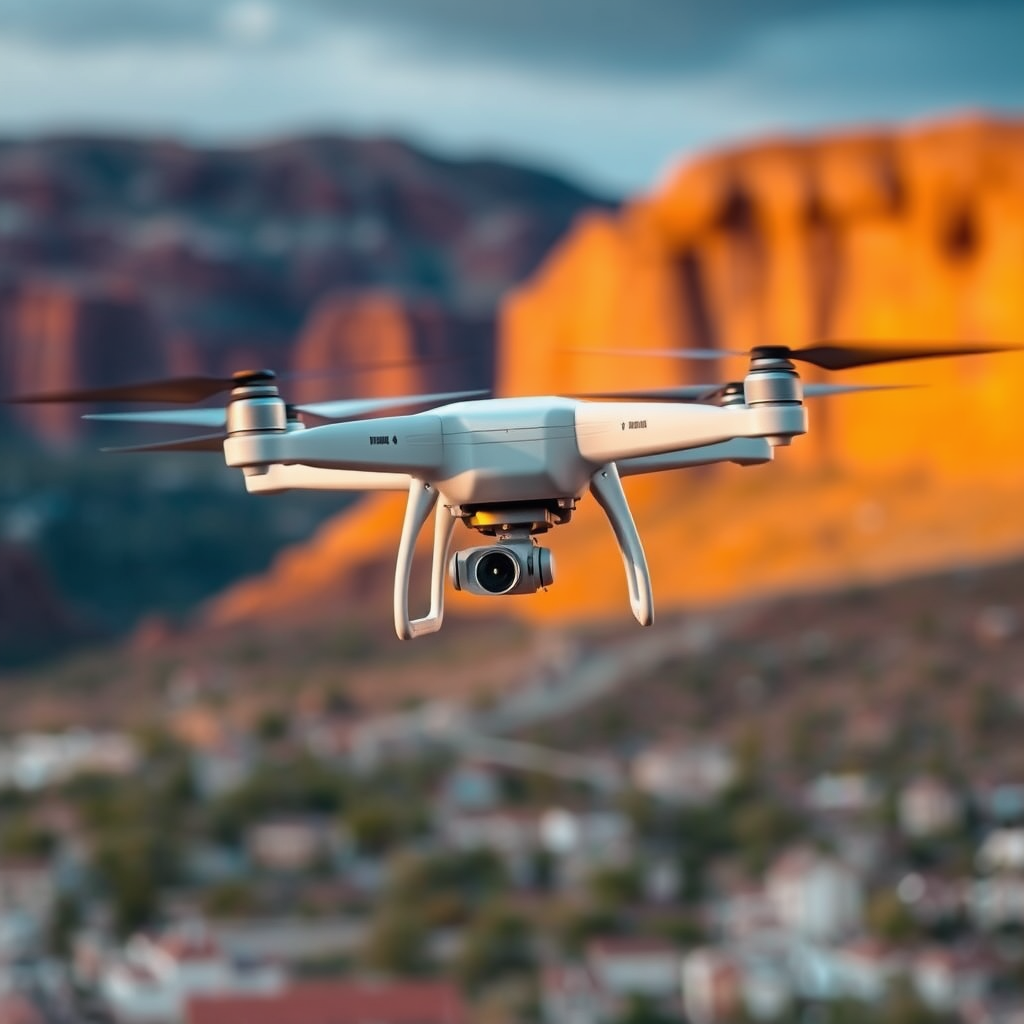
Yes, you can fly a drone in Moab, but there are specific regulations and guidelines you need to follow to ensure a safe and enjoyable experience. The breathtaking landscapes, including red rock formations and vast canyons, make Moab an appealing destination for drone enthusiasts. However, understanding the local laws and best practices is crucial for compliance and to protect the environment while capturing stunning aerial footage.
Understanding Local Regulations

The Federal Aviation Administration (FAA) governs drone use across the United States, including Moab. As a drone operator, you are required to familiarize yourself with the FAA’s regulations, which include registering your drone if it weighs more than 0.55 pounds, flying below 400 feet, and maintaining a visual line of sight with your aircraft. Additionally, commercial drone pilots must obtain a Part 107 certification from the FAA.
Beyond federal regulations, local ordinances may impose additional restrictions that could affect where and when you can fly your drone in Moab. For instance, certain areas may have specific no-fly zones, particularly near crowded places, wildlife habitats, or sensitive areas like archaeological sites. It’s advisable to check with local authorities or the Moab City website for any updates or changes to drone regulations before your flight. Compliance with these guidelines not only ensures your safety but also contributes to the preservation of Moab’s unique ecosystems.
Popular Drone-Flying Locations in Moab
While Moab offers many stunning landscapes for drone photography and videography, not every location is suitable or legal for flying. One of the most notable sites, Arches National Park, is known for its incredible rock formations and natural arches. Unfortunately, the National Park Service enforces strict regulations that generally prohibit drone flights within park boundaries. This is to protect the wildlife and the natural serenity of the park.
Similarly, Canyonlands National Park also has restrictions on drone usage, and it is advised to plan your drone operations outside of these park boundaries. However, there are numerous other picturesque locations near Moab where you can legally and safely fly your drone. Areas like the Potash Road or the vast expanses of the BLM (Bureau of Land Management) lands surrounding Moab offer ample opportunities for stunning aerial photography without the stringent regulations of national parks. Always scout these locations ahead of time to ensure they are not within restricted zones.
Best Practices for Drone Safety
Safety should always be your primary concern when flying a drone. To minimize risks, ensure that you maintain a visual line of sight with your drone at all times. This not only helps you keep track of your drone but also allows you to react quickly if it enters restricted airspace or if something unexpected occurs.
Avoid flying near crowds, wildlife, or sensitive areas. Doing so minimizes potential disturbances and helps protect the natural environment, which is especially important in a place as pristine as Moab. Always be aware of your surroundings and stay informed about any changing conditions, such as weather patterns or air traffic, that could impact your flight safety.
Before taking off, conduct a pre-flight check of your equipment, ensuring that your drone is in good working condition. Familiarize yourself with the specific area you plan to fly in and be aware of any nearby natural features, such as cliffs or canyons, which could pose hazards. Utilizing apps that track airspace restrictions and real-time weather updates can further enhance your flying experience.
Required Equipment and Preparations
Before embarking on your drone adventure in Moab, make sure you have the right equipment and preparations in place. If your drone weighs over 0.55 pounds, you must register it with the FAA. This registration is simple and can be completed online, typically with a small fee involved.
In addition to registration, check your drone’s battery life and ensure it is fully charged before heading out. Moab’s vast landscapes can sometimes lead to long travel times between locations, and you wouldn’t want to miss out on capturing the perfect shot due to a dead battery.
Also, consider the weather conditions on the day of your flight. Wind can be particularly strong in the Moab area, especially in the canyons. It is advisable to consult weather apps or websites for forecasts specific to the location you intend to fly. Planning your flight for calm days can significantly enhance your drone’s performance and your overall filming experience.
Tips for Capturing Stunning Footage
To capture stunning footage of Moab’s breathtaking landscapes, timing and creativity are key. One of the best practices is to time your flights during the golden hours—shortly after sunrise or just before sunset. The soft, diffused light during these times enhances the colors and textures of the land, resulting in striking images and videos.
Experiment with various angles and heights while flying your drone to showcase Moab’s unique geology. Low-altitude flying can emphasize the textures of the rock formations, while higher altitudes provide panoramic views that encompass the vastness of the area. Additionally, using techniques such as panning or orbiting around a subject can add dynamism to your footage.
Don’t forget to adhere to the “Five-second rule.” This means allowing your drone to hover for at least five seconds before capturing a shot. This practice not only gives you a stable picture but also allows you to assess the surroundings before making any adjustments or movements.
Community and Resources
Engaging with local drone enthusiast groups can be invaluable for both novice and experienced drone pilots. These communities often share advice, tips, and experiences about the best flying spots in Moab, as well as updates on any changing regulations. Local meetups or online forums can serve as platforms for knowledge exchange, fostering a sense of community among drone operators.
Additionally, staying updated with online resources is essential for any drone pilot. Websites such as the FAA’s official page or local government sites frequently provide updated information on regulations, airspace restrictions, and safety tips. Utilizing apps designed for drone pilots can also help you stay informed about no-fly zones and weather conditions, ensuring a safe and enjoyable flying experience.
In conclusion, flying a drone in Moab can be an incredible experience, provided you adhere to the regulations and practice safety. By understanding local rules, choosing the right locations, and employing best practices, you can enjoy the stunning scenery and capture unforgettable moments. Always stay informed and responsible while flying, ensuring that you contribute to the preservation of this natural wonder. Whether you’re shooting breathtaking videos of the iconic landscapes or simply enjoying the thrill of flying, your experience in Moab will undoubtedly be memorable.
Frequently Asked Questions
Can you fly a drone in Moab, Utah?
Yes, you can fly a drone in Moab, Utah, but there are specific regulations and guidelines you must follow. The area is famous for its stunning landscapes and national parks, such as Arches and Canyonlands, where drone use is heavily restricted. Always check local rules and the FAA regulations before flying, as certain areas may require permits or have no-fly zones.
What are the drone regulations in Moab?
Drone regulations in Moab include adhering to the FAA’s rules, such as flying below 400 feet and keeping your drone in sight at all times. Additionally, flying in national parks is generally prohibited, so it is essential to familiarize yourself with the local ordinances before your trip. Consult the Bureau of Land Management and state park guidelines for any specific restrictions that may apply to public lands around Moab.
How can I find the best drone flying spots in Moab?
To find the best drone flying spots in Moab, consider visiting areas that are publicly accessible and allowed for drone use, such as certain Bureau of Land Management (BLM) lands. Popular locations may include the vast desert landscapes outside national parks. Research drone forums, local drone clubs, and websites dedicated to drone enthusiasts, as they often share valuable insights about ideal locations that offer stunning scenery for aerial photography and videography.
Why are drones restricted in national parks like those in Moab?
Drones are restricted in national parks, including those around Moab, to protect wildlife, preserve the natural landscape, and ensure visitor safety. The noise and potential disturbances caused by drones can disrupt wildlife habitats and the overall natural experience for visitors. Therefore, it is crucial to respect these regulations and seek alternative locations for flying your drone while enjoying the breathtaking views Moab has to offer.
Which drone should I choose for flying in Moab’s rugged terrain?
When selecting a drone for flying in Moab’s rugged terrain, look for models that are lightweight, durable, and equipped with GPS capabilities for stable flight. Drones like the DJI Mavic Air 2 or the DJI Mini 2 are popular choices due to their portability, ease of use, and excellent camera quality, which is perfect for capturing Moab’s stunning landscapes. Always ensure your drone has a reliable battery life to cover long flights over expansive areas.
References
- https://www.faa.gov/uas/getting_started/where_to_fly
- https://www.blm.gov/programs/recreation/recreation-activities/rocky-mountain-region/drone-use
- https://www.nps.gov/articles/drone-regulations-in-national-parks.htm
- https://www.utah.gov/tech/drones.html
- https://www.moabcity.org/government/departments/planning/drones.html
- https://www.researchgate.net/publication/330854123_The_Impact_of_Drones_on_Natural_Resources_Management_in_Utah
