

Police Drone Use: The Direct Answer
Police use drones to collect real-time aerial information, enhance situational awareness, and support safer decision-making across investigations, emergencies, and public safety operations. The key difference is that drones can reach elevated or hazardous areas quickly while providing data for teams on the ground.
Drones are typically equipped with cameras, stabilization systems, and in many cases thermal imaging. Law enforcement agencies commonly use these tools to observe scenes, document evidence, locate missing people, and monitor large public gatherings—often in coordination with patrol officers, incident commanders, and detectives.
Aerial Surveillance and Incident Monitoring
Aerial surveillance is defined as the use of airborne sensors to observe locations from above and relay actionable information during incidents. In police work, drones enable rapid overviews of streets, buildings, and complex environments that are difficult to access by foot or vehicle.
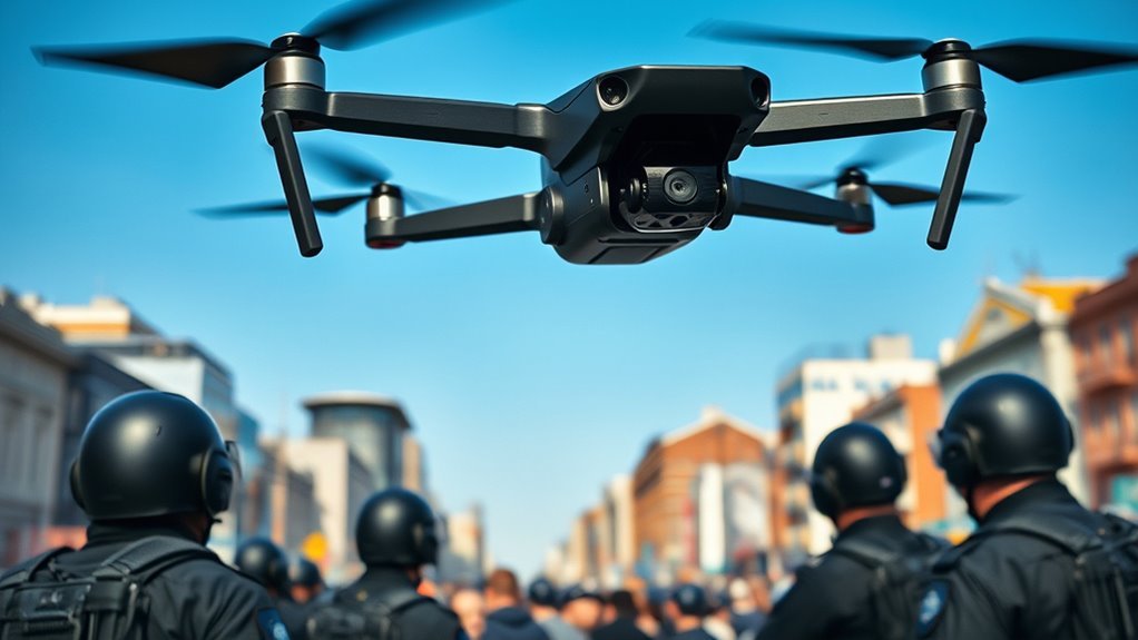
Many departments deploy drones for short-duration monitoring during active calls. A live video feed can help command staff assess crowd movement, identify hazards, and confirm whether a suspect has left a particular area. This capability is especially valuable during rapidly evolving events such as active threat incidents, barricaded subjects, or vehicle pursuits where situational awareness can change minute by minute.
Because drones can cover large areas more quickly than ground units, they may reduce response time to visual-confirmation tasks. For example, a drone can inspect rooftops, alleyways, wooded areas, or multi-story apartment complexes without risking additional officer exposure.
The widely accepted public safety principle is that better intelligence supports better officer safety and improved coordination. In practice, drone video can also help structure incident reports by providing a verifiable timeline of what responders saw and when.
What sensor types do police drones use for surveillance?
Police surveillance drones commonly combine optical cameras with additional payloads, depending on mission needs. The key difference is that optical imaging supports identification and context, while thermal imaging supports detection in low visibility conditions.
- High-resolution zoom cameras: Used for visual observation of people, vehicles, and specific objects.
- Thermal cameras (infrared): Used to detect heat signatures at night or through light smoke and darkness, depending on conditions.
- Stabilized gimbals: Provide steadier imagery for clearer documentation and easier review later.
- Optional loudspeaker payloads: Used for public safety directions in some jurisdictions and policies.
Public-Safety Drone Platforms Commonly Used by Law Enforcement (Key Spec Snapshot)
| # | Model | Typical Mission | Max Flight Time | Max Payload | Operational Fit |
|---|---|---|---|---|---|
| 1 | DJI Matrice 350 RTK | SAR + evidence capture | 55 min | 1.2 kg | ★★★★☆ |
| 2 | Autel EVO Max 4T | Day/night patrol support | 40 min | 2 kg payload class | ★★★★☆ |
| 3 | Skydio 2+ | Search routes + autonomy assist | ~35 min | Fixed payload (camera) | ★★★☆☆ |
| 4 | Parrot Anafi USA | Perimeter checks + rapid mapping | 32 min | Fixed payload (camera) | ★★★☆☆ |
| 5 | BRINC Protector (Public Safety) | Hazardous approach + remote video | Up to 2.5 hrs (ground time) | Modular payload options | ★★★☆☆ |
| 6 | DJI Matrice 300 RTK | Evidence capture + wide coverage | 55 min | 1.2 kg | ★★★★☆ |
| 7 | Autel EVO Lite+ (public-safety use variant) | Rapid overhead documentation | Up to 40 min | Fixed payload (camera) | ★★★☆☆ |
Common follow-up: Are drones used only during emergencies?
No. While drones are frequently associated with urgent calls, agencies also use them for planned monitoring and operational reconnaissance. Examples include perimeter checks for special events, support for parole or warrant service operations when permitted and authorized, and training flights that validate coverage patterns and camera settings.
Crowd Management, Event Safety, and Public Order
Drones support crowd management by providing real-time aerial visibility into density, movement, and potential conflict zones. The direct benefit is that incident commanders can identify risks earlier and coordinate ground units more effectively.
At large events, police must manage safety while minimizing disruption to lawful activity. A drone’s overhead perspective can help supervisors spot bottlenecks, assess whether an area is becoming overcrowded, and determine where to deploy officers or medical teams. Because the information comes from above, it can be less obstructed than ground-level views in streets lined with barriers and spectators.
For many departments, drone video and still images also support after-action reviews. These records can help agencies evaluate what worked, identify communication issues, and improve future operational plans for crowd routing, officer placement, and emergency communications.
How do drones improve coordination among officers during events?
Drones can improve coordination by aligning what leadership sees from the sky with what teams on the ground need to know. The key difference is that aerial information reduces guesswork and supports faster tactical decisions.
- Improved perimeter assessment: Helps verify the location of crowd lines, exits, and restricted zones.
- Targeted officer deployment: Guides officers toward specific areas instead of general sweeps.
- Incident documentation: Provides footage that can support investigation of assaults, property damage, or unsafe behavior.
- Faster situational updates: Shortens the gap between what changes in the crowd and how quickly command staff respond.
Common follow-up: Do police drones record everyone at an event?
Policies vary by agency and jurisdiction, and use is generally governed by local laws, department rules, and authorization requirements. Many agencies restrict operations to relevant public safety objectives, and some implement privacy-focused controls such as data minimization, restricted retention periods, and masking/redaction procedures where available and legally required.
Search and Rescue (SAR) and Missing Person Locating
Police use drones for search and rescue by quickly scanning large areas and delivering live or recorded visuals to help teams locate missing people. The direct advantage is coverage speed: drones can reach over difficult terrain while reducing risk to rescuers.
Search and rescue operations often involve time-sensitive decisions across farms, forests, wetlands, parks, and rural road networks. Drones fitted with thermal imaging can be particularly valuable at night or in conditions where visibility is limited. In daylight, high-resolution cameras can also assist with identifying clothing colors, footprints, or other visual clues.
The typical workflow includes launching a drone to survey assigned sectors, sending imagery or thermal cues to the incident command center, and then guiding ground teams to the most likely locations. This reduces wasted time and can improve the chances of locating individuals sooner.
What makes thermal imaging useful in SAR?
Thermal imaging is defined as the detection of infrared heat patterns that can reveal individuals or objects even when standard cameras struggle. The key difference is that thermal sensors can highlight heat signatures against cooler backgrounds, depending on weather and environmental conditions.
- Night operations: Thermal can extend search capabilities after dark.
- Low-contrast environments: Vegetation and uneven terrain can reduce visible clues; thermal may still provide detection cues.
- Rapid area scanning: Operators can map sectors and revisit them quickly if conditions change.
It is important to note that thermal detection is not perfect. Air temperature, wind, humidity, reflective surfaces, and clothing materials all influence how heat signatures appear. Trusted SAR practices generally combine thermal leads with ground confirmation.
Common follow-up: How do police avoid false leads?
Agencies reduce false leads by using structured search grids, documenting flight paths, and requiring ground verification before conclusions are treated as confirmed. Teams also cross-check drone observations with witness reports, last-known coordinates, and GPS data from radios or 911 call systems.
Traffic Collision Investigation and Accident Reconstruction
Police use drones in traffic-related incidents to capture aerial measurements, document scene geometry, and support accident reconstruction. The direct outcome is often more accurate mapping and clearer evidence than relying only on ground photos.
In traffic collisions, speed and safety matter. Drones can quickly document vehicle positions, skid marks, debris fields, and lane layouts from above. Many agencies use photogrammetry workflows—where software reconstructs a site from overlapping images—to produce scaled maps or 3D models.
When properly calibrated and documented, these outputs can support investigations ranging from rear-end collisions to multi-vehicle crashes. They can also help explain how sight lines, road curvature, lighting conditions, and environmental factors contributed to the incident.
What is photogrammetry in the context of police drones?
Photogrammetry is defined as a process where multiple overlapping photos are used to estimate distances and create accurate spatial models. The key difference is that the drone provides image capture, while specialized software converts images into measurable outputs for investigators.
- Scaled mapping: Creates a scene representation aligned to real-world dimensions.
- Scene documentation: Preserves a record before roads are cleared and evidence disappears.
- Evidence support: Helps investigators communicate findings with visual aids that are easier to review.
Common follow-up: Are drone maps admissible in court?
They may be, depending on jurisdiction, chain-of-custody, how the data was collected, and the qualifications of operators. Many courts and legal teams focus on documentation quality: operator logs, calibration records, timestamps, and how the mapping process was validated. Agencies that follow standardized evidence handling practices generally have stronger documentation for legal review.
Crime Scene Documentation and Evidence Preservation
Police use drones to document crime scenes efficiently and consistently, especially when the environment is large, dangerous, or difficult to access. The direct purpose is evidence capture that preserves spatial context and reduces the need to repeatedly re-enter hazardous areas.
Drones can capture high-resolution imagery of yards, rooftops, alleyways, and perimeter lines. Investigators may use these images to annotate routes, estimate distances, and create visual records for detectives, prosecutors, and expert witnesses.
When combined with geotagging and consistent flight parameters, drone footage can support reporting accuracy. For sensitive scenes—such as active investigations involving firearms, fire hazards, or unstable structures—unmanned documentation can reduce risk to officers while still collecting relevant information.
How do agencies manage data quality and reliability?
Data reliability is supported through standard operating procedures that define how flights are planned, how sensors are configured, and how files are stored. The key difference is that evidence-grade collection emphasizes repeatability, documentation, and defensible handling processes.
- Operator training and certification: Many agencies require documented competency before deployments.
- Device calibration and maintenance: Helps ensure accuracy for imaging and mapping tasks.
- Chain-of-custody procedures: Ensures digital files remain attributable and tamper-evident.
- Metadata and logs: Provide timestamps, flight paths, and configuration details for review.
Common follow-up: What about privacy and civil liberties?
Privacy concerns are a major part of how police drone programs are designed. Most responsible deployments include limitations on when drones can be activated, what areas are targeted, how long data is retained, and who can access it. Many agencies also follow guidelines aligned with public oversight expectations and legal standards established in their region.
Legal, Ethical, and Safety Standards That Shape Drone Use
Police drone operations are shaped by federal aviation rules, state privacy laws, and department policies designed to protect safety and civil rights. The direct answer is that agencies cannot simply deploy drones without authorization and compliance.
In the United States, drone use by police is commonly governed under FAA aviation regulations and department-specific procedures for surveillance and evidence. The FAA defines key operational categories and safety requirements, while law enforcement agencies set additional rules about targeting, data retention, and oversight.
Ethically, many jurisdictions evaluate drone deployment against principles of necessity, proportionality, and accountability. This is particularly relevant for aerial surveillance where cameras can capture information from private property or identifiable individuals.
What safeguards are commonly used?
Safeguards are defined as procedural and technical controls that limit misuse and protect personal privacy. The key difference is that safeguards focus on both operational behavior and how collected data is stored and used.
- Role-based access controls: Limits who can view footage and download files.
- Retention limits: Deletes or archives data after a defined period unless needed for an active case.
- Privacy impact assessments: Evaluates risks before rollout and during policy updates.
- Use-of-force and notification policies: Ensures drone operations align with broader public safety practices.
- Audit and oversight: Supports accountability through documentation and review.
Common follow-up: Do drones replace officers?
No. Drones generally supplement police work rather than replace it. Human judgment, legal authority, and on-scene verification remain essential. In most operations, drones provide information that helps officers act more safely and effectively.
Drone Workflows: From Mission Planning to Reporting
Police drone operations typically follow a structured workflow that begins with mission planning and ends with evidence handling and reporting. The direct advantage is consistency, which supports both operational effectiveness and defensibility.
A standard workflow often includes selecting an appropriate aircraft, confirming payload requirements (optical vs. thermal), establishing flight boundaries, and defining data handling rules before takeoff. Operators then collect imagery or video, and a command liaison or investigative team reviews the material to decide next steps.
After the mission, departments commonly generate deliverables such as annotated stills, timelines, or mapping outputs. These materials can be used for incident reports, prosecution support, training, and after-action improvement.
What information is typically included in a drone deployment record?
A deployment record is defined as documentation that captures the key details of the flight and how the data was collected and preserved. The key difference is that a complete record enables independent verification of how the information was obtained.
- Date and time of flight
- Operator name and role
- Location and mission objective
- Sensor configuration and payload used
- Flight path summary and relevant timestamps
- File storage location and chain-of-custody notes
Common follow-up: Are there specific brands or models used?
Agencies may use a range of commercially available and specialized drones depending on budget, mission requirements, and payload needs. Common categories include professional multirotor platforms and mapping-capable systems used with photogrammetry software. What matters most is not the brand alone, but whether the platform and operator training meet the agency’s accuracy, reliability, and legal documentation standards.
How to Evaluate Police Drone Programs as a Community
To assess how police drones are used in your area, focus on policies, transparency, oversight mechanisms, and data handling rules. The direct takeaway is that accountability is as important as technology.
Community members can often evaluate program quality by looking for public documentation about mission types, privacy safeguards, retention timelines, and complaint or audit processes. Many responsible departments also provide training statements and governance structures for operators.
When drone usage is clearly governed and measured, residents gain more trust in how the technology is applied. When policies are vague, data retention is unclear, or oversight is weak, public concern tends to increase.
📋 About This Article
This article explains how police use drones to gather real-time aerial information that helps teams stay aware, document scenes, and make safer decisions. It’s written for readers who want a clear, practical look at drone roles in investigations, emergencies, and public safety events. You’ll learn what drone equipment is used for (like video cameras and thermal imaging) and how drones support tasks such as observing and monitoring from the air, locating missing people, and capturing evidence from hard-to-reach areas.
Frequently Asked Questions
How do police use drones in their day-to-day work?
Police may use drones to support a variety of routine and time-sensitive tasks, including traffic and incident monitoring, searching for missing persons, inspecting large events, and assessing public safety concerns from above. In many departments, drones are deployed as an extension of officers’ ability to observe scenes quickly and safely—especially in areas that are hard to reach on foot or by vehicle. Drones can provide real-time video to help teams coordinate, locate hazards, and understand what is happening without putting personnel at unnecessary risk.
What types of missions do police drones commonly perform?
Common drone missions include: (1) accident scene documentation and reconstruction support, (2) perimeter security during protests, demonstrations, or major public gatherings, (3) search-and-rescue operations for missing persons, (4) locating suspects or tracking individuals in larger areas when safe and lawful, (5) fire or hazardous incident support by observing smoke spread and identifying hotspots (where permitted), and (6) aerial inspection of infrastructure such as bridges, rooftops, or large facilities for public-safety concerns. The exact missions vary by jurisdiction, department policy, and local authorization requirements.
Are police drones only used for surveillance, or do they have other roles?
While drone operations can involve surveillance, many uses are operational and investigative rather than open-ended monitoring. For example, drones are often used to capture overhead imagery to document a scene accurately after a crash or to help investigators understand spatial relationships (vehicle positions, distances, road conditions, and environmental factors). They may also be used for search-and-rescue to quickly scan terrain, or for event support to help direct resources and improve situational awareness. Reputable agencies typically set specific mission goals, time limits, and approved data-handling procedures to reduce unnecessary data collection.
What safeguards and rules govern police drone use?
Police drone use is generally governed by a combination of federal aviation rules, state and local laws, and departmental policies. Safeguards often include operator training and certification, pre-approved flight planning, maintaining communication and safety procedures, and restrictions on where and when drones can fly. Many agencies implement requirements for warrants or court authorization in certain circumstances, especially when drones are used to gather evidence in ways that raise privacy concerns. Data-handling rules are also common—such as limiting access to recordings, defining retention periods, and logging deployments so the public can understand how and why drones were used.
How can people understand when drones are being used by police?
In many areas, law enforcement agencies follow transparency practices such as publishing drone policies, posting notices for large events where drones may be used, and providing updates after incidents. During an active deployment, the drone may be visible or officers may communicate that aerial support is being used. However, the exact notification practices vary by jurisdiction and operational requirements. If you’re concerned about a particular flight or deployment, you can often review the department’s drone policy online, request information under applicable public records laws, or contact the agency’s public information office for clarification.
References
- Seeing as One?: Materialisation and Distribution of the Police-drone Gaze Google Scholar
https://www.ntnu.no/ojs/index.php/njsts/article/view/5869 - Intelligent surveillance and reconnaissance mode of police UAV based on grid Google Scholar
https://ieeexplore.ieee.org/abstract/document/9407552/ - Drones and law enforcement Google Scholar
https://www.taylorfrancis.com/chapters/edit/10.4324/9781003028031-6/drones-law-enforcement-robert-barrows - Systematic review on civilian drones in safety and security applications Google Scholar
https://www.mdpi.com/2504-446X/7/3/210 - Policing with the drone: Towards an aerial geopolitics of security Google Scholar
https://journals.sagepub.com/doi/abs/10.1177/0967010621992661
📅 Last Updated: July 03, 2026 | Topic: How Do Police Use Drones in Work? | Content verified for accuracy and freshness.
