
Police drones can typically see and capture images from altitudes of up to 400 feet, with the ability to detect movements and objects from several miles away depending on the camera quality and environmental conditions. This impressive range is a result of advanced technology, including high-resolution cameras and various sensor types that enhance visibility under different circumstances. In this article, we will explore the factors affecting the visibility range of police drones, delve into their technology, and examine their real-world applications in law enforcement.
Understanding Drone Technology

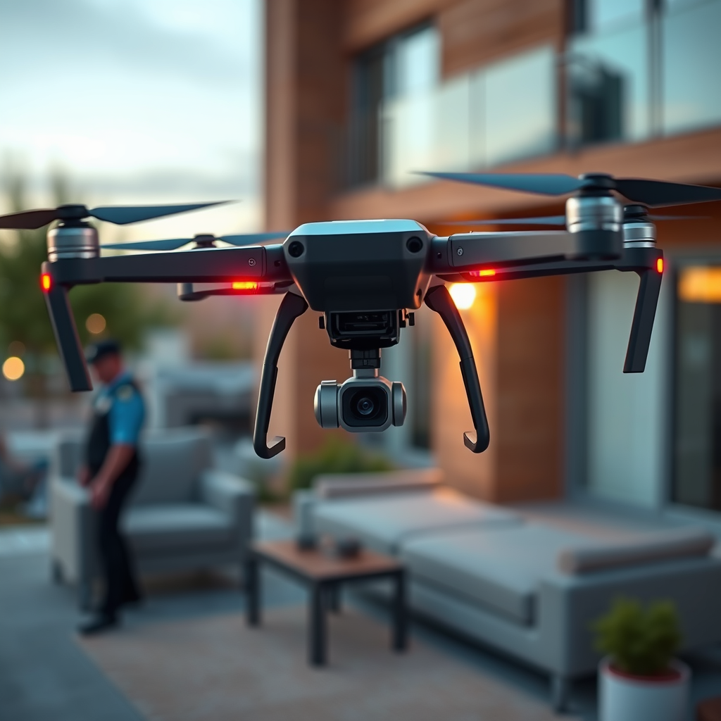
Drones have revolutionized surveillance capabilities for law enforcement agencies, primarily due to their sophisticated technological features. Most police drones are equipped with high-resolution cameras that provide clear, detailed images from significant distances. These cameras often boast resolutions of 4K and beyond, enabling them to capture fine details that can be crucial for investigations and monitoring.
In addition to high-quality cameras, many police drones are fitted with specialized sensors such as infrared and thermal imaging. Infrared sensors are particularly useful in low-light conditions, allowing officers to detect heat signatures from individuals or vehicles. Thermal imaging can identify body heat, making it invaluable for search and rescue operations, especially at night or in dense foliage. The combination of these technologies significantly enhances the operational capabilities of police drones, broadening their visibility range under various conditions.
Factors Affecting Visibility Range
Several factors influence how far police drones can see, with altitude being a primary determinant. Most commercial drones can operate legally at altitudes up to 400 feet, which is the FAA’s maximum altitude for recreational and many commercial drones. At this height, drones can cover a wider area and see farther, but this range does not guarantee clear visibility, as other environmental factors come into play.
Environmental conditions significantly affect a drone’s visibility range. Weather elements such as rain, fog, and snow can obscure visibility, limiting the drone’s ability to capture clear images. Lighting conditions also matter; bright sunlight can cause glare, while nighttime operations may require thermal sensors for effective surveillance. Additionally, physical obstacles like buildings, trees, and mountains can hinder the line of sight, further complicating the drone’s operational effectiveness. Consequently, understanding these factors is essential for law enforcement agencies to maximize the utility of drone surveillance.
Real-World Applications of Drone Surveillance
Police drones have found numerous applications in law enforcement, enhancing safety and efficiency in various operations. One notable use is in crime scene investigations, where drones can provide aerial views of the scene, helping investigators document evidence from angles that ground-based cameras cannot capture. This capability is especially beneficial in complex scenes, where a comprehensive overview can lead to better analysis and quicker resolutions.
Another critical application is in monitoring public events, such as concerts or sporting events. Drones can provide real-time surveillance of large crowds, allowing law enforcement to manage safety more effectively. For instance, during large-scale protests, drones can help assess crowd dynamics, detect potential disturbances, and deploy resources as needed.
Additionally, police drones play a vital role in search and rescue operations. When traditional methods may be too slow or dangerous, drones equipped with thermal imaging can quickly locate missing persons in challenging terrains, such as forests or mountainous regions. Their ability to cover vast areas in a short time enhances the chances of finding individuals quickly and safely.
Limitations of Police Drones
Despite their advantages, police drones face several limitations that must be considered. One of the most significant challenges is the legal restrictions on their flight and surveillance height. In many jurisdictions, laws regulate where and how drones can be operated, particularly in urban environments where privacy concerns are paramount. These regulations can limit the effectiveness of drone surveillance and necessitate careful planning by law enforcement agencies.
Furthermore, privacy concerns and ethical implications surrounding drone use cannot be overlooked. There is an ongoing debate about the balance between public safety and individual privacy rights. Drones equipped with high-resolution cameras can capture images of private property and individuals without consent, raising questions about surveillance overreach. As a result, law enforcement agencies must navigate these ethical dilemmas while ensuring compliance with privacy laws and maintaining public trust.
Future Developments in Drone Technology
The future of police drones looks promising, with ongoing advancements in camera technology and sensor capabilities. As drone technology continues to evolve, we can expect improvements in image resolution and stabilization, which will enhance their effectiveness in various operational contexts. Additionally, the development of smaller, lighter drones with more robust capabilities will enable greater flexibility in law enforcement operations.
Another exciting area of growth is the potential integration of artificial intelligence (AI) to enhance object recognition and tracking. AI algorithms can analyze video feeds in real-time, identifying suspicious behaviors or specific objects, which could significantly streamline surveillance efforts. Such advancements could allow police to respond more swiftly to incidents, potentially preventing crimes before they happen.
Case Studies of Police Drone Use
Several notable case studies illustrate the successful application of drone surveillance in law enforcement. For example, in 2020, the Los Angeles Police Department utilized drones to monitor public gatherings during protests, enabling them to assess crowd dynamics without deploying officers into potentially volatile situations. This approach allowed for better resource allocation and enhanced situational awareness.
Another case involved the use of drones in a search and rescue operation in a rural area. When a hiker went missing in the woods, local law enforcement deployed drones equipped with thermal imaging to scan the terrain. Within hours, the drone located the individual, who was stranded but unharmed, showcasing the drone’s effectiveness in critical situations.
These examples highlight how police drones can significantly enhance operational effectiveness, providing law enforcement agencies with invaluable tools for modern policing.
In conclusion, police drones have impressive visibility capabilities that can significantly enhance law enforcement operations. With the ability to see and capture images from considerable altitudes, complemented by advanced technological features, these drones have become essential tools in modern policing. As technology advances, these drones are likely to become even more effective in aiding police work while navigating the associated legal and ethical challenges. By understanding their limitations and potential, law enforcement can leverage drone technology to improve public safety and operational efficiency.
Frequently Asked Questions
What is the typical range of visibility for police drones?
The typical visibility range for police drones can vary significantly depending on the model and equipment used. Many commercial police drones have a range of 1 to 5 miles, while advanced models equipped with high-resolution cameras and thermal imaging can effectively see up to 10 miles. However, factors like weather conditions, terrain, and the drone’s altitude can affect visibility, making it essential for law enforcement to choose the right drone for specific surveillance needs.
How do police drones enhance situational awareness during emergencies?
Police drones enhance situational awareness during emergencies by providing real-time aerial footage that can be streamed directly to incident command centers. This allows law enforcement to assess the situation from above, identify potential threats, and make informed decisions quickly. Equipped with thermal imaging and night vision capabilities, drones can also locate individuals in challenging environments, further improving response times and safety for both officers and civilians.
Why are police drones preferred over traditional surveillance methods?
Police drones are often preferred over traditional surveillance methods due to their versatility, cost-effectiveness, and ability to cover large areas quickly. Drones can fly at varying altitudes and angles, providing a unique perspective that ground vehicles cannot offer. Additionally, they can be deployed in situations that may be dangerous for officers, reducing risks while still gathering critical intelligence for investigations and public safety operations.
What types of cameras do police drones use for surveillance?
Police drones typically use a variety of cameras for surveillance, including high-definition optical cameras, thermal imaging cameras, and night vision cameras. High-definition cameras allow for detailed visual monitoring during the day, while thermal imaging cameras excel in low-light conditions by detecting heat signatures. This combination of technology enables law enforcement to effectively monitor activities in various environments and weather conditions, making police drones a valuable tool for public safety.
Which factors limit the visibility range of police drones?
Several factors can limit the visibility range of police drones, including weather conditions such as fog, rain, or snow, which can obstruct camera lenses and reduce image clarity. Terrain obstacles like buildings, trees, and hills can also hinder a drone’s line of sight. Additionally, regulatory restrictions on flying beyond visual line of sight (BVLOS) can further limit operational range for police drones, requiring careful planning and adherence to local laws to maximize their effectiveness.
References
- https://en.wikipedia.org/wiki/Police_drone
- https://www.nytimes.com/2020/06/04/us/police-drones.html
- https://www.ojp.gov/ncjrs/virtual-library/abstracts/police-use-drones
- https://www.faa.gov/air_traffic/publications/media/2020-2024_NP.pdf
- https://www.rand.org/pubs/research_reports/RR2024.html
- https://www.abc.net.au/news/2021-05-20/police-drones-how-they-work/100197674
- https://www.bbc.com/future/article/20200107-how-drones-are-changing-policing
- https://www.ncbi.nlm.nih.gov/pmc/articles/PMC6311812/
