
Drones are revolutionizing various industries in unexpected ways. You might not know they enhance precision agriculture by monitoring crop health and optimizing resources. They’re also essential in wildlife conservation, tracking endangered species without disturbance. Drones facilitate quick infrastructure inspections, ensuring public safety, and are crucial in search and rescue operations, delivering medical supplies to remote areas. Their advantages extend to film and photography, as well as real estate marketing, showcasing properties from unique angles. Discover even more innovative applications ahead.
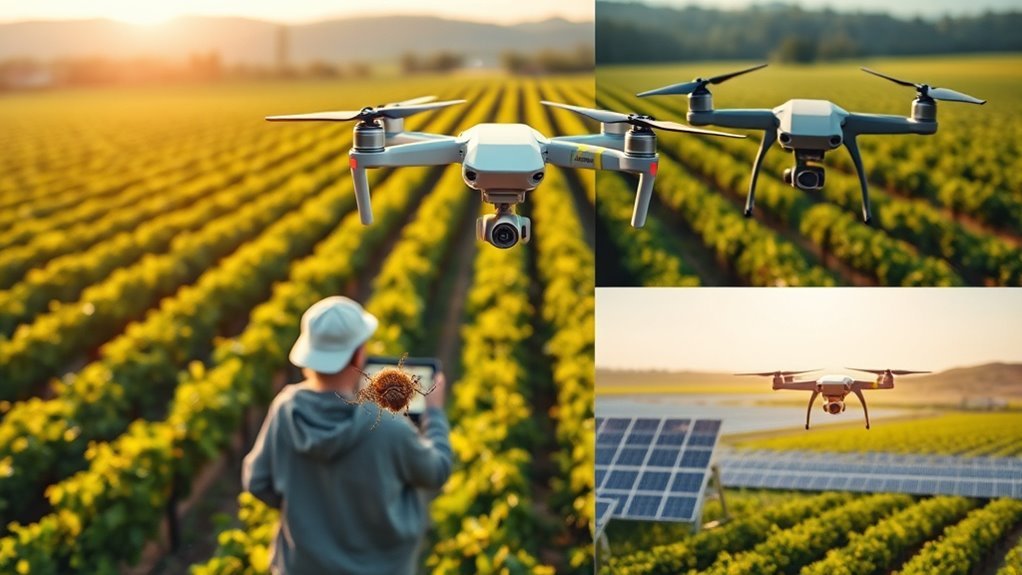
Precision Agriculture: Enhancing Crop Management
As the world faces increasing food demands, it’s no surprise that precision agriculture has emerged as a game-changer in crop management. By leveraging drone technology, you can closely monitor crop health and optimize your farming practices. Drones equipped with advanced sensors capture high-resolution images, allowing you to analyze plant health in real time. This data-driven approach empowers you to make informed decisions about irrigation, fertilization, and pest control, ultimately enhancing your yield prediction accuracy. With the ability to identify problem areas quickly, you can allocate resources more efficiently, reducing waste while boosting productivity. Embracing precision agriculture not only improves your crop output but also supports sustainable farming practices, giving you the freedom to innovate and succeed in the ever-evolving agricultural landscape. Furthermore, drones like the Delair UX11 AG offer advanced geofencing capabilities that enhance operational safety in crop management. Additionally, the use of multispectral cameras enables the detection of early signs of disease or nutrient deficiencies, further optimizing crop management strategies.
Wildlife Conservation: Monitoring Endangered Species
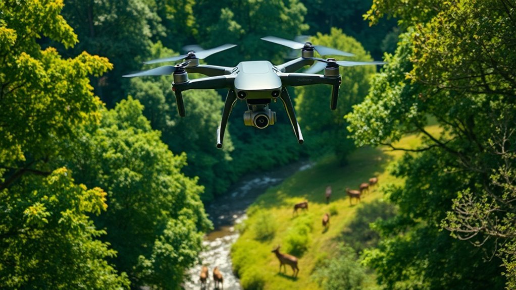
You might be surprised to learn how drones are revolutionizing wildlife conservation by tracking animal movements and mapping their habitats. These aerial tools offer a bird’s-eye view that provides essential data without disturbing the ecosystems they monitor. By harnessing this technology, conservationists can make informed decisions to protect endangered species more effectively.
Tracking Animal Movements
While the challenges of wildlife conservation are intimidating, drones have emerged as a revolutionary tool for tracking animal movements, especially for endangered species. Using drone telemetry, researchers can monitor animal migration patterns with unprecedented precision. Imagine soaring high above vast landscapes, capturing real-time data on elusive creatures. This technology not only helps you understand their habits but also allows for better protection strategies. By analyzing this data, conservationists can identify critical habitats and migration routes, helping to guarantee these animals thrive. Drones offer a freedom of movement that’s essential for studying wildlife without disturbing their natural behaviors. So, embrace the innovative potential of drones in conservation, as they pave the way for a better understanding of our planet’s most vulnerable inhabitants.
Habitat Mapping Techniques
Drones are redefining habitat mapping techniques in wildlife conservation, particularly for monitoring endangered species. By utilizing aerial technology, you can gather data efficiently, leading to improved ecological assessments and insights into species habitats. Here are four innovative ways drones enhance habitat mapping:
- High-Resolution Imagery: Capture detailed images that reveal vegetation patterns and habitat structures.
- 3D Mapping: Create three-dimensional models of landscapes, aiding in understanding terrain complexities.
- Real-Time Monitoring: Track changes in ecosystems promptly, allowing for quick conservation responses.
- Data Integration: Combine drone data with GIS tools to analyze habitat suitability for endangered species.
Infrastructure Inspection: Keeping Our Cities Safe
When it comes to ensuring the safety of our cities, drones are transforming how we inspect infrastructure. You might be surprised to learn that they’re now being used for real-time monitoring of bridge health and power line surveillance, making inspections faster and more efficient. This innovative approach not only saves time but also greatly enhances safety measures for the public. Additionally, advanced AI and data-driven capabilities are enabling drones to analyze inspection data in real-time, further improving efficiency and accuracy. Furthermore, the integration of error detection technology allows for proactive identification of potential issues before they escalate, ensuring a safer environment for urban communities.
Bridge Structural Health Monitoring
As cities expand and infrastructure ages, ensuring the safety of bridges becomes increasingly critical. Drones are revolutionizing bridge inspection and monitoring structural integrity, providing a fresh perspective on this essential task. Here’s how they’re making a difference:
- Rapid Assessments: Drones can quickly survey large areas, considerably reducing inspection time.
- High-Resolution Imaging: They capture detailed images, allowing inspectors to identify potential issues before they escalate.
- Hard-to-Reach Areas: Drones can access difficult locations, ensuring no part of the structure is overlooked.
- Real-Time Data: With live feeds, engineers can analyze structural integrity in the moment, facilitating immediate decision-making.
Power Line Surveillance Efficiency
Ensuring the safety and reliability of power lines is essential for maintaining the integrity of urban infrastructure, especially since outages can disrupt daily life. Drones offer a revolutionary approach to power line monitoring, allowing for efficient aerial inspections that cover vast areas quickly. Instead of relying on manual assessments, which can be time-consuming and hazardous, drones can swiftly capture high-resolution images and data from hard-to-reach locations. This technology not only enhances safety for inspection teams but also provides real-time insights into potential issues, like wear or vegetation interference. By adopting drone technology for power line surveillance, cities can proactively address maintenance needs, ensuring a stable power supply and ultimately granting citizens the freedom to go about their daily lives uninterrupted.
Search and Rescue Operations: Saving Lives in Emergencies
While disasters can strike unexpectedly, the integration of drones into search and rescue operations has revolutionized how we respond to emergencies. Drone technology enhances emergency response efforts, allowing for rapid assessment and deployment. Here are four ways drones are making a difference:
- Real-Time Aerial Surveillance: Drones capture live footage, helping teams locate victims quickly.
- Thermal Imaging: Equipped with thermal cameras, drones can detect heat signatures, identifying individuals in challenging environments. This capability enables responders to swiftly pinpoint potential hazards and transform chaotic scenes into manageable assessments with precision.
- Delivery of Supplies: Drones can transport medical supplies and equipment to remote or hard-to-reach areas.
- Data Collection: They gather valuable data for planning and improving future rescue missions. Additionally, drones provide real-time data that enhances situational awareness for first responders, enabling them to make informed decisions. This technology offers actionable intelligence that supports rapid decision-making in emergencies.
Environmental Monitoring: Tracking Climate Change Effects
Drones are transforming environmental monitoring by providing unprecedented access to hard-to-reach areas, allowing researchers to track climate change effects with remarkable accuracy. With their ability to gather real-time climate data, drones are essential for evaluating shifting ecosystems and biodiversity. You might be amazed to learn how they conduct habitat evaluations, helping scientists assess the health of forests, wetlands, and coastlines. By capturing high-resolution imagery and analyzing thermal patterns, drones offer insights into temperature variations and species migration. This innovative approach not only enhances our understanding of environmental changes but also empowers you to advocate for sustainable practices. As these technological marvels continue to evolve, they pave the way for a more informed and proactive stance against climate change. Additionally, drones equipped with real-time data collection capabilities enable researchers to monitor air quality and pollution levels, further enhancing our understanding of the environment. Furthermore, drones can assist in disease outbreak monitoring by collecting precise data from affected areas, which can be critical for understanding the broader impacts of climate change on public health.
Construction Site Monitoring: Improving Project Efficiency
When it comes to construction site monitoring, drones can transform how you manage your projects. You can track progress in real-time, simplify safety inspections, and obtain accurate site measurements, all from a bird’s-eye view. This technology not only boosts efficiency but also enhances safety and decision-making on site. Additionally, advanced stabilization technology in drones ensures high-quality imagery, crucial for precise assessments and evaluations. The use of high-resolution RGB cameras allows for detailed imagery that supports better project oversight and accountability.
Real-time Progress Tracking
As construction projects become increasingly complex, keeping track of progress in real-time has never been more critical for ensuring efficiency and meeting deadlines. Drones empower you to monitor construction sites seamlessly, delivering real-time aerial data that enhances decision-making. Here are four ways drones improve project efficiency through progress tracking:
- Site Mapping: Quickly create accurate maps to visualize project status.
- Material Delivery: Optimize drone logistics to manage supplies on-site.
- Progress Monitoring: Capture high-resolution images to compare against project milestones.
- Data Analysis: Utilize aerial data for predictive analysis and forecasting.
Safety Inspections Simplified
While traditional safety inspections can be time-consuming and labor-intensive, utilizing drones can greatly streamline the process. With drone inspections, you can capture detailed aerial images of construction sites, allowing you to identify potential hazards quickly and efficiently. This not only enhances safety but also reduces the need for manual inspections, freeing up your team to focus on more critical tasks. Furthermore, drones provide real-time data, enabling you to make informed decisions on safety enhancements and project improvements. By integrating drone technology into your safety protocols, you can guarantee compliance with regulations while fostering a culture of safety. Embracing this innovative tool empowers you to maintain oversight and efficiency in your construction projects, ultimately leading to a safer work environment.
Accurate Site Measurements
Accurate site measurements are essential for any construction project, and utilizing drones can greatly enhance this process. By leveraging remote sensing technology, you can gather precise geospatial data that not only saves time but also reduces human error. Here are four ways drones improve site measurements:
- High-resolution imagery: Capture detailed images that allow for accurate site assessments.
- 3D mapping: Create three-dimensional models for better visualization of the terrain.
- Topographic surveys: Generate precise elevation data to inform planning.
- Real-time monitoring: Track progress continuously, ensuring projects stay on schedule.
These innovative applications enable you to make informed decisions, ultimately boosting project efficiency and ensuring successful outcomes. Embrace the future of construction with drone technology!
Delivery of Medical Supplies: Reaching Remote Areas
Drones are revolutionizing the delivery of medical supplies to remote areas, ensuring that even the most isolated communities have access to essential healthcare resources. Imagine a world where life-saving medications, vaccines, and equipment can be flown directly to your doorstep, bypassing the hurdles of traditional transport. This is where telemedicine logistics come into play, enabling healthcare providers to respond swiftly to emergencies. Drones can deliver supplies within minutes, considerably improving emergency response times. In regions with challenging terrain or limited infrastructure, these airborne innovators bridge the gap between patients and crucial care. By harnessing drone technology, we empower communities, ensuring that everyone has the freedom to access the healthcare they deserve, regardless of their location. Furthermore, the integration of real-time monitoring allows for efficient tracking of medical deliveries, enhancing overall logistic operations. This capability is complemented by advanced obstacle avoidance technology, which enables drones to navigate difficult terrains safely and effectively.
Event Security: Enhancing Safety Measures
In addition to transforming healthcare logistics, drone technology is making significant strides in the domain of event security. By leveraging drones, event organizers can enhance safety measures while allowing attendees to enjoy their experience freely. Here are four key ways drones contribute to event security:
Drone technology is enhancing event security, allowing for safer experiences and improved peace of mind for organizers and attendees alike.
- Crowd Monitoring: Drones provide real-time aerial views, helping security personnel manage crowd dynamics effectively. This capability allows for proactive vulnerability identification of potential security issues before they arise.
- Threat Detection: Equipped with advanced sensors, drones can identify unusual activities or potential threats before they escalate.
- Rapid Response: Drones can quickly relay information to security teams, enabling faster response times to incidents.
- Access Control: They can monitor restricted areas, ensuring that unauthorized individuals don’t enter sensitive zones.
Moreover, with AI-enhanced flight capabilities, drones can adapt to changing conditions and obstacles, further improving their effectiveness in security operations.
With these capabilities, drones are revolutionizing how we approach safety at events, granting peace of mind to both organizers and attendees.
Film and Photography: Capturing Unique Perspectives
While traditional cameras have long captured stunning visuals, the introduction of drone technology has opened up a whole new world for filmmakers and photographers. Drones enable you to explore aerial storytelling, offering creative cinematography that was once unimaginable. You can now capture breathtaking landscapes, dynamic action shots, and unique angles that add depth to your projects. Additionally, advanced image stabilization systems minimize shake and vibrations during flight, ensuring that your aerial shots remain smooth and professional. The DJI Mavic 3 Pro, for instance, features a 4/3-inch CMOS sensor that enhances low-light performance, making it ideal for capturing stunning visuals in various conditions.
Here’s a quick comparison of conventional photography versus drone photography:
| Feature | Traditional Photography | Drone Photography |
|---|---|---|
| Perspective | Ground-level | Aerial views |
| Mobility | Limited | Highly mobile |
| Cost | Varies | Affordable options |
| Creative Potential | Standard angles | Unique angles & shots |
With drones, your creativity knows no bounds! Embrace this freedom and elevate your visual storytelling.
Real Estate Marketing: Showcasing Properties From Above
When it comes to real estate marketing, showcasing properties from above offers a fresh and compelling perspective that can captivate potential buyers. Drones enhance your listings with stunning visuals that traditional methods can’t match. Here are four innovative ways to leverage aerial photography in your marketing strategy:
Showcasing properties from above with drones creates captivating visuals that elevate real estate marketing to new heights.
- Highlight Property Features: Capture expansive views of the land, gardens, or unique architecture.
- Create Virtual Tours: Integrate drone footage into immersive virtual tours, allowing clients to explore from anywhere.
- Show Neighborhood Context: Provide a broader view of the area, showcasing nearby amenities and attractions.
- Capture Seasonal Changes: Document how properties look throughout the seasons, appealing to a wider audience.
Using drones can truly elevate your real estate marketing game!
Frequently Asked Questions
How Do Drones Impact Local Wildlife During Conservation Efforts?
Drones greatly enhance wildlife monitoring and habitat mapping, enabling you to gather essential data without disturbing ecosystems. By capturing aerial views, they help you understand wildlife patterns and conservation needs, promoting better protection strategies for local habitats.
What Regulations Govern Drone Usage in Urban Infrastructure Inspections?
When considering drone regulations for urban inspections, you’ll find guidelines that guarantee safety, privacy, and compliance. Understanding these rules empowers you to utilize drones effectively while respecting local laws and maintaining public trust.
Can Drones Operate in Extreme Weather Conditions for Search and Rescue?
Yes, drone technology can operate in extreme weather conditions, enhancing search operations. These advanced drones, equipped with specialized sensors, can navigate harsh environments, improving efficiency and safety during critical rescue missions when every second counts.
What Are the Privacy Concerns With Drone Surveillance in Real Estate?
Imagine a watchful eye in the sky; drone surveillance raises significant privacy concerns. You’ve got to navigate privacy laws and ethical implications, ensuring personal spaces aren’t intruded upon while balancing technological advancements and freedom.
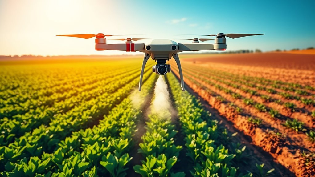
How Do Drones Improve the Efficiency of Agricultural Pesticide Application?
Drones revolutionize pesticide application through precision agriculture, allowing you to target specific areas while minimizing waste. They enhance crop monitoring, ensuring healthier yields and reducing environmental impact, ultimately giving you greater freedom in managing your farm.
