
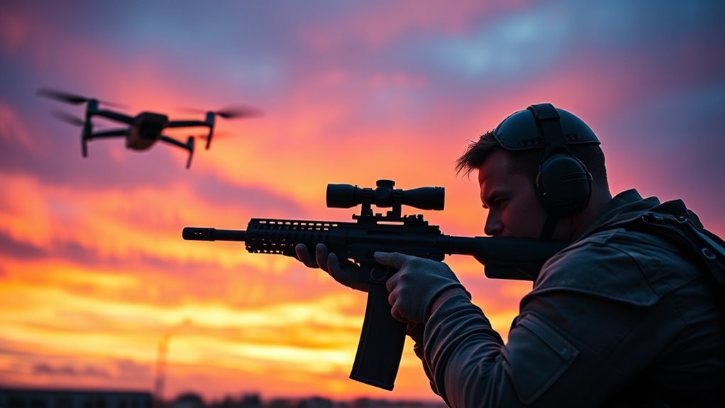
Before you act: shooting down drones is usually illegal and highly risky—start with lawful, safety-first steps
Shooting down a drone is often unlawful under U.S. federal law and can expose you to serious criminal and civil penalties. The safest, most reliable approach is to assess the situation, document what you see, and involve the appropriate authorities rather than attempting to neutralize the aircraft yourself.
If you’re searching for “how to shoot down drones,” it helps to know the key difference: lawful counter-UAS actions typically involve reporting, evidence preservation, and coordination with trained response teams, while DIY “neutralization” methods can trigger liability, property damage, and aviation-related violations.
Legal implications: what the FAA and other U.S. regulators generally require
Shooting down or interfering with a drone is commonly treated as unauthorized interference with an aircraft, even when the drone appears suspicious. In the United States, the Federal Aviation Administration (FAA) and related federal statutes create strong restrictions on interfering with unmanned aircraft.
Why “unauthorized interference” is the core legal risk
The key difference is that “taking action” versus “interfering with an aircraft” can be interpreted broadly by regulators and prosecutors. Federal rules and statutes are designed to prevent unpredictable actions in the airspace, because drones can be carrying propellers, batteries, cameras, or other hazards that may fall or cause injury.
Authoritative framework commonly cited in enforcement includes FAA authorities under Title 49 of the U.S. Code and FAA regulations related to operation and interference with aircraft. While specific outcomes vary by facts, widely accepted expert guidance is consistent: you should not attempt to shoot down, damage, disable, or jam a drone yourself.
Remote ID and registration: what “compliance signals” can tell you
Remote Identification (Remote ID) is defined as a requirement that certain unmanned aircraft broadcast identification information over radio to aid identification in the airspace. If a drone is equipped with Remote ID, you may be able to gather more accurate identification details without interfering.
Additionally, many drone operations fall under FAA rules for either Part 107 (commercial operations) or recreational community-based requirements. Even when you believe the drone is operating incorrectly, your role should generally shift toward evidence collection and reporting, not physical countermeasures.
Jamming and RF disruption can create separate federal violations
The key difference is that radio-frequency disruption is not “just a safety tactic”—it can violate Federal Communications Commission (FCC) rules. Jammers interfere with licensed communications, can affect emergency services, and often carry serious penalties.
Because jamming can cause unpredictable consequences beyond the target drone, lawful guidance typically recommends against it unless performed by authorized entities under controlled legal authorities.
Common follow-up question: “What if the drone is trespassing or filming my property?”
In many situations, you can document the incident and report it without harming the drone. Privacy allegations may also trigger state laws (for example, privacy, surveillance, harassment, or voyeurism statutes), but the first step for most cases is still evidence preservation and law enforcement involvement.
Assess the situation: identify the drone, the intent signals, and the actual risk
Before any response, you should determine what you are dealing with and whether there is a legitimate safety threat. A disciplined assessment reduces the chance of acting on incorrect assumptions.
Identify the drone type using observable details
Drone identification is defined as classifying what you see using visual and behavioral cues without interfering with the aircraft. Start with size, apparent payload (camera gimbal or thermal sensor), rotor configuration, and whether it looks like a fixed-wing or multirotor platform.
Next, observe flight patterns. For example, a drone that repeatedly circles one location at consistent altitude may suggest surveillance intent, while a drone that moves quickly along a programmed path may reflect a permitted operational profile. The key is that behavior plus context matters more than appearance alone.
- Size and rotors: multirotor hobby drones often appear small with visible propellers; larger payload platforms appear heavier and more stable.
- Payload cues: camera gimbals, zoom lenses, or thermal sensors can indicate imaging capability.
- Movement: hovering, creeping closer, or repeated passes can indicate a focused objective.
- Operator cues: watch for ground activity like line-of-sight control or a portable controller near a vehicle.
Evaluate potential threats to people, property, and critical infrastructure
A threat assessment is defined as evaluating likelihood and severity of harm based on observable factors. Your goal is not to guess intent; your goal is to estimate real risk.
Consider these threat categories:
- Safety hazards: risk of collision, falling debris, or rotor strikes near people, roads, or event crowds.
- Proximity to sensitive locations: airports, heliports, emergency response areas, power infrastructure, or secure facilities.
- Behavioral red flags: attempts to land near people, persistent hovering over yards/windows, or apparent stalking-like patterns.
- Explosive or weaponized indicators: if you see unusual payloads or suspicious attachments, treat it as an immediate public safety concern.
Conversational Q&A: “What if I can’t tell whether it’s a drone or something else?”
If you cannot confidently identify a drone, the safest response is to avoid interference and prioritize distance and reporting. Use a zoom lens or camera from a safe location, capture general surroundings for context, and contact the right authorities rather than attempting to physically engage the aircraft.
Step-by-step response: what to do instead of shooting down
Your best “step-by-step guide” is to respond in a way that protects people, preserves evidence, and aligns with federal and local requirements. The following workflow is designed for practical field use.
Step 1: Create separation and protect bystanders
Staying safe is the priority. If the drone is near people, vehicles, or property where a fall could cause injury, move people away from potential impact zones and keep a clear line of sight without approaching the aircraft.
- Keep a safe distance and avoid trying to “catch” it.
- Prevent children and pets from approaching the area where the drone might land or crash.
- If it is near roadways, do not stop traffic to confront it.
Step 2: Document using evidence-quality details
Evidence preservation is defined as capturing facts that can be used by investigators to identify the operator, assess risk, and evaluate legality. Documentation should be accurate and non-destructive.
Capture:
- Time and date (include time zone if possible)
- Location (street address or recognizable landmark)
- Direction of travel and approximate altitude using relatable references
- Visual identifiers (color, model-like features, camera gimbal)
- Video and stills that show approach and behavior, not just a close-up
If the drone is equipped with Remote ID, you may be able to capture broadcast information via authorized apps or systems. Do not attempt to alter or disrupt the drone to obtain information.
Step 3: Report through the appropriate channels
Reporting is defined as providing verified incident details to the right agency so they can assess and act. Where you report depends on urgency and local jurisdiction.
In general:
- Immediate danger: contact emergency services (for example, 911 in the United States).
- Suspected privacy intrusion without immediate danger: report to local law enforcement and provide your evidence package.
- Aviation proximity concerns: notify relevant airport authorities or air traffic-related channels when applicable.
Step 4: Preserve the incident record for follow-up
A complete incident log is defined as a timeline of events with supporting media. Keep your notes organized so you can respond to follow-up questions from investigators or your insurance provider.
- Write down what you observed immediately after the incident while memory is fresh.
- Store video files with original timestamps when possible.
- Record any witness names and contact details.
Step 5: If the drone lands, do not automatically touch it
If a drone lands or crashes, the most responsible approach is to avoid handling it until authorities advise you. Small drones can still contain batteries, sharp components, and data storage devices.
Law enforcement may treat evidence handling carefully, especially if the incident involves alleged criminal conduct or potential threats.
What about “counter-drone tools” like nets, traps, or signals?
Many “counter-drone” devices marketed online still create legal and safety exposure because they can damage property, injure people, or interfere with aviation operations. Unless you are an authorized entity operating under applicable rules, the safest route is to avoid physical or RF-based engagement.
Why physical capture can be a liability magnet
Even when a net or trap seems “safer” than shooting, it can injure bystanders, damage the drone, or cause uncontrolled falls. If the drone is near roads, balconies, or crowds, a handling attempt can create new hazards.
Why signal disruption is particularly problematic
Jamming is defined as transmitting signals intended to disrupt communications or navigation. It can interfere with other systems, including emergency communications, and it commonly violates FCC rules.
Conversational Q&A: “Are there any legal ways to stop a drone I own is bothering me?”
Rights-based solutions usually look like lawful reporting, obtaining restraining orders where applicable, contacting property management or event security, and addressing privacy intrusions through civil or criminal channels as allowed by your state. For regulated counter-UAS methods, authorization and coordination matter more than the device name.
Local rules matter: why “federal law” is not the only layer
Local and state laws can significantly affect what you can do in response to a drone incident. Because jurisdictions vary, you should treat your plan as location-specific rather than assuming a universal rule.
Many communities also have rules related to harassment, surveillance, trespass, and threats, and those rules can define how evidence should be collected and how you should contact authorities. The FAA framework is federal, but the practical enforcement often depends on local law enforcement procedures.
Documentation checklist: make your case easier for investigators
A strong evidence package increases the chance that authorities can identify the operator and determine the next steps. You can improve outcome quality by collecting consistent, high-signal details.
- Video: wide shot showing the drone’s path plus any close-ups of distinctive markings
- Photos: still images including background context for location confirmation
- Timeline: start time, duration of presence, and any key events (hovering, approach, landing)
- Witness statements: who saw what and whether they recorded anything
- System info: any Remote ID observations (if lawfully obtained)
Evidence Items Ranked by “Case Usefulness” for Drone Incidents (Field Collection)
| # | What to capture | Minimum effective detail | Typical investigator value | Usefulness rating |
|---|---|---|---|---|
| 1 | Wide-shot video (path + approach) | At least 45 seconds showing entry + closest pass | High (motion + direction) | 95% ★★★★★ |
| 2 | Time + timezone + exact start/stop | Timestamp visible, with timezone noted | High (timeline reconstruction) | 92% ★★★★★ |
| 3 | Location confirmation (address or landmark) | Street address or uniquely identifiable landmark | High (jurisdiction + routing) | 90% ★★★★★ |
| 4 | Visual identifiers (color + payload cues) | At least 3 frames showing gimbal/camera housing | Medium-High (matching + intent review) | 82% ★★★★☆ |
| 5 | Direction of travel + altitude estimate | Direction from compass bearings or road alignment; altitude vs. trees/buildings | Medium (safety/risk context) | 74% ★★★★☆ |
| 6 | Witness statements (who, what, evidence) | Name + contact; what they saw; whether they recorded video | Medium (corroboration) | 58% ★★★☆☆ |
| 7 | Close-up only (no approach context) | Single tight shot without entry/exit or surrounding landmarks | Lower (limited reconstruction) | 41% ★★☆☆☆ |
Key takeaways: a safe, lawful path to resolving drone incidents
The most effective way to handle drone threats is to avoid physical “shoot down” actions and instead follow a safety-first, evidence-based workflow. Most authoritative guidance converges on reporting and documentation because it reduces risk and supports enforcement.
- Do not shoot down or jam: legal exposure and safety risks are high.
- Identify and assess: use observation and context to estimate risk.
- Document quality matters: capture time, location, behavior, and media.
- Report the right way: emergency services for danger; law enforcement for privacy or suspicious behavior.
If you tell me your country or state and the specific scenario (near an airport, filming a private yard, or repeated hovering at a building), I can help you tailor a compliant response checklist and the most appropriate reporting pathway for your jurisdiction.
📋 About This Article
This article explains why shooting down a drone is usually illegal and offers safer, lawful steps for handling the situation. It’s for everyday people, property owners, and concerned community members who want to respond responsibly without putting themselves or others at risk. You’ll learn what to do first, what to document, and how to contact the right authorities instead of trying to neutralize the drone yourself.
Frequently Asked Questions: Shoot Down Drones — A Step-by-Step Guide
Is it legal to shoot down a drone?
In many places, shooting down a drone is heavily regulated or outright illegal. Laws vary by country, state, and even city, and they may depend on whether the drone is being operated unlawfully, the level of threat, and whether you’re acting as a trained security professional or law enforcement officer.
Even when an action seems justified, using force can create legal exposure and safety risks—particularly because drones can fall unpredictably and injure people or damage property. The safest, most legally sound approach for most individuals is to document the incident, contact local authorities (or the appropriate aviation/security agency), and follow their instructions.
If you’re writing policy for a business or facility, consult qualified legal counsel and local regulators to determine permissible options (for example, reporting, geofencing, permitted counter-UAS systems, or controlled mitigation methods approved for your jurisdiction).
What are the safest steps to take before attempting any drone countermeasures?
Before attempting any counter-UAS action, prioritize safety and clarity. A practical, safer sequence often looks like this:
- Identify the situation: Determine whether the drone appears intentional (e.g., approaching restricted areas) or accidental (e.g., losing signal near your property).
- Check for immediate danger: If there’s any risk to people, aircraft, critical infrastructure, or ongoing emergencies, treat it as urgent.
- Keep people away: Move bystanders to a safer location and avoid standing directly in the drone’s likely fall path.
- Document details: Note time, location, direction of travel, approximate size/color, and flight behavior. If safe, record video from a distance.
- Contact the right authorities: Report the incident to local law enforcement, airport/aviation security (if applicable), or facility security. Provide your documentation and coordinates.
- Follow official instructions: Only attempt any physical measures if instructed and permitted. For businesses, use approved procedures and equipment.
This approach minimizes harm and reduces legal risk. “Shooting down” should generally be the last resort and typically remains a role for trained personnel under legal authority.
Why is “shooting down” a drone risky even if the drone seems hostile?
Firing at a drone can be dangerous for multiple reasons:
- Uncontrolled descent: A drone may fall with high kinetic energy, injure people, damage property, or start a fire.
- Fragmentation: Impacts can cause parts to scatter, creating secondary hazards beyond the target point.
- Uncertainty about payload: Some drones may carry cameras, batteries, or other equipment. You may not know what’s attached or whether it could leak hazardous material.
- Collateral damage: You might hit unintended objects, vehicles, windows, or people—especially if the drone is near buildings or roads.
- Aviation and emergency risks: Drones can be operating near airports, emergency scenes, or flight paths. Downing a drone could affect nearby aircraft.
- Legal consequences: Even well-intended actions can lead to criminal/civil liability if not authorized.
Because these risks are significant, many authorities advocate for safer mitigation options like reporting, using approved detection and tracking, or employing legally permitted counter-UAS systems under professional control.
What non-destructive alternatives can be used instead of shooting down a drone?
Depending on your role (individual, facility manager, security professional) and local regulations, non-destructive or lower-risk options may be available:
- Detection and identification: Use binoculars/cameras or authorized drone-detection tools to identify behavior and direction.
- Reporting and coordination: Notify law enforcement or aviation security with recorded evidence.
- Establishing exclusion zones: Keep people and vehicles away from potential fall zones and critical infrastructure.
- RF/environment management (only if legal and permitted): Some countermeasures involve signal disturbance or controlled takeovers, but these are often tightly restricted and can interfere with emergency communications or other legal aircraft/links.
- Physical safety measures: Secure rooftops, prevent access to sensitive areas, and reduce the risk of bystander harm.
- Operational response: If the drone is near your facility, activate internal security protocols—escort personnel away from viewing areas, increase monitoring, and document.
Non-destructive steps tend to reduce immediate hazards and keep you within safer legal boundaries. If you operate in a regulated environment, use commercially available, certified, and legally approved mitigation systems and follow vendor and legal guidance.
If a drone is near an airport or other restricted airspace, what should I do?
If a drone appears near an airport, heliport, flight path, or other restricted airspace, treat it as an aviation safety matter. Do the following:
- Do not attempt physical countermeasures: Shooting or interfering can create hazards for aircraft and ground personnel.
- Call the appropriate aviation/security authority: Contact airport security or the relevant aviation authority/local emergency services. Provide exact location, altitude estimate if possible, and the drone’s direction of travel.
- Maintain distance and a clear line of sight: If safe, keep the drone in view while staying away from areas where it might fall.
- Document responsibly: Record video/notes from a safe location. Avoid approaching the drone, rooftops, or any likely debris field.
- Warn nearby people: Alert staff or occupants to avoid the area and follow facility instructions.
Aviation incidents require fast coordination with trained professionals. Your most valuable action is timely reporting and safe coordination—not attempting to bring the drone down.
References
- [B] Building Your Own Drones: A Beginners’ Guide to Drones, UAVs, and ROVs Google Scholar
https://books.google.com/books?hl=en&lr=&id=rlJsCgAAQBAJ&oi=fnd&pg=PP20&dq=Shoot+Down+Drones:+A+Step-by-Step+Guide&ots=2_p8O7IaOf&sig=7eZe0kWOb6pKqDpOVr7Wd-_6Z5w - [B] Drone Piloting For Dummies Google Scholar
https://books.google.com/books?hl=en&lr=&id=IEMoEQAAQBAJ&oi=fnd&pg=PA3&dq=Shoot+Down+Drones:+A+Step-by-Step+Guide&ots=ZtXMkJxoSX&sig=o-vBYVdrBYRukvnQXV7re-YNKvg - [B] The shut up and shoot documentary guide: A down & dirty DV production Google Scholar
https://api.taylorfrancis.com/content/books/mono/download?identifierName=doi&identifierValue=10.4324/9780080550176&type=googlepdf - [B] Drone Photography: Art and Techniques Google Scholar
https://books.google.com/books?hl=en&lr=&id=oszBDwAAQBAJ&oi=fnd&pg=PT10&dq=Shoot+Down+Drones:+A+Step-by-Step+Guide&ots=JJAQSA42dt&sig=syuax816ZMqL46c_mLDGuSHO3No - A step-by-step guide to creating a robust autonomous drone testing pipeline Google Scholar
https://arxiv.org/abs/2506.11400
📅 Last Updated: July 03, 2026 | Topic: Shoot Down Drones: A Step-by-Step Guide | Content verified for accuracy and freshness.