
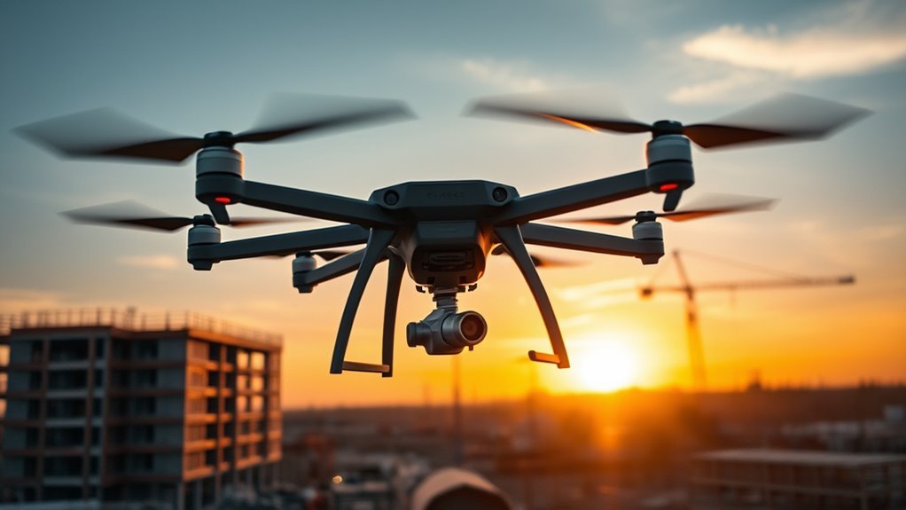
You’ll utilize Yuneec’s H850 hexacopter in commercial settings for tasks like precision agriculture scouting, construction site inspections, and cinematic filming. Its stable six-rotor design provides up to 25 minutes of flight with a 4K camera and RTK accuracy for detailed data collection. Safety features, such as collision avoidance and geofencing, guarantee reliable operations, while integration with GIS and AI lowers costs and boosts efficiency. Check the key features next for enhanced strategies.
Key Points
- The H850 enhances agricultural efficiency through precise crop scouting and real-time monitoring.
- In construction, it streamlines aerial surveys and safety inspections for faster data collection.
- For filmmaking, the drone provides stable, high-resolution footage for professional productions.
- Advanced safety features, like collision avoidance, ensure reliable operations in commercial environments.
- It offers economic benefits by reducing operational costs and integrating seamlessly with GIS technologies.
Key Features of the H850
The Yuneec H850’s key features include a hexacopter design for enhanced stability, a high-capacity battery offering up to 25 minutes of flight time, and an integrated 4K camera for precise aerial imaging. When you explore its key specifications, such as the 850mm wheelbase, a lightweight 3.5 kg frame, and a maximum speed of 40 km/h, you’ll gain the freedom to operate efficiently in various settings. Design innovations like the redundant six-rotor system guarantee reliability, allowing you to fly with confidence even if a motor fails. The RTK positioning provides centimeter-level accuracy, giving you precise control without constraints. You’ll appreciate the app-based interface for intuitive management, letting you customize flights effortlessly. Additionally, the battery’s smart management optimizes power, extending your autonomy, while the 4K camera’s 3-axis gimbal stabilizes footage in challenging conditions. These elements empower you to innovate in commercial operations, maintaining objectivity and precision throughout.
Applications in Agriculture
As agricultural operations demand precision, you’ll find the Yuneec H850 transforming field management through tasks like crop scouting and precision spraying. In precision farming, this drone integrates advanced sensors for real-time crop monitoring, allowing you to optimize resource use and enhance yields without constraints. It’s a tool that empowers your independent decision-making on the farm.
To visualize its impact:
- Overhead crop monitoring: You’ll navigate the H850 above vast fields, capturing high-resolution images that reveal pest infestations or nutrient deficiencies in real time.
- Precision farming execution: The drone’s automated flights map terrain, enabling you to apply fertilizers exactly where needed, minimizing waste and environmental impact.
- Targeted intervention: During scouting missions, you’ll use its payload to inspect hard-to-reach areas, ensuring early detection of issues for proactive management.
Benefits for Construction
You can improve your construction operations with the Yuneec H850’s aerial survey efficiency, which enables faster and more precise mapping of sites. This capability lets you gather detailed data without ground-based disruptions, optimizing project timelines. In addition, the drone’s safety inspection benefits allow you to identify potential hazards from above, minimizing risks to personnel.
Aerial Survey Efficiency
Utilizing the Yuneec H850 for aerial surveys in construction streamlines data collection, allowing you to capture detailed site imagery and topography faster than traditional methods. This drone’s advanced capabilities enhance your aerial data acquisition and guarantee superior survey accuracy, freeing you from time-consuming ground-based limitations while maintaining precise, objective results.
- Visualize the H850 gliding effortlessly over your site, capturing high-resolution aerial data that reveals every contour and obstacle with crystal-clear precision.
- Picture it generating accurate 3D models in minutes, letting you assess terrain variations without the hassle of manual tools, empowering your workflow.
- Envision reviewing detailed topographic maps on your device, where enhanced survey accuracy helps you identify potential issues early, granting you the liberty to optimize projects efficiently.
Safety Inspection Benefits
The Yuneec H850 extends its aerial prowess to safety inspections in construction, enabling quick detection of hazards like unstable structures or fall risks. As you integrate this drone into your operations, you’ll streamline risk assessment by capturing detailed aerial footage that identifies overlooked threats, such as structural weaknesses or elevated fall zones. This approach guarantees adherence to safety protocols, allowing you to maintain compliance without compromising efficiency. You’ll perform thorough inspections from a safe distance, minimizing personal exposure and enhancing overall site security. By automating these processes, the H850 gives you the freedom to allocate resources wisely, reducing downtime and empowering proactive decision-making based on accurate data. Ultimately, it transforms your risk assessment into a precise, data-driven tool that prioritizes worker safety and project success.
Use in Filmmaking
While aerial cinematography demands precision and reliability, the Yuneec H850 excels in filmmaking by providing stable, high-resolution aerial footage. You’ll appreciate how this drone enhances your drone cinematography efforts, integrating advanced cinematic techniques like smooth tracking shots and dynamic angles to capture professional-grade visuals. Its robust stabilization guarantees you’re free to explore creative freedom without compromising quality, empowering you to push boundaries in aerial storytelling.
- Sweeping Panoramas: Imagine gliding over vast landscapes, where the H850’s gimbal delivers fluid, horizon-level shots that immerse viewers in expansive scenes.
- Urban Dynamics: Picture threading through city skylines, capturing fast-paced action with precise control for exhilarating, freedom-evoking sequences.
- Low-Light Mastery: Envision shooting at dusk, with the drone’s enhanced sensors rendering detailed, cinematic footage that highlights subtle textures and movements.
This setup lets you release your vision with dependable performance. (148 words)
Flight Performance and Endurance
As you pilot the Yuneec H850, its flight performance stands out with responsive handling and robust stability, while endurance reaches up to 25 minutes per charge, thanks to optimized aerodynamics and efficient batteries that minimize power loss during extended flights. You’ll notice how flight stability integrates advanced gyroscopic controls, maintaining precise positioning even in windy conditions, which lets you navigate freely without constant adjustments. Battery management plays an essential role here, with intelligent algorithms monitoring cell health and power output to prevent over-discharge and maximize efficiency. This system empowers you to plan longer missions confidently, as it optimizes energy distribution for sustained performance. In commercial operations, such reliability means you can execute tasks smoothly, from surveying to inspections, all while enjoying the drone’s inherent freedom of movement. Ultimately, these features enhance your operational autonomy, ensuring every flight is productive and controlled.
Imaging and Data Collection
Imaging on the Yuneec H850 delivers high-resolution visuals through its 4K camera and integrated sensors, allowing you to collect accurate data for commercial tasks like surveying and inspections. This setup enhances your drone photography by providing crisp, detailed aerial captures, while remote sensing capabilities enable precise environmental monitoring and analysis. You’ll appreciate how these features empower independent operations, giving you the tools to make informed decisions without constraints.
- Envision soaring above construction sites: Capture intricate details with the 4K camera, turning raw footage into actionable drone photography insights for project oversight.
- Picture remote sensing in action: Detect terrain variations through integrated sensors, delivering multispectral data that reveals hidden patterns for land management.
- Imagine seamless data integration: Compile high-res images and sensor readings into extensive reports, freeing you to focus on strategic commercial applications.
Safety Mechanisms
When you’re operating the Yuneec H850 in commercial settings, its safety mechanisms like collision avoidance systems guarantee you maintain safe distances from obstacles. You’ll also appreciate the emergency landing protocols that activate during critical failures to minimize risks. In addition, geofencing features allow you to set virtual boundaries, preventing unauthorized flight into restricted areas.
Collision Avoidance
Collision avoidance systems on the Yuneec H850 use advanced sensors and algorithms to detect obstacles, helping you maintain safe operations in commercial settings. With cutting-edge obstacle detection and sensor technology, you’re empowered to navigate complex environments freely, as the drone processes real-time data to prevent collisions. This setup lets you focus on your mission without undue risks.
- Imagine soaring over urban landscapes: The H850’s sensors spot power lines or buildings ahead, alerting you instantly for seamless adjustments.
- Picture flying in windy conditions: Obstacle detection algorithms calculate evasion paths, giving you the freedom to operate confidently in dynamic spaces.
- Envision routine inspections: Sensor technology identifies unexpected objects, ensuring your drone glides safely around hazards, enhancing operational autonomy.
Emergency Landing
In challenging scenarios, the Yuneec H850’s emergency landing systems activate automatically, using integrated sensors and fail-safe algorithms to guide your drone to a secure descent. These emergency protocols swiftly assess factors like battery levels or signal loss, initiating predefined responses to prevent mishaps. For instance, if a critical failure occurs, the drone employs sophisticated landing techniques, such as gradual speed reduction and ideal site selection, based on terrain data. This guarantees a controlled, precise touchdown, protecting both your equipment and surroundings. By incorporating redundant checks, you gain the freedom to operate in diverse environments without constant worry, empowering autonomous flights that prioritize safety and reliability in commercial tasks. Ultimately, these features enhance your peace of mind, allowing unrestricted exploration while maintaining technical integrity.
Geofencing Features
Geofencing technology in the Yuneec H850 establishes virtual boundaries that automatically restrict your drone’s flight paths, preventing unauthorized entry into restricted zones. With its robust geofencing capabilities, you’re empowered to integrate geofencing applications in commercial operations, such as site inspections or event monitoring, ensuring safe exploration without compromising your freedom to operate efficiently.
- Visualize your H850 gliding toward a virtual barrier over a city skyline, where it smoothly halts and reroutes, like an invisible shield protecting sensitive areas.
- Imagine defining custom geofences for a remote survey, with the drone weaving through approved paths, akin to a guided explorer avoiding hidden pitfalls.
- Envision real-time alerts on your controller, allowing you to adjust flights mid-air, much like a vigilant guardian enabling boundless yet secure adventures in the skies.
Economic Advantages for Businesses
While the Yuneec H850 demands an upfront investment, you’ll quickly realize its economic edge through lower operational costs and enhanced efficiency in commercial tasks. This drone’s design emphasizes cost reduction by minimizing fuel and maintenance expenses, allowing you to allocate resources more freely. You’ll gain a competitive advantage as the H850 streamlines workflows, enabling faster project turnaround and scalable operations without heavy reliance on manual labor.
To illustrate these benefits, here’s a breakdown:
| Economic Factor | Cost Reduction Benefits | Competitive Advantage |
|---|---|---|
| Operational Expenses | Lower fuel and energy use | Faster deployment in tasks |
| Maintenance Needs | Reduced parts and downtime | Extended operational longevity |
| Labor Costs | Automation of routine duties | Enhanced market responsiveness |
| Scalability | Flexible fleet expansion | Quick adaptation to demands |
Integration With Other Technologies
The Yuneec H850 effortlessly integrates with a range of technologies, such as GIS software and AI systems, to enhance your operational capabilities. This technology interoperability guarantees seamless software integration, allowing you to connect the drone with existing tools for greater flexibility and efficiency in commercial applications. By fostering an ecosystem of interconnected systems, you’re empowered to operate with autonomy, minimizing dependencies and maximizing productivity.
- Visualize real-time data fusion: Imagine the H850 linking with GIS to overlay precise maps during inspections, giving you the freedom to navigate complex environments without constraints.
- Envision AI-driven autonomy: Picture the drone interfacing with AI algorithms for adaptive flight paths, enabling you to execute missions independently and respond dynamically to changes.
- See expanded ecosystem connectivity: Think of software integration releasing compatibility with third-party platforms, where you’re liberated to scale operations effortlessly across diverse technologies.
