

Tracking a drone effectively requires selecting the right location technology, configuring your drone and tracker correctly, and using a reliable data path that matches your mission range. This step-by-step guide focuses on practical, legally compliant approaches used in real-world operations, from GPS-based tracking to cellular modules and modern Remote ID.
Before you start, confirm you’re tracking your own aircraft or you have lawful permission to track the target. Drone tracking often intersects with privacy and aviation regulations, so start with compliance planning alongside the technical setup.
How Drone Tracking Works (and What You’re Actually Measuring)
Drone tracking is defined as determining an aircraft’s position over time using one or more sensing and communication channels. In practice, that means converting signals like GPS, radio telemetry, Wi-Fi, or cellular data into coordinates your system can display and record.
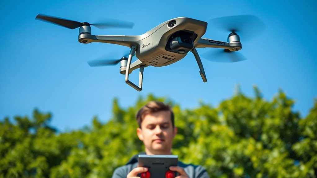
The key difference between tracking approaches is where the position data originates and how it gets to you (or to an authorized monitoring service). For example, GPS provides an estimated position based on satellite signals, while radio-frequency telemetry provides position only if the aircraft or ground system derives it from navigation data.
Most consumer and prosumer drones rely on a GNSS receiver (commonly GPS with augmentation from GLONASS, Galileo, or BeiDou) for navigation. Many also transmit telemetry over common control links that operate in industrial, scientific, and medical (ISM) bands such as 2.4 GHz and 5.8 GHz. Visual tracking systems (often camera-based) can also estimate motion, but they typically require good lighting and stable scenes.
Signal types you’ll encounter
Understanding the signal source helps you choose a tracker that will remain accurate in your environment. The same tracking device can behave very differently in urban canyons, forests, or open fields.
- GNSS (GPS/Galileo/GLONASS/BeiDou): Position is computed from satellite signals. Urban areas can cause multipath errors and brief accuracy drops.
- Radio telemetry (2.4/5.8 GHz): Useful for real-time control and telemetry when line-of-sight exists and interference is low.
- Wi-Fi-based location: Often leverages nearby Wi-Fi access points for approximate positioning, particularly effective in dense coverage.
- Cellular location: Uses mobile networks for wide-area connectivity and can support long-range “check-in” tracking.
- Computer vision tracking: Estimates relative position and motion from camera frames, depending on scene features and processing quality.
Why accuracy changes: environment and attenuation
The key operational reality is that RF and GNSS signals weaken or distort with distance and obstacles. Tracking reliability depends on antenna placement, link budget, terrain, and interference.
Signal attenuation is defined as the reduction of signal power as distance increases and as obstacles absorb or reflect radio waves. In real deployments, this can lead to telemetry gaps, delayed updates, or “last known location” behavior when the link is disrupted.
Choose the Right Tracking Method for Your Range and Use Case
The right tracking method is defined by the distance you need, the environment you fly in, and whether you need real-time updates or delayed recovery support. Start by writing down your typical flight radius, likely obstacles, and expected mission duration.
Most tracking setups fall into one of three categories: local short-range locating, wide-area tracking with cellular data, or command-and-control telemetry tracking through the drone’s existing control link.
Bluetooth trackers: best for short-range recovery
Bluetooth tracking is defined as using short-range radio to locate the drone when you are relatively close. It is commonly used for “walk it down” recovery rather than long-distance tracking.
- Strength: Often low power and easy to pair with a phone.
- Limitation: Usually works only within tens of meters to a few hundred meters, depending on hardware and obstacles.
- Best for: Backyard or field retrieval where you can physically search the area.
RF/RFID tags: strong for identification, limited for navigation
RFID tracking is defined as identifying an object when it comes within reader range. It is excellent for confirming presence, but it does not reliably provide a continuous position trace by itself.
- Strength: Reliable identification at close proximity.
- Limitation: Typically requires a reader near the tag.
- Best for: Post-recovery confirmation or controlled environments.
Wi-Fi locators: effective where networks are dense
Wi-Fi tracking is defined as estimating or reporting location based on nearby Wi-Fi access points and network availability. It can deliver faster “area awareness” in cities and suburban areas with dense coverage.
- Strength: Useful in urban environments with many access points.
- Limitation: Coverage gaps occur in rural or remote zones.
- Best for: Urban navigation awareness and last-known location reporting.
Cellular modules: the practical choice for wide-area tracking
Cellular tracking is defined as reporting the drone’s location through the mobile network (2G/3G/4G/5G depending on module support). It’s the most common path for tracking beyond line-of-sight.
- Strength: Wider coverage, often supporting updates even when you lose radio control link.
- Limitation: Performance depends on carrier coverage, signal strength, and configuration.
- Best for: Remote fields, larger operational areas, and “check-in” tracking.
Telemetry-based tracking: depends on link quality
Telemetry tracking is defined as using the drone’s command-and-control or companion link to stream position data to your ground station. It is ideal when you maintain connectivity.
- Strength: Often real-time and integrated with your flight controller and ground software.
- Limitation: When interference or distance breaks the link, updates stop.
Select a Compatible Tracking Device (Without Guesswork)
Compatibility is defined as whether the tracker can physically connect, power safely, and communicate correctly with your drone and app stack. The safest way to avoid “it won’t work” failures is to match interfaces and power requirements before field deployment.
Start with your drone model and confirm its supported accessories and external power rails. Then map the tracker’s requirements: voltage range, connector type, antenna needs, and software integration method (Bluetooth pairing, Wi-Fi app, cellular APN settings, or API support).
Compatibility checklist you can verify today
Use this checklist to validate compatibility before you fly. If any item is unclear, contact the manufacturer or consult your drone’s technical documentation.
- Electrical compatibility: Confirm input voltage and current draw for the tracker and ensure safe power tapping.
- Physical fit: Confirm mounting location for vibration isolation and antenna line-of-sight.
- Firmware support: Verify the tracker works with your flight controller firmware and companion computer, if applicable.
- Connector and cable interfaces: Confirm port type (for example JST-style connectors) and pinout if you’re using a custom harness.
- Network configuration: For cellular devices, confirm SIM type and settings like APN (Access Point Name) and update interval.
Battery life and update interval: plan around real numbers
Battery life is defined as the time the tracker can transmit or log data at your chosen update rate. Update interval changes power consumption, so choose a rate you can sustain.
As a practical planning baseline, note that trackers configured to transmit every 5 to 60 seconds typically consume dramatically more power than devices that report every 5 to 15 minutes. If your module vendor lists standby and active current, use those numbers to estimate runtime. When battery capacity is unknown, treat aggressive update rates as a risk.
GNSS Setups That Influence Drone Tracking Stability (Typical Spec Ranges)
| # | GNSS configuration | Cold start TTFF | Typical horizontal accuracy | Tracking reliability |
|---|---|---|---|---|
| 1 | Single GPS (L1 only) | 30–60 s | 5–15 m | ★★★☆☆ |
| 2 | GPS + GLONASS (L1/L2) | 25–50 s | 3–10 m | ★★★★☆ |
| 3 | GPS + Galileo (L1) | 20–45 s | 2–8 m | ★★★★☆ |
| 4 | GPS + BeiDou (L1) | 20–45 s | 2–9 m | ★★★★☆ |
| 5 | Multi-constellation, multi-band (L1/L5) | 15–40 s | 1.5–5 m | ★★★★★ |
| 6 | Multi-constellation + SBAS/assisted corrections | 15–35 s | 1–4 m | ★★★★★ |
| 7 | RTK GNSS (base/rover) | 30–120 s (fix) | 0.01–0.05 m | ★★★★★ |
Set Up Drone Tracking Correctly (Configuration That Prevents Failures)
Setup success is defined by three outcomes: reliable power, reliable network connectivity, and accurate time-stamped location reporting. A good configuration reduces “last known position” ambiguity when the drone loses contact.
Most tracking failures come from avoidable issues: incorrect GPS settings, misconfigured cellular credentials, poor antenna placement, or power brownouts when motors draw current bursts. Proceed systematically using the ground test workflow before flight.
Step-by-step configuration workflow
Follow this workflow to validate tracking before you rely on it in the field. Each step can be done without flying farther than needed.
- Step 1: Power on and verify stable voltage: Ensure the tracker does not reset during typical drone power draw and vibration.
- Step 2: Validate GNSS lock (if GPS-based): Confirm the tracker reports a valid fix quality before departure.
- Step 3: Confirm network connectivity: For cellular, verify signal strength and confirm the device can send test messages to your platform.
- Step 4: Test update intervals: Trigger a manual “ping” and confirm the expected latency (for example, how many seconds between update and dashboard display).
- Step 5: Check timestamp and coordinate format: Prefer standardized outputs such as WGS 84 latitude/longitude with ISO 8601 timestamps for log integrity.
- Step 6: Perform a range and obstruction test: Walk or drive to simulate distance and common obstacles (trees, buildings, terrain).
Position accuracy expectations you should know
GNSS-based position is defined as an estimate that can be affected by multipath, satellite geometry, and receiver quality. You can’t assume constant precision across all environments.
In open-sky conditions, many GNSS receivers report meter-level accuracy or better, but accuracy degrades under canopy, in urban “street canyon” conditions, or when the drone experiences rapid movement. Treat reported accuracy figures (when available) as an important part of decision-making.
Use Real-Time Tracking Safely and Legally
Legal compliance is defined as operating your drone and any tracking feature in a way that respects aviation rules and privacy obligations. In many jurisdictions, you must follow airspace restrictions and rules governing identification and operation.
In the United States, the Federal Aviation Administration (FAA) is the primary authority. As an example, the FAA’s Remote ID requirements were published through rulemaking under the agency’s unmanned aircraft framework. In the European Union, EASA (European Union Aviation Safety Agency) issues regulatory guidance under its continuing oversight of unmanned aviation.
If your operation includes Remote ID, ensure your drone and tracking system meet applicable requirements for identification and broadcasting. For broader alignment, many systems and manufacturers reference Remote ID concepts shaped by ASTM standards and related industry guidance, though exact compliance details depend on your region and drone category.
Privacy and data minimization
Privacy-safe tracking is defined as collecting and sharing only the minimum location data required for authorized recovery and operation. Avoid sharing live location publicly, and restrict access to trusted operators.
- Store location logs securely and apply role-based access when possible.
- Use retention limits so data is not kept indefinitely.
- Ensure your tracking app or platform does not expose sensitive coordinates to unauthorized users.
How to Troubleshoot Drone Tracking Issues in the Field
Most tracking problems are fixable once you isolate whether the failure is power, GPS, connectivity, or configuration. Use a structured troubleshooting approach rather than repeated random changes.
Common symptoms and their most likely causes
- Tracker shows no updates: Usually indicates power reset, cellular/Wi-Fi credentials error, or the platform endpoint is unreachable.
- Tracker updates but location is “off”: Often GNSS lock quality issues, poor antenna placement, or coordinate format mismatches.
- Updates stop at certain distances: Typically RF attenuation, interference, or network coverage gaps for cellular.
- Intermittent “last known location” jumps: Often network variability, poor signal strength, or aggressive update rate leading to data throttling.
Q and A: What if my drone loses control link?
If the control link is lost, tracking still works only if your tracker has its own communication path or logs locally. For example, telemetry tracking may stop when the radio link fails, while a cellular module can continue reporting location if it has adequate coverage.
Q and A: How often should I update my tracker?
Update frequency is a trade-off between battery life and situational awareness. A higher frequency (like every 5 to 15 seconds) improves real-time monitoring, while a lower frequency (like every 5 to 15 minutes) preserves battery during extended missions or uncertain recovery scenarios.
Q and A: Can I rely on GPS alone?
GPS alone can provide location on the device, but you still need a way to retrieve or transmit it. If your drone cannot send data back after link loss, you may only have “on-device” knowledge unless the system logs and you can later retrieve the data.
Best Practices for Reliable Drone Tracking Performance
Reliable tracking is achieved through hardware placement, conservative configuration, and repeatable pre-flight testing. The goal is to turn “it worked once” into a dependable system you can trust.
- Mount antennas correctly: Ensure cellular/Wi-Fi antennas have minimal obstruction and are oriented to improve signal path.
- Stabilize power: Use safe power tapping and verify the tracker does not brown out when motors draw peak current.
- Validate data flow: Confirm that logs and dashboard updates are time-stamped and consistent (for example, WGS 84 coordinate outputs).
- Perform a controlled test flight: Test in a safe area that allows you to observe how tracking behaves as distance increases.
- Plan for failover: Combine telemetry with a secondary method such as cellular or local logging so you’re not dependent on a single link.
If you want the most dependable results, prioritize a dual-path strategy: keep telemetry-based monitoring for real-time control when possible, and pair it with cellular or local logging so recovery tracking can continue when radio links fail.
📋 About This Article
This step-by-step guide shows you how to track a drone accurately, using the right location method and a setup that matches your mission range. It’s written for drone owners, operators, and hobbyists who want to follow practical, legally compliant tracking practices. You’ll learn how drone position tracking works, how to configure the drone and tracker, and how to use options like GPS-based tracking, cellular modules, and Remote ID where applicable.
Frequently Asked Questions
What do I need before I start tracking a drone?
Before you start tracking, gather the key items that affect accuracy and safety. You typically need: (1) a compatible drone and controller (or flight app) that supports telemetry output, (2) a smartphone/tablet or monitor for your tracking/flight interface, (3) the drone’s firmware/app updated to the latest stable version, (4) a clear understanding of your tracking method (GPS-based location on a map, Remote ID, or visual/manual methods), (5) sufficient battery on both the drone and controller, and (6) a plan for signal loss (e.g., return-to-home settings). If you plan to track using a third-party app or receiver, confirm compatibility with the drone model and the data types you need (location, altitude, speed, heading). Finally, check local rules about drone operation and any required Remote ID or airspace permissions.
How can I track my drone in real time during a flight?
Real-time tracking usually relies on telemetry and a map view in your flight app. To do it step by step: (1) Power on the controller and drone, then launch the official app or the tracking-capable software for your model. (2) Confirm you have a strong GPS lock (or other positioning system) on the drone—wait for status indicators like “Ready” or “GPS/RTK locked,” depending on the system. (3) Establish a stable link between the drone and controller; the app should show signal strength and link status. (4) Use the live map/telemetry screen to monitor latitude/longitude, altitude, distance from home, and direction/heading. (5) Keep an eye on key health metrics such as battery, GPS satellites, wind/compass calibration alerts, and any geofencing warnings. (6) If your system supports it, enable “Return-to-Home” (RTH) and verify the configured altitude and behavior. For best results, avoid shielding (under trees/indoors) and maintain line-of-sight for the remote link.
What should I do if my drone signal is lost while tracking?
If you lose signal, your goal is to recover safely and minimize risk to people and property. Follow this general sequence: (1) Stay calm and check the controller status—some systems will attempt to reconnect automatically. (2) Do not walk straight toward where you last saw the aircraft if it could increase risk; instead, move only if needed to regain link and keep awareness of surroundings. (3) Verify whether your drone has entered a failsafe mode such as Return-to-Home, Hover, or Landing. Many drones decide this based on settings and the time since link loss. (4) If RTH is enabled, confirm the RTH altitude is high enough to clear obstacles. If it is not, avoid obstacles when planning how to position yourself for recovery. (5) If you’re using an advanced tracking method (like Remote ID or a receiver), consult it for last-known coordinates, altitude, and heading. (6) After power is regained, re-launch carefully and verify navigation sensors and calibration status. If your drone may have crashed, use the last recorded telemetry point and expand search outward in a grid pattern from the predicted location.
How accurate is drone tracking, and what affects tracking precision?
Drone tracking accuracy depends on positioning technology and link quality. Most consumer drones rely on GPS (and sometimes assisted GPS) for location, which can introduce error from several meters to tens of meters, especially under challenging conditions. Accuracy is influenced by: (1) GPS satellite quality and sky view (urban canyons and tree cover reduce accuracy), (2) multipath effects (signals bouncing off buildings), (3) RTK/PPK availability (more advanced setups can greatly reduce error), (4) compass calibration and magnetic interference, (5) barometer accuracy for altitude, (6) controller/drone sensor health, and (7) latency or dropped telemetry updates caused by weak radio link. For tracking tasks where precision matters (e.g., searching for a downed drone), use the most reliable position source available, take note of timestamped telemetry, and search around the last-known point rather than assuming it’s exact.
Can I track a drone beyond line of sight, and what are my options?
Tracking beyond line of sight (BVLOS) depends on both your equipment and regulations. Many consumer drone systems are designed for line-of-sight operation, where the radio link can directly communicate with the controller. For beyond line of sight tracking, you generally need one or more of the following: (1) an enhanced long-range datalink system that maintains telemetry over greater distances, (2) a cellular or network-based solution (where permitted) for telemetry and map updates, (3) a Remote ID-capable setup that broadcasts identification information (where supported by your aircraft and applicable laws), and (4) third-party tracking services that aggregate telemetry or use receivers compatible with the drone’s broadcast. Even with these options, performance can degrade due to coverage gaps, network latency, and changes in positioning quality. Always verify local legal requirements for BVLOS operations, Remote ID compliance, and any required authorization or safety procedures.
References
- [B] Drone Piloting For Dummies Google Scholar
https://books.google.com/books?hl=en&lr=&id=IEMoEQAAQBAJ&oi=fnd&pg=PA3&dq=Tracking+a+Drone:+A+Step-by-Step+Guide&ots=ZtXMkJAvTT&sig=4s5QmJY-f7zXk4ulQgMgpNkXk04 - A step-by-step guide to creating a robust autonomous drone testing pipeline Google Scholar
https://arxiv.org/abs/2506.11400 - The Drone tour guide Google Scholar
https://air.ashesi.edu.gh/items/94ab0c15-f5f8-494c-9930-08cab8ec3863 - [B] Building Your Own Drones: A Beginners’ Guide to Drones, UAVs, and ROVs Google Scholar
https://books.google.com/books?hl=en&lr=&id=rlJsCgAAQBAJ&oi=fnd&pg=PP20&dq=Tracking+a+Drone:+A+Step-by-Step+Guide&ots=2_p8O7LhPb&sig=0Hr-upkwChjWPXj-Vzq8g3lf3OM - Practical guidelines for performing UAV mapping flights with snapshot sensors Google Scholar
https://www.mdpi.com/2072-4292/17/4/606
📅 Last Updated: July 03, 2026 | Topic: Tracking a Drone: A Step-by-Step Guide | Content verified for accuracy and freshness.
