

Drone geofencing is one of the most important safety systems in modern unmanned aircraft operations. It uses GPS-based virtual boundaries to control where a drone can and cannot fly, helping pilots avoid restricted airspace, sensitive locations, and regulatory violations. For recreational users, commercial drone operators, and enterprise fleets alike, geofencing supports safer flight planning, stronger airspace awareness, and better compliance with aviation rules. Understanding how this technology works is essential for anyone who wants to operate a drone responsibly in an increasingly regulated airspace environment.
📋 About This Article
This article explains how drone geofencing works to help you fly safely within allowed areas. It’s for recreational pilots, commercial operators, and enterprise drone team members who want clearer guidance and fewer accidental rule violations. You’ll learn what geofencing does as a virtual boundary, how it can warn or limit flights when you get near restricted zones, and how to use that knowledge for better flight planning and airspace awareness.
What Is Drone Geofencing?
Drone geofencing is a digital safety feature that creates virtual perimeters around specific geographic areas. These boundaries are programmed into the drone’s flight control system or companion software and are typically based on GPS coordinates, aviation databases, and manufacturer-defined restrictions. When a drone approaches, enters, or attempts to take off within one of these zones, the system can issue a warning, limit movement, prevent takeoff, or trigger an automatic response.
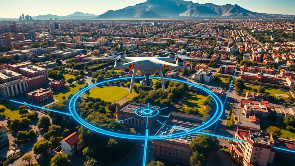
In practical terms, geofencing acts like an invisible airspace barrier. It is designed to reduce the risk of drones entering prohibited or high-risk areas such as airports, military installations, government facilities, critical infrastructure sites, or emergency response zones. Rather than simply restricting pilots, the technology supports safe operations by aligning drone activity with national airspace regulations and operational best practices.
For drone pilots, geofencing creates a more structured flying environment. It helps prevent accidental airspace incursions, improves situational awareness, and reduces the likelihood of unsafe encounters with manned aircraft. In this way, geofencing serves both as a technical safeguard and as a compliance tool.
Why Drone Geofencing Matters for Safe Operations
The growth of unmanned aerial systems has made airspace management more complex. As drones become more common in photography, surveying, inspection, mapping, agriculture, and public safety, the need for reliable operational controls has increased. Geofencing addresses this need by adding an automated layer of protection between the pilot and restricted airspace.
Its value extends across several safety and regulatory areas:
- Airspace protection: It helps keep drones away from controlled airspace, no-fly zones, and temporary flight restrictions.
- Collision risk reduction: It lowers the chance of drone interference with aircraft operations, especially near airports and heliports.
- Operational compliance: It supports adherence to civil aviation authority rules and manufacturer safety policies.
- Public safety: It prevents flights over hazardous zones, emergency scenes, and sensitive infrastructure.
- Pilot accountability: It encourages operators to plan flights carefully and understand local flight restrictions.
For organizations managing multiple drones, geofencing also contributes to fleet governance. It can standardize where aircraft are allowed to operate and reduce the chance of unauthorized missions.
How Drone Geofencing Technology Works
At a technical level, drone geofencing combines satellite positioning, onboard sensors, digital maps, and flight control software. The system continuously compares the drone’s real-time location against predefined geographic boundaries. If the aircraft nears a restricted area, the software evaluates the situation and applies programmed safety logic.
Virtual Boundary Creation
The core of geofencing is the creation of virtual boundaries, often defined by latitude, longitude, altitude, and radius. These boundaries may be circular, polygonal, or layered to reflect different levels of restriction. Some geofence zones are permanent, while others are dynamic and change based on temporary events such as emergency operations, VIP movement, or wildfire response.
Manufacturers, software platforms, and aviation authorities may all contribute data used to define these boundaries. In many systems, the pilot can also create custom geofences for site-specific operations, such as keeping a drone within a construction perimeter or away from neighboring property.
GPS and Sensor Integration
Geofencing depends heavily on GPS or GNSS positioning to determine the drone’s location in real time. The flight controller receives coordinate data from the onboard navigation module and combines it with information from other sensors such as inertial measurement units, compasses, barometers, and vision positioning systems. This sensor fusion improves accuracy and supports more stable geofence enforcement.
When GPS data is strong and calibration is correct, the drone can reliably identify its position relative to restricted areas. In advanced systems, the aircraft may also factor in altitude, heading, speed, and flight path to predict whether a boundary is about to be crossed.
Real-Time Monitoring and Automated Response
Once the geofence is active, the drone continuously monitors its own position. If it approaches a restricted boundary, the system may trigger one or more predefined actions. These responses vary by manufacturer and geofence type but commonly include:
- On-screen alerts or audible warnings
- Restricted takeoff from certain locations
- Limited horizontal or vertical movement
- Automatic braking before entering a prohibited zone
- Forced hover at the boundary edge
- Return-to-home or automatic rerouting
This real-time control logic is what makes geofencing an active safety system rather than a passive map overlay. The technology does not simply inform the pilot; it can directly influence aircraft behavior to maintain operational limits.
Types of Drone Geofence Zones
Not all geofence zones function in the same way. Different airspace categories and operational priorities require different levels of restriction. Understanding these variations helps drone pilots interpret warnings correctly and plan compliant missions.
Restricted Zones
Restricted zones are areas where drone flight is blocked entirely or subject to strict limitations. These often include airport runways, military bases, prisons, embassies, and highly sensitive government locations. In many cases, a drone will not be allowed to take off inside these areas, or it may be prevented from entering them during flight.
Warning Zones
Warning zones notify pilots that they are approaching an area with increased operational risk. These areas may not always be fully prohibited, but they require heightened awareness. A pilot may receive a prompt, map alert, or software notification before proceeding.
Authorization Zones
Authorization zones allow access only after certain conditions are met. Depending on the platform, this may involve logging into a verified account, requesting manufacturer unlock approval, or confirming legal authorization from the applicable aviation authority. These zones are common near controlled airspace where approved drone operations may still be possible under specific conditions.
Altitude-Limited Zones
Some geofences do not prohibit flight completely but impose altitude restrictions. This approach is useful in locations where low-level drone operations may be acceptable, while higher-altitude flights would interfere with other aircraft or violate airspace classifications.
Custom Operational Geofences
Commercial operators often create their own geofenced boundaries for internal safety management. For example, a utility inspection company may set a perimeter around a worksite, or a film production team may define an operational box to keep drones away from crowds, roads, or neighboring structures. These custom zones improve mission discipline and reduce human error.
Key Benefits of Geofencing for Drone Pilots and Organizations
Geofencing offers more than regulatory protection. It improves mission quality, pilot confidence, and operational consistency across a wide range of use cases.
Improved Flight Safety
The most obvious benefit is safety. By preventing accidental entry into hazardous or sensitive areas, geofencing reduces the chance of collisions, disruptions, and emergency incidents. This is especially valuable for less experienced pilots who may not yet have strong airspace judgment.
Better Regulatory Compliance
Aviation regulations can be complex and location-specific. Geofencing helps translate those rules into real-time operational limits. While it does not replace pilot responsibility, it does act as an additional safeguard against unauthorized flights.
Enhanced Operational Discipline
In commercial environments, geofencing supports standardized procedures. Teams can predefine approved flight zones, limit drift outside work areas, and create repeatable mission frameworks. This is useful for infrastructure inspection, surveying, security patrols, and industrial operations.
Reduced Liability Exposure
Unauthorized drone activity can lead to legal, financial, and reputational consequences. By reducing the risk of entering prohibited areas, geofencing helps organizations lower liability exposure and demonstrate a stronger commitment to risk management.
Limitations of Drone Geofencing
Although geofencing is highly valuable, it is not perfect. Pilots should understand its limitations and avoid treating it as a complete replacement for flight planning or airspace research.
GPS Dependence
Geofencing relies on accurate positioning data. In areas with poor GPS reception, electromagnetic interference, dense urban structures, or signal degradation, performance may be affected. If location accuracy drops, the system may become less reliable.
Database Accuracy and Update Delays
Geofence systems are only as effective as the data they use. If airspace maps, firmware, or zone databases are outdated, the drone may not reflect the latest restrictions. Temporary flight restrictions and local emergency zones can also change quickly, making manual verification essential.
Variation Between Manufacturers
Different drone brands implement geofencing differently. Some have aggressive restrictions, while others offer more pilot control or fewer built-in limitations. This inconsistency means operators should not assume the same rules apply across all aircraft platforms.
False Sense of Security
One of the biggest operational risks is overreliance. A pilot may assume that if the drone allows takeoff, the flight must be legal. That is not always true. Geofencing is a support tool, not a legal authority. Pilots are still responsible for checking airspace classifications, weather conditions, local laws, and mission-specific hazards.
Best Practices for Operating with Drone Geofencing
To use geofencing effectively, pilots should integrate it into a broader flight safety process rather than viewing it as a standalone feature.
Keep Firmware and Flight Apps Updated
Manufacturers frequently update geofence databases, flight control logic, and safety alerts through firmware and software releases. Running outdated systems can create avoidable compliance gaps. Before any mission, confirm that the aircraft, remote controller, and flight application are updated.
Review Airspace Before Every Flight
Even if a drone includes built-in geofencing, pilots should always check official airspace sources, NOTAMs, and local restrictions before launch. This is especially important near airports, stadiums, emergency sites, and urban centers.
Understand Unlock Procedures
In some legitimate cases, a flight may be authorized inside a controlled or restricted zone. Pilots should understand the manufacturer’s unlocking process and distinguish it from legal flight permission. Unlocking a geofence does not automatically mean the operator has regulatory approval.
Use Custom Geofences for Risk Management
For professional operations, custom geofencing can improve site safety. Setting perimeter limits around obstacles, roads, power lines, buildings, or public gathering areas can help keep flights contained and predictable.
Train Pilots on Geofence Behavior
Every operator should know how their drone reacts when it encounters a boundary. Training should cover warning prompts, braking behavior, return-to-home logic, and how the aircraft responds during manual versus autonomous flight modes. Familiarity reduces confusion during critical moments.
Drone Geofencing and Regulatory Compliance
Geofencing is closely tied to aviation compliance, but it does not replace formal regulatory obligations. Civil aviation authorities such as the FAA, EASA, and other national regulators establish the legal framework for drone operations, including airspace access, operational categories, pilot certification, and remote identification requirements.
Manufacturers build geofencing around this regulatory environment, but the implementation is often broader or more conservative than the law itself. In some cases, a drone may block flight in an area where legal authorization is possible. In other cases, local restrictions may exist even when the drone software does not flag them.
For this reason, professional drone operations should treat geofencing as one layer within a full compliance strategy that includes:
- Pre-flight airspace review
- Remote pilot qualification
- Operational risk assessment
- Mission documentation
- Authorization or waiver management
- Maintenance and firmware tracking
The Role of Geofencing in Advanced Drone Operations
As drone technology evolves, geofencing is becoming more sophisticated. It now plays a growing role in autonomous flight, enterprise drone management, beyond visual line of sight operations, and urban air mobility frameworks. In advanced use cases, geofencing can integrate with route planning systems, cloud-based fleet software, live airspace feeds, and geospatial intelligence platforms.
This development is particularly relevant for sectors such as logistics, infrastructure inspection, emergency response, precision agriculture, and smart city operations. In these environments, geofencing is not just a safety feature; it is part of the operational architecture that helps drones function reliably at scale.
Mastering the basics of drone geofencing gives pilots and organizations a stronger foundation for safe, lawful, and efficient flights. By understanding how virtual boundaries are created, how GPS and sensors enforce them, and how different geofence zones affect aircraft behavior, operators can make better decisions before and during every mission. In a rapidly changing airspace environment, that knowledge is essential for responsible drone use.
Frequently Asked Questions About Drone Geofencing
What is drone geofencing and how does it work?
Drone geofencing is a safety feature that uses GPS, mapping data, and onboard software to create virtual boundaries that a drone should not enter or can only enter under certain conditions. These boundaries are often placed around sensitive or restricted areas such as airports, military zones, prisons, power plants, government facilities, or temporary no-fly zones. When a drone approaches one of these areas, the geofencing system may warn the pilot, limit altitude, prevent takeoff, or automatically stop the aircraft from crossing into the restricted airspace. The exact response depends on the drone manufacturer, the local regulations, and how the geofence has been programmed. Geofencing helps reduce accidental airspace violations and supports safer, more responsible drone operations.
Why is geofencing important for safe drone operations?
Geofencing is important because it adds an extra layer of protection between drone pilots and restricted or hazardous airspace. Even experienced operators can misjudge their location, overlook temporary flight restrictions, or lose situational awareness during a flight. Geofencing helps prevent these mistakes by alerting the pilot or restricting the drone before it enters an unsafe area. This is especially valuable near airports, emergency response scenes, crowded public spaces, and critical infrastructure where unauthorized drone activity can create safety risks, legal issues, or operational disruptions. While geofencing should never replace proper flight planning, regulatory compliance, and pilot training, it serves as a practical safeguard that supports safer decision-making and reduces the chance of avoidable incidents.
Can a drone fly in a geofenced area if the pilot has permission?
In many cases, yes, but it depends on the drone brand, the type of geofence, and the approval process required by both regulators and the manufacturer. Some geofenced zones can be unlocked by submitting authorization documents, verifying pilot credentials, or using built-in unlocking tools provided by the drone company. However, having permission from a property owner or an airspace authority does not always mean the drone will automatically be able to fly there unless the geofence is also unlocked in the system. Pilots should confirm local airspace rules, secure any required waivers or approvals, and complete the manufacturer’s unlocking steps before the operation. It is important to plan ahead, because some unlock requests are instant while others may require manual review and extra documentation.
Are all drone geofencing systems the same?
No, drone geofencing systems vary significantly between manufacturers, software platforms, and enterprise flight solutions. Some systems use fixed no-fly zones, while others apply layered restrictions such as warning zones, altitude-limited areas, or authorization-required regions. The quality and frequency of map updates can also differ, which affects how current the restricted area data is. In addition, some drones allow custom geofences for internal safety management, enabling organizations to define operational boundaries around job sites, schools, private land, or hazardous terrain. Because of these differences, pilots should learn how their specific drone handles geofencing, how updates are delivered, what alerts appear during flight, and what procedures are needed if an unlock request becomes necessary.
What should pilots do if geofencing data is outdated or inaccurate?
If geofencing data appears outdated or inaccurate, pilots should avoid relying on the drone’s map alone and verify airspace information using official aviation sources, local regulations, and trusted flight planning tools. Geofencing databases may not always reflect the latest temporary flight restrictions, emergency airspace controls, or local operational limitations. Before flying, the pilot should update the drone firmware, flight app, and geofencing database whenever possible. If a legitimate flight is blocked because of incorrect geofence information, the pilot should contact the manufacturer or use the official unlocking process rather than attempting unsafe workarounds. Safe operations depend on combining geofencing with pre-flight checks, current airspace research, and sound judgment, especially when operating near sensitive or rapidly changing environments.
