
Drones can see a variety of landscapes and objects from the air, including natural features, human-made structures, and wildlife. Equipped with advanced cameras and sensors, they capture high-resolution images and data, making them valuable tools for various industries such as agriculture, surveillance, and environmental monitoring. This capability not only enhances operational efficiency but also provides insights that were previously difficult to obtain without extensive manpower or resources.
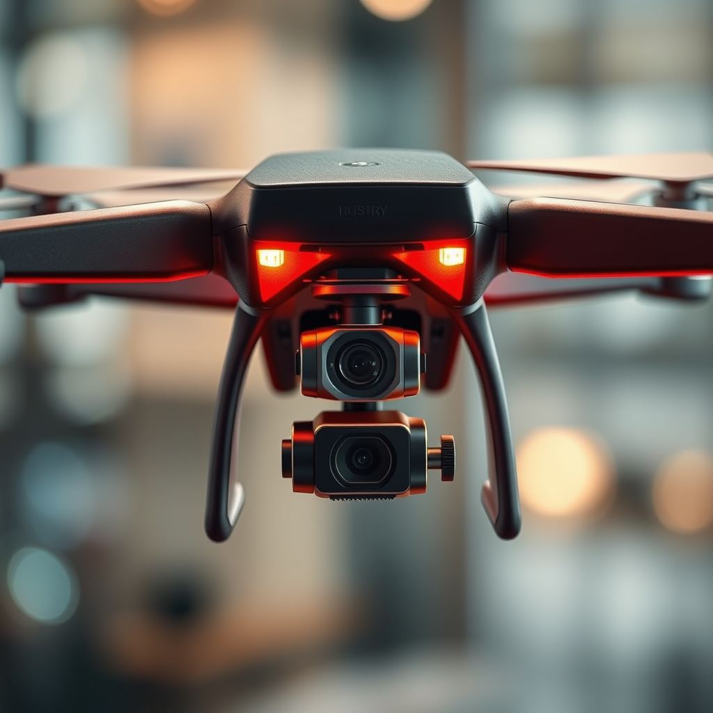
Types of Cameras Used in Drones

Drones leverage various types of cameras and sensors to capture distinct visual data, each serving specific purposes depending on the mission at hand.
– Optical Cameras: These are the most common types of cameras found on drones and are designed to capture high-resolution images and videos. They are particularly effective for detailed analysis in applications such as real estate photography, landscape surveying, and inspection of infrastructure. With advancements in camera technology, drones can now capture images with resolutions that rival traditional photography, making them invaluable for tasks that require meticulous detail.
– Thermal Cameras: Unlike optical cameras, thermal cameras detect heat signatures emitted by objects. This capability is particularly useful in search and rescue operations, where locating individuals in remote or hazardous environments is crucial. Thermal imaging drones can identify heat sources, making them effective in wildfire detection, pipeline monitoring for leaks, and even assessing the energy efficiency of buildings by identifying heat loss.
Applications in Agriculture
The agricultural sector has seen significant advancements through the integration of drone technology, which enhances efficiency and productivity.
– Crop Monitoring: Drones equipped with multispectral cameras can assess plant health by analyzing various wavelengths of light reflected by crops. This technology allows farmers to identify areas needing attention, such as those suffering from disease or nutrient deficiencies. By regularly monitoring crops from above, farmers can make informed decisions about irrigation, fertilization, and pest control, ultimately leading to increased yields and reduced costs.
– Soil Analysis: Drones also play a critical role in soil analysis by providing data on soil moisture levels and nutrient content. Utilizing sensors that gauge moisture levels, farmers can optimize irrigation schedules, conserving water and enhancing crop productivity. This proactive approach allows for targeted interventions, ensuring that resources are used efficiently.
Role in Environmental Monitoring
Drones are becoming essential tools for environmental monitoring, offering valuable insights into ecosystems and aiding in conservation efforts.
– Wildlife Observation: Drones can monitor wildlife without the intrusive presence of humans, which can disrupt natural behaviors. For instance, researchers use drones to track migratory patterns of birds or monitor endangered species in their natural habitats. This non-invasive approach ensures that data collection does not interfere with the animals’ daily activities, leading to more accurate findings.
– Disaster Response: In the wake of natural disasters, drones provide real-time aerial views that are essential for assessing damage. They can quickly survey affected areas, identifying hazards such as flooding, landslides, or wildfire impacts. This rapid assessment capability allows emergency responders to allocate resources more effectively and strategize recovery efforts, ultimately saving lives and minimizing loss.
Drones in Urban Planning
Urban planners are increasingly utilizing drones to enhance the planning and development processes within cities.
– Infrastructure Inspection: Drones are invaluable for inspecting urban infrastructure, such as bridges, roads, and buildings. Equipped with high-resolution cameras, they can identify structural issues that may not be easily visible from the ground. This capability not only improves safety by facilitating regular inspections but also reduces the need for costly scaffolding or manual inspections in hard-to-reach areas.
– Land Use Mapping: By capturing aerial views of urban landscapes, drones assist in land use mapping and planning. They provide planners with comprehensive data on existing land use, enabling more informed zoning decisions. This aerial perspective helps planners visualize the potential impact of new developments and assess how they fit within the broader urban fabric.
Security and Surveillance Uses
The versatility of drones extends into the realm of security and surveillance, where they serve crucial roles in monitoring and protecting assets.
– Perimeter Security: Drones equipped with cameras can monitor large properties, such as warehouses, factories, and estates, for unauthorized access. They can cover extensive areas more efficiently than ground patrols, providing real-time surveillance data that enhances security measures. This capability is especially beneficial for critical infrastructure sites, where timely detection of intrusions can prevent theft or vandalism.
– Crowd Monitoring: During large events, drones can be deployed to observe crowds, ensuring safety and security management. They provide a bird’s-eye view that helps security personnel monitor behavior, identify potential issues, and respond swiftly to incidents. This aerial oversight is becoming increasingly important in managing public safety at concerts, festivals, and sporting events.
Limitations of Drone Vision
Despite their numerous advantages, drones do have limitations that must be considered when integrating them into various applications.
– Weather Dependency: Drone visibility can be significantly hindered by adverse weather conditions such as rain, fog, or darkness. These environmental factors can affect the quality of data captured and may even pose operational challenges that limit flight capabilities. Consequently, drone operators must remain cognizant of weather forecasts and conditions to plan effective missions.
– Altitude Restrictions: Legal limitations on how high drones can fly may restrict their viewing capabilities. Regulatory bodies, such as the Federal Aviation Administration (FAA) in the United States, impose altitude restrictions to ensure safety and minimize interference with manned aircraft. These limitations can affect the types of data that can be collected, particularly in urban environments where tall buildings may obstruct views.
In conclusion, drones offer an extensive range of visual capabilities that benefit many sectors. Their ability to capture high-resolution images, monitor environmental changes, and enhance security measures showcases their versatility and importance in modern applications. As technology advances, their ability to see and analyze data will only continue to improve, making them essential tools for both individual and professional use. Explore how drones can enhance your projects today!
Frequently Asked Questions
What types of cameras can drones use to capture images and videos?
Drones can be equipped with various types of cameras, including standard HD cameras, 4K video cameras, thermal imaging cameras, and multispectral sensors. Each camera type serves different purposes, such as capturing high-definition footage for filmmaking, thermal cameras for search and rescue operations, or multispectral sensors for agricultural monitoring. The choice of camera depends on the specific use case and the data needed.
How do drones use thermal imaging to see in the dark?
Drones equipped with thermal imaging cameras can detect heat signatures emitted by objects, allowing them to “see” in complete darkness. This technology is especially useful in search and rescue missions, wildlife monitoring, and building inspections, as it can identify temperature differences that are invisible to the naked eye. By translating heat into visual images, thermal drones can provide valuable data in low-light situations.
Why do drones have limitations in what they can see?
Drones have limitations based on several factors, including their camera capabilities, altitude, and environmental conditions. For example, cameras might struggle to capture clear images in foggy or rainy weather, and the altitude of the drone affects its field of view. Additionally, regulations may restrict drone operations in certain areas, limiting what they can visually survey. Understanding these limitations helps users select the right drone for their needs.
Which drone features enhance visibility and image quality?
To enhance visibility and image quality, look for drones equipped with 4K cameras, gimbals for stabilization, and advanced sensors like optical zoom or thermal capabilities. Features such as high dynamic range (HDR) video and adjustable ISO settings can also significantly improve image quality in varying lighting conditions. Investing in drones with these features can lead to more professional-looking results and improved data collection.
What can drones detect in agricultural monitoring?
Drones used in agricultural monitoring can detect various factors critical to crop health, such as moisture levels, plant health, and pest infestations. Using multispectral and hyperspectral cameras, these drones can analyze vegetation indices like NDVI (Normalized Difference Vegetation Index), which helps farmers make informed decisions about irrigation, fertilization, and pest control. This technology ultimately leads to increased yield and more efficient farming practices.
References
- https://en.wikipedia.org/wiki/Drone
- https://www.faa.gov/uas/recreational_flyers/
- https://www.nature.com/articles/s41598-019-43248-4
- https://www.sciencedirect.com/science/article/abs/pii/S2352864817301874
- https://www.researchgate.net/publication/329888748_Applications_of_Drones_in_Science_and_Technology
- https://www.bbc.com/news/technology-37476252
- https://www.nytimes.com/2021/09/14/technology/drones-surveillance.html
