
You can rely on radar to detect a drone’s size, shape, speed, direction, and altitude by analyzing returned signal properties like amplitude, phase, and Doppler shifts. Radar cross-section impacts visibility, with smaller or stealth drones being harder to detect. Environmental factors and low-altitude flight add complexity, requiring optimized frequency bands and advanced signal processing. Challenges remain in precise identification and altitude tracking, but ongoing technology improvements are enhancing these capabilities greatly, offering deeper insight into drone characteristics and behavior.
Principles of Radar Detection for Aerial Objects
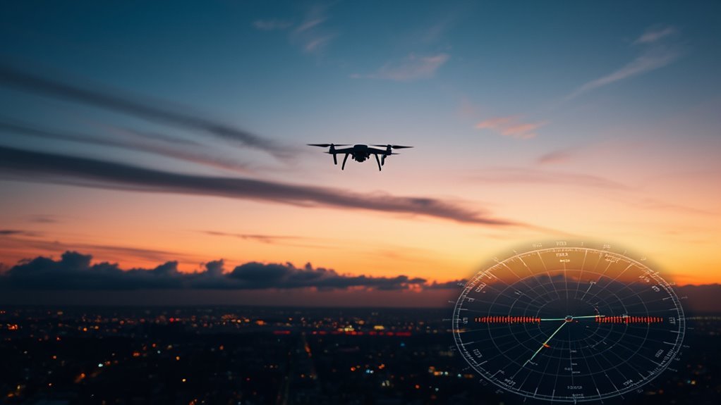
Although radar technology has been around for decades, its application to detecting aerial objects like drones involves specific principles that you need to understand. Radar systems emit radio waves that reflect off objects, with the return signal analyzed to determine distance and velocity. However, you must recognize radar limitations, especially regarding small, low-flying drones. Their minimal size and slow speeds reduce the strength of reflected signals, compromising detection accuracy. Environmental factors like clutter, interference, and multipath reflections further challenge reliable identification. To maintain your operational freedom, you should be aware that enhancing radar detection requires optimizing frequency bands, pulse repetition frequencies, and antenna design. Understanding these technical constraints helps you navigate the balance between effective surveillance and preserving the autonomy drones afford you.
Radar Cross-Section and Its Impact on Drone Visibility
Building on radar detection principles, understanding how a drone’s radar cross-section (RCS) affects its visibility is key to evaluating detection capabilities. The RCS quantifies how much radar energy a drone reflects back to the receiver, directly influencing its detectability. You’ll find that smaller RCS values mean reduced radar reflection characteristics, making drones harder to spot. Drone stealth technology exploits this by minimizing reflective surfaces and using radar-absorbent materials, effectively lowering the RCS. As a result, drones equipped with stealth features can evade or delay radar detection, granting operators greater operational freedom. Evaluating RCS provides a measurable framework to anticipate radar performance against various drone designs, enabling you to understand the limits and strengths of radar systems in identifying these increasingly sophisticated aerial platforms.
Identifying Drone Size and Shape Using Radar
When radar systems analyze returned signals, they can extract detailed information about a drone’s size and shape by examining the amplitude, phase, and time delay of the echoes. You’ll find that drone silhouette analysis relies heavily on processing these parameters to reconstruct the drone’s geometric profile. Significantly, radar frequency selection influences resolution and penetration depth; higher frequencies yield finer shape discrimination but may be limited by environmental factors. By carefully selecting frequency bands and applying advanced signal processing techniques, you can differentiate between multi-rotor drones and fixed-wing types based on their radar cross-sectional patterns. This precise identification empowers you to assess potential threats or monitor airspace without compromising your operational freedom, enabling a clear understanding of what’s approaching without unnecessary constraints.
Measuring Drone Speed and Direction With Radar
You’ll measure drone speed and direction by analyzing radar signal processing techniques that extract velocity data from returned signals. The Doppler effect plays a key role, shifting frequencies based on drone movement relative to the radar. Combining this with trajectory tracking algorithms allows precise determination of the drone’s flight path and velocity vectors.
Radar Signal Processing
Although radar systems emit electromagnetic waves that reflect off objects, measuring a drone’s speed and direction requires sophisticated signal processing techniques to accurately interpret Doppler shifts and time delays. To guarantee precise detection, you need to focus on:
- Signal amplification – Enhancing weak reflected signals from small drones without introducing distortion.
- Noise reduction – Filtering environmental and electronic noise that can mask drone echoes, preserving signal integrity.
- Time-delay analysis – Calculating the elapsed time between emission and reception to determine range and velocity vectors.
Doppler Effect Usage
Since the Doppler effect causes frequency shifts in reflected radar signals from moving drones, you can analyze these shifts to accurately measure their speed and direction. When a drone moves toward the radar, the reflected frequency increases; moving away, it decreases. This Doppler shift is detected through frequency modulation techniques, allowing you to quantify velocity components precisely. By comparing transmitted and received signal frequencies, the radar system calculates the radial speed of the drone relative to the radar’s position. This method provides real-time data without requiring visual contact, preserving your operational freedom. Understanding Doppler shift lets you differentiate drone movement patterns effectively, ensuring accurate speed and directional assessments critical for monitoring and control applications where freedom of movement and situational awareness are paramount.
Trajectory Tracking Methods
When tracking a drone’s trajectory, radar systems rely on continuous measurement of speed and direction to construct accurate flight paths. You’ll find that real time monitoring is essential, allowing immediate response to any unexpected changes in the drone’s movement. Trajectory prediction algorithms analyze this data to forecast future positions, enhancing situational awareness.
Here’s how trajectory tracking methods work in practice:
- Doppler radar measures velocity by detecting frequency shifts, providing instant speed and direction data.
- Kalman filtering integrates multiple measurements to reduce noise and improve accuracy in trajectory estimation.
- Predictive modeling uses historical and current data for trajectory prediction algorithms, enabling proactive control or interception.
Altitude Detection Capabilities of Radar Systems
You need to understand how radar systems determine a drone’s altitude by considering their maximum altitude range and altitude resolution accuracy. These parameters directly influence detection reliability, especially as drones operate at varying heights. However, challenges arise in accurately detecting high-altitude targets due to signal attenuation and environmental factors.
Maximum Altitude Range
Although radar systems vary widely in design and application, their maximum altitude range fundamentally limits the scope of aerial detection and tracking. When considering drone height, you must understand that altitude limitations directly impact whether a radar can detect objects flying at various elevations. This is essential for drones, which often operate at low to moderate altitudes.
To grasp maximum altitude range, consider these factors:
- Radar frequency: Higher frequencies generally offer better detection at lower altitudes but shorter maximum range.
- Antenna design: Beam elevation angles and antenna gain influence vertical coverage.
- Atmospheric conditions: Refraction and absorption affect signal propagation and maximum altitude detection.
Altitude Resolution Accuracy
Altitude resolution accuracy defines a radar system’s ability to distinguish between two targets at different elevations within its coverage area. When you rely on altitude measurement, precision hinges on advanced resolution techniques such as pulse compression and angle beamforming. These methods empower you to separate drones flying closely in vertical space, preserving your freedom to monitor airspace accurately.
| Resolution Technique | Altitude Accuracy (meters) | Impact on Detection |
|---|---|---|
| Pulse Compression | 1.5 | High |
| Angle Beamforming | 2.0 | Moderate |
| Frequency Modulation | 3.0 | Low |
Challenges in High Altitude Detection
When operating at high elevations, radar systems face unique challenges that can degrade their detection capabilities. Understanding these detection limitations is vital if you want reliable high altitude surveillance. Here are three primary challenges:
- Signal Attenuation: At higher altitudes, radar signals weaken due to atmospheric absorption and scattering, reducing effective range and sensitivity.
- Clutter and Noise Interference: High altitude environments often include atmospheric turbulence and weather phenomena that generate clutter, complicating target discrimination.
- Angular Resolution Constraints: The angular resolution decreases with distance, making it harder to pinpoint small, fast-moving drones at extreme altitudes.
You need to account for these factors when designing radar systems to guarantee freedom from blind spots and maintain robust detection performance at high altitude.
Challenges in Detecting Small and Low-Flying Drones
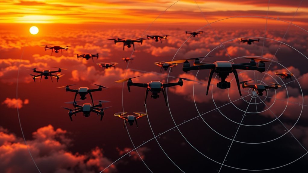
Detecting small and low-flying drones presents unique challenges because their minimal radar cross-section and erratic flight patterns often blend into background clutter. You’ll find that traditional detection techniques struggle with these targets, as radar limitations hinder consistent identification. Small drones typically return weak signals that can be masked by ground reflections, vegetation, or urban structures. Low altitude flight further complicates detection by increasing interference from terrain and man-made objects. To overcome these issues, specialized radar systems with higher resolution and advanced signal processing algorithms are necessary. However, even with these improvements, distinguishing drones from environmental noise remains a constant battle. Understanding these radar limitations helps you appreciate why continuous innovation in detection techniques is essential to maintaining situational awareness and preserving your freedom in increasingly complex airspaces.
Differentiating Drones From Birds and Other Objects
How can you reliably distinguish drones from birds and other airborne objects using radar data? Employing advanced drone recognition techniques is key to maintaining situational awareness while preserving your freedom to operate. You must analyze specific radar signatures and flight behaviors unique to drones versus birds.
- Velocity Patterns – Drones exhibit steadier, controlled speeds compared to erratic bird flight, aiding differentiation.
- Radar Cross Section (RCS) Analysis – Drones generally have a consistent RCS, while birds’ RCS fluctuates due to wing flapping.
- Flight Path Predictability – Drones follow programmed or operator-controlled routes, unlike the unpredictable trajectories of birds.
Incorporating bird differentiation methods alongside drone recognition techniques guarantees you accurately identify objects, minimizing false alarms without compromising operational freedom.
Advances in Radar Technology for Enhanced Drone Tracking
Recent advances in radar technology have significantly improved the precision and reliability of drone tracking systems. You can now benefit from enhanced drone identification capabilities through sophisticated radar integration, allowing for more accurate differentiation between drones and other aerial objects. These systems leverage high-resolution Doppler processing and adaptive signal filtering to reduce false positives and improve tracking range. The following table outlines key improvements:
| Feature | Benefit | Impact on Tracking |
|---|---|---|
| High-resolution radar | Precise target imaging | Better drone identification |
| Adaptive filtering | Noise reduction | Fewer false alarms |
| Radar integration | Multi-sensor fusion | Enhanced situational awareness |
With these advancements, you gain greater freedom in managing drone activity while ensuring reliable detection and identification.