

A drone pilot license can do far more than simply let you fly legally for work. It can open the door to a wide range of commercial drone services, specialized technical roles, and profitable freelance opportunities across fast-growing industries. From aerial photography and real estate marketing to agricultural drone operations, infrastructure inspections, mapping, and public safety support, licensed drone pilots are increasingly valuable in today’s data-driven economy.
📋 About This Article
This article explains what you can do with a drone pilot license—beyond just flying legally—so you can turn your credential into real opportunities. It’s for aspiring drone pilots, hobbyists, and working professionals who want to know how the license can lead to paid work. You’ll learn about common service options like aerial photography and real estate marketing, plus other in-demand uses such as mapping, infrastructure inspections, and agricultural or public safety support.
As unmanned aerial systems become standard tools in construction, energy, media, farming, and surveying, the value of a certified drone operator continues to rise. A license demonstrates regulatory compliance, flight competency, and professional credibility. For hobbyists, it can turn a personal passion into a side business. For professionals, it can become a direct path into a modern aviation career with strong market demand.
Commercial Aerial Photography and Videography
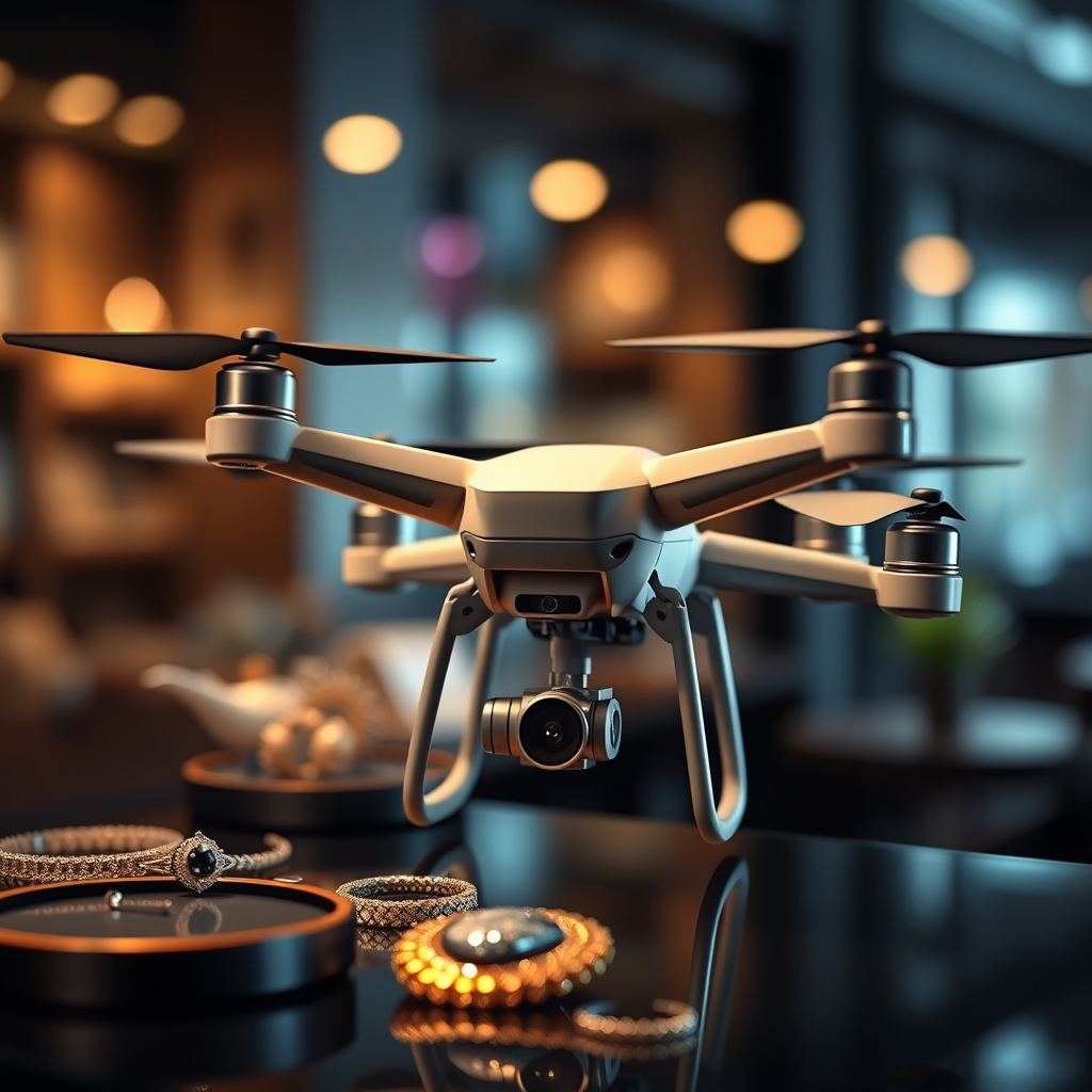
One of the most recognized ways to use a drone pilot license is in commercial aerial photography and videography. Businesses, agencies, and private clients regularly need high-quality aerial visuals for marketing, storytelling, and documentation. A licensed drone pilot can capture perspectives that ground-based cameras simply cannot deliver, making drone footage highly desirable in competitive industries.
Real Estate Marketing
Real estate is one of the biggest markets for drone services. Agents, brokers, and property developers use drone photography to showcase homes, commercial buildings, land parcels, and luxury estates. Aerial footage helps highlight property boundaries, nearby amenities, landscaping, pools, waterfront access, and neighborhood context.
For larger properties, drone video can create immersive listing presentations that improve buyer engagement. In commercial real estate, aerial visuals are especially useful for demonstrating access roads, parking areas, surrounding infrastructure, and development potential.
Events, Weddings, and Tourism Content
Licensed drone pilots are also hired for weddings, festivals, sports events, resorts, and destination marketing. Aerial footage adds cinematic value to event coverage and gives clients memorable visuals for promotional use or personal keepsakes. Travel brands and hospitality businesses often rely on drones to capture scenic locations, hotels, beaches, and attractions in a way that feels polished and visually compelling.
Branded Content and Social Media Production
Modern brands need attention-grabbing content for websites, advertising campaigns, and social media platforms. Drones equipped with high-resolution cameras can produce dynamic visuals for restaurants, construction firms, automotive companies, outdoor brands, and corporate campaigns. A licensed drone pilot can work with content creators, marketing agencies, and in-house brand teams to deliver promotional assets that stand out in crowded digital spaces.
Agricultural Drone Services
Agriculture is another major field where a drone pilot license can create meaningful career opportunities. Farmers and agribusinesses increasingly use drones to improve efficiency, reduce waste, and make smarter operational decisions. Drone pilots who understand agricultural workflows can become valuable partners in precision farming programs.
Crop Monitoring and Plant Health Analysis
Drones can survey large fields quickly and provide visual insight into crop performance. With multispectral, thermal, or RGB imaging, drone pilots can help identify plant stress, irrigation issues, disease patterns, and areas with uneven growth. This allows growers to respond earlier and apply targeted interventions instead of relying only on manual scouting methods.
By collecting repeatable aerial data over time, drone operators support crop health assessments that improve both yield forecasting and field management. This kind of monitoring is especially useful for corn, soybean, wheat, orchard, and vineyard operations.
Precision Agriculture and Input Optimization
Precision agriculture depends on accurate data, and drones are a powerful tool for collecting it. Licensed pilots can generate maps that help farmers decide where to irrigate, fertilize, or treat for pests. This supports data-driven farming decisions, reduces unnecessary chemical use, and improves cost control.
As more farms adopt smart agriculture technologies, the need for drone operators with technical knowledge in agronomy, GIS mapping, and aerial data collection is expected to grow.
Field Mapping and Seasonal Documentation
Drone mapping can provide a clear picture of field conditions across different stages of the growing cycle. These maps help document drainage issues, planting progress, storm damage, and harvest readiness. For farm managers, lenders, insurers, and consultants, timely aerial records can support reporting, planning, and long-term land management strategies.
Infrastructure and Industrial Inspections
A drone pilot license can also lead to inspection work in infrastructure, utilities, engineering, and industrial maintenance. Drones reduce the need for scaffolding, lifts, rope access, and manual climbing, making inspections faster, safer, and often more cost-effective.
Roof, Building, and Structural Inspections
Property owners, insurance adjusters, and contractors use drones to inspect roofs, facades, towers, and other hard-to-reach structures. A licensed pilot can gather detailed images of damage, wear, drainage problems, cracks, or storm-related issues without exposing workers to unnecessary risk.
These inspections are especially valuable after severe weather events, during pre-purchase property assessments, or when planning maintenance and repairs. Thermal imaging can also be used to identify moisture intrusion, insulation gaps, or heat loss in building envelopes.
Power Lines, Solar Farms, and Wind Turbines
Energy companies rely on drone pilots to inspect utility infrastructure such as transmission lines, substations, solar panel arrays, and wind turbines. Drone inspections help detect corrosion, loose components, vegetation encroachment, and equipment degradation while minimizing downtime.
In renewable energy, drones are commonly used to inspect large solar installations for defective panels and thermal anomalies. Wind energy operators use them to evaluate blades and structural components in areas that are difficult and dangerous to access manually.
Bridges, Roads, and Construction Assets
Government agencies, engineering firms, and contractors use drones to inspect bridges, highways, rail corridors, and job site assets. A licensed drone pilot can provide overhead visuals, condition reports, and progress imagery that support maintenance planning and operational oversight.
Because drone technology improves visual access while reducing field exposure, it has become an important tool in civil infrastructure management.
Surveying, Mapping, and Geospatial Data Collection
Many licensed drone pilots move into surveying support and mapping services, where drones are used to capture accurate topographic and spatial data. This type of work is highly valuable in construction, land development, mining, environmental consulting, and urban planning.
Orthomosaic Maps and 3D Models
Using photogrammetry software, drone pilots can create orthomosaic maps, digital surface models, and 3D reconstructions of land and structures. These deliverables help clients visualize terrain, track site changes, and plan development activities with greater precision.
Construction companies use drone mapping to monitor excavation, stockpiles, grading, and project progress. Developers use it for land analysis, feasibility assessments, and presentation materials. In mining and aggregates, aerial mapping supports volume calculations and operational planning.
Site Planning and Progress Tracking
Drone mapping is especially useful on active job sites. Repeated aerial surveys can document progress, verify completed work, and identify deviations from plans. This helps project managers, engineers, and stakeholders make faster decisions using visual and measurable site intelligence.
For pilots interested in technical careers, mapping can be one of the most scalable and specialized paths available after obtaining a drone license.
Construction and Project Management Support
The construction industry has become a strong source of demand for licensed drone operators. Builders, developers, and contractors use drones throughout the project lifecycle, from pre-construction surveys to final marketing materials.
Pre-Construction and Site Evaluation
Before work begins, drones can help assess land conditions, access points, drainage patterns, and surrounding obstacles. A licensed pilot can gather visual records that support planning discussions, budgeting, and scheduling decisions.
Job Site Monitoring
During active construction, drone flights provide regular updates on progress, equipment placement, safety conditions, and material staging. These images and videos are useful for internal management, investor reporting, and client communication. They also create a documented visual timeline of the project from start to finish.
Marketing Completed Developments
Once construction is complete, the same drone operator may help market the finished property through aerial photos, promotional video, and portfolio content. This makes drone services especially valuable to design-build firms and commercial developers who need both operational insight and polished media assets.
Public Safety and Emergency Response
Licensed drone pilots can also support public safety missions. Law enforcement agencies, fire departments, search and rescue teams, and emergency management organizations increasingly rely on drones for rapid situational awareness.
Search and Rescue Operations
Drones can cover large areas faster than ground teams and can access locations that may be dangerous or difficult to reach. Equipped with zoom cameras, spotlights, or thermal sensors, they can help locate missing persons, assess terrain, and improve coordination during time-sensitive operations.
Disaster Assessment
After storms, floods, fires, or other emergencies, drones provide immediate aerial views of affected areas. These visuals help emergency responders assess damage, identify hazards, and prioritize response efforts. Insurance and recovery teams may also use drone imagery to document losses and accelerate claims review.
Incident Documentation
Public agencies use drone footage to document accident scenes, hazardous material incidents, and wildfire perimeters. The ability to gather aerial evidence safely and efficiently makes licensed drone operators useful in both tactical response and post-incident analysis.
Environmental and Conservation Work
Environmental organizations, researchers, and land managers use drones to monitor ecosystems, track land use change, and support conservation efforts. For drone pilots interested in science or sustainability, this can be a particularly meaningful application of a drone pilot license.
Wildlife Monitoring
Drones can help monitor wildlife populations, nesting sites, and migration patterns with less disturbance than some traditional survey methods. Conservation teams may use aerial data to observe habitat conditions, track species movement, and evaluate human impact on sensitive environments.
Forestry and Land Management
Forestry operations use drones for canopy assessment, storm damage review, wildfire risk analysis, and timber planning. Land management agencies may use them to inspect erosion, invasive species spread, wetland boundaries, and restoration progress. These insights support more informed environmental decision-making.
Insurance and Claims Support
Insurance is another sector where licensed drone pilots can offer practical value. Carriers, adjusters, and inspection firms use drones to evaluate property conditions before and after loss events. Aerial imaging can speed up claims processing while improving documentation quality.
Storm Damage Assessment
After hail, wind, or hurricane events, drones help capture roof damage, siding impacts, fallen trees, and structural issues without requiring immediate physical roof access. This improves safety while giving adjusters detailed visual evidence for review.
Underwriting Inspections
Insurers may also use drone footage for underwriting assessments. Aerial imagery can reveal roof condition, surrounding hazards, vegetation overgrowth, and general property maintenance concerns. For drone pilots, this creates recurring work opportunities with inspection companies and regional service providers.
Education, Training, and Consulting
Once a pilot gains experience, a drone license can lead to teaching, consulting, and operational support roles. Many businesses want to build internal drone programs but need guidance on compliance, flight procedures, equipment selection, and risk management.
Flight Training and Mentorship
Experienced pilots can help new operators prepare for licensing exams, understand airspace rules, and build safe flight habits. Training services may include one-on-one flight instruction, classroom education, and operational best practices for commercial drone use.
Business Consulting for Drone Operations
Construction companies, media teams, farms, and utility providers often need help setting up legal and efficient drone programs. A knowledgeable licensed pilot can consult on software workflows, maintenance procedures, mission planning, and regulatory compliance. This is especially valuable for organizations that want to bring drone services in-house.
Freelance, Side Hustle, and Business Opportunities
For many people, a drone pilot license is not just a certification. It is a business asset. Licensed operators can work as freelancers, subcontractors, or full-service aerial media providers. Depending on location and specialization, drone work can become a profitable side hustle or a full-time company.
Local Service Business Potential
A drone pilot can offer services to real estate agents, roofers, event planners, farmers, survey firms, and marketing agencies in a local market. By combining flight skills with editing, reporting, or mapping expertise, pilots can create service packages that deliver more value than simple aerial photos alone.
Niche Specialization
Some of the strongest business opportunities come from specialization. Instead of serving every market, a drone operator may focus on one profitable niche such as thermal roof inspections, construction progress documentation, agricultural imaging, or commercial real estate media. Specialization helps build authority, improve efficiency, and attract better clients.
How a Drone Pilot License Improves Career Prospects
Beyond the direct tasks you can perform, a drone pilot license adds credibility to your professional profile. It signals that you understand aviation rules, operational safety, and legal commercial use. In many industries, that matters just as much as flying skill.
Employers increasingly look for licensed drone operators in fields such as media production, surveying, engineering, utilities, agriculture, and emergency services. Even if drone operation is only one part of the role, having the certification can make a candidate more competitive and more versatile.
For entrepreneurs, the license reduces barriers to entry in a technology-driven service market. For hobbyists, it creates a path to monetize existing skills responsibly and professionally. As drone regulations, payload technologies, and software capabilities continue to evolve, licensed pilots who keep learning will have access to even broader opportunities.
A drone pilot license is ultimately a gateway to modern aerial work. Whether your goal is to build a creative business, support industrial inspections, provide mapping services, or enter a high-demand technical field, the certification can help transform a simple interest in drones into a practical and scalable career path.
Frequently Asked Questions About What You Can Do with a Drone Pilot License
What jobs can you get with a drone pilot license?
A drone pilot license can open the door to a wide range of commercial opportunities. Licensed drone pilots often work in real estate photography, construction site monitoring, roof and infrastructure inspections, agriculture, mapping and surveying support, event coverage, filmmaking, public safety support, and environmental research. Businesses hire licensed operators because they need aerial data, photos, and video captured legally and safely. In many cases, having a drone pilot license also makes you more competitive because clients want proof that you understand airspace rules, safety procedures, and commercial operating requirements. Whether you want to freelance, join a media company, support engineering teams, or start your own drone services business, a license gives you the legal foundation to offer professional drone work.
Can you make money with a drone pilot license?
Yes, a drone pilot license can be used to generate income in several ways. Many licensed drone pilots earn money by offering aerial photography and videography, property marketing visuals, inspection services, promotional content for businesses, land surveys, and recurring progress reports for construction projects. Some pilots build full-time businesses, while others use their license for part-time freelance work or as an additional service within an existing business such as photography, roofing, farming, or engineering. Earnings can vary based on your location, experience, equipment, specialization, and client base, but the license is often the first step toward legally charging for drone-related services. It also helps build trust with clients who want a qualified operator rather than a hobbyist.
Do you need a drone pilot license for commercial drone work?
In most cases, yes, if you plan to use a drone for business purposes or any operation that goes beyond casual recreational flying, you need the appropriate drone pilot certification required in your country. In the United States, for example, commercial operators generally need a Remote Pilot Certificate under FAA Part 107. This license shows that you understand aviation rules, weather, airspace classifications, operational limitations, and safety responsibilities. Without the proper license, you may face legal penalties, insurance issues, and lost business opportunities. Even when a project seems simple, such as taking aerial photos for a client or inspecting a building for pay, commercial use usually requires proper certification.
What types of businesses benefit from hiring a licensed drone pilot?
Many industries benefit from working with a licensed drone pilot because aerial data can save time, reduce costs, and improve safety. Real estate agencies use drones for property listings and neighborhood views. Construction companies rely on them for progress tracking, site planning, and documentation. Farmers use drones to monitor crops, irrigation, and field conditions. Insurance companies and inspectors may use aerial imagery to assess roofs or storm damage without sending workers into risky situations. Marketing agencies, tourism companies, and event organizers also use drone footage to create engaging visual content. A licensed drone pilot helps these businesses operate more efficiently while ensuring flights are conducted in compliance with regulations.
Can a drone pilot license help you start your own business?
Absolutely. A drone pilot license is one of the most important starting points for launching a drone-based business because it allows you to offer services legally and professionally. Once licensed, you can choose a niche such as aerial photography, inspections, mapping support, agricultural imaging, or media production. The license also strengthens your credibility when marketing to clients, applying for insurance, and building partnerships with other businesses. Starting your own drone business usually involves more than just flying skills; you may also need to invest in equipment, editing software, insurance, maintenance, and client contracts. However, the license gives you the authority to begin operating commercially and can serve as the foundation for a scalable service business.
