
Drone photography is essential for urban planning as it provides high-resolution aerial imagery that helps city planners visualize and analyze spatial data more effectively. This innovative technology enables better decision-making, enhances communication with stakeholders, and fosters creative design solutions. In this article, we’ll explore how drone photography is transforming urban planning practices and the myriad benefits it offers to city developers, planners, and communities alike.
Enhanced Data Collection

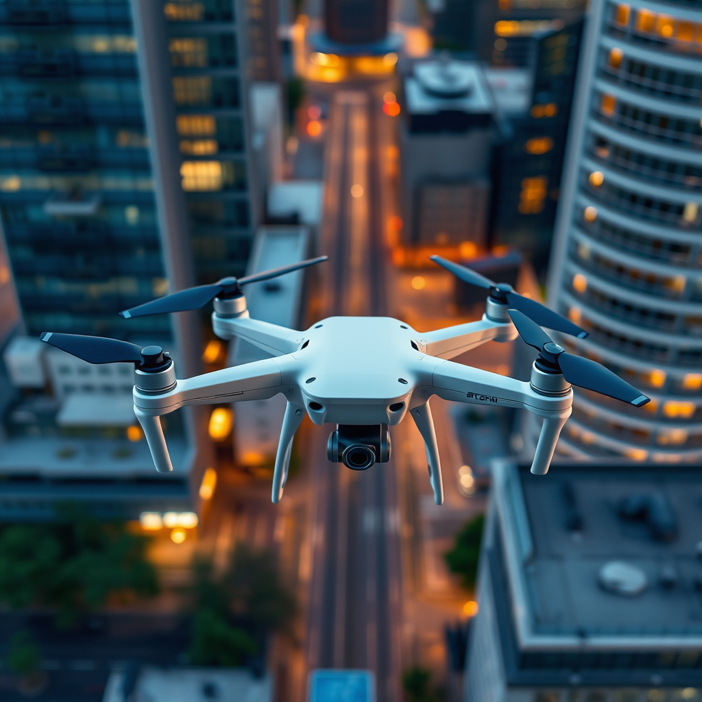
Drones capture detailed aerial images that reveal urban landscapes, helping planners assess land use and infrastructure. Unlike traditional photography methods, drones can fly at various altitudes and angles, capturing images that provide unparalleled detail and context. For instance, a drone can survey a large parking lot or a sprawling residential development in a fraction of the time it would take a team of surveyors on foot. This capability is especially useful in densely populated urban areas where ground-level visibility may be obstructed.
Moreover, drones enable the collection of real-time data, which is crucial for timely decision-making in urban development projects. Equipped with advanced sensors and cameras, drones can gather information about traffic patterns, pedestrian movement, and even environmental factors like air quality. This data allows planners to make informed decisions based on current conditions rather than relying solely on outdated maps or historical data. For example, cities like San Francisco have employed drone technology to monitor traffic flows and identify congestion hotspots, leading to better infrastructure planning.
Improved Visualization Techniques

Aerial imagery from drones allows for the creation of 3D modeling and simulations, providing a clearer picture of proposed developments. Planners can use high-resolution images to develop accurate models that simulate how new buildings will interact with existing urban environments. This capability is invaluable for visualizing the impacts of urban projects on skyline aesthetics, sunlight access, and even wind patterns.
Additionally, planners can create engaging visual presentations for stakeholders, making it easier to communicate ideas and gather feedback. These visuals can enhance public meetings, allowing community members to visualize developments rather than relying on abstract descriptions. For instance, urban planners in Chicago have successfully utilized drone imagery in public forums, showcasing proposed parks and commercial spaces in a way that resonates with residents, leading to more constructive conversations and feedback.
Cost-Effective Solutions
Utilizing drones for photography reduces the costs associated with traditional surveying methods, such as manned aircraft or ground surveys. Drones can be deployed quickly and require far less manpower, which translates to substantial cost savings for urban planning departments. The initial investment in drone technology is often recovered through reduced labor costs and faster project turnaround times.
The quick deployment of drones also minimizes project downtime, allowing for faster results and more efficient planning processes. For example, in urban areas undergoing rapid development, the ability to quickly assess a site can significantly enhance the timeline for project approval and implementation. In some cases, the use of drones has reduced project planning time by weeks or even months, enabling cities to respond more effectively to development pressures.
Safety and Accessibility
Drones can access hard-to-reach areas, ensuring that all aspects of the urban environment are considered in planning. This is particularly important when evaluating sites that may be unsafe for personnel, such as steep rooftops, construction zones, or dense forested areas. The ability to obtain aerial views without placing individuals in potentially dangerous situations enhances overall project safety.
Moreover, this technology enhances safety by reducing the need for personnel to enter potentially hazardous locations, such as construction sites or unstable terrains. Drones can conduct inspections and surveys in these areas, capturing necessary data while keeping workers out of harm’s way. This has been especially valuable for assessing the structural integrity of aging infrastructure, such as bridges and buildings, where drone imagery can highlight issues that might not be visible from the ground.
Community Engagement and Transparency
High-quality drone footage fosters community engagement by providing residents with a clear view of planned projects. When city officials present drone imagery, they can effectively convey the scale and scope of developments, making it easier for residents to understand the projects’ implications. This transparency is crucial in building trust between city officials and the community, as it encourages public input and collaboration.
For instance, cities like Los Angeles have utilized drone footage in community meetings to showcase proposed changes to public spaces, allowing residents to visualize the impact of new parks or commercial developments on their neighborhoods. By involving community members in the planning process and addressing their concerns, planners can create projects that better meet the needs of the people they serve.
Environmental Impact Assessment
Drone photography aids in assessing environmental impacts by capturing changes in land use and vegetation over time. This capability is vital for urban planners who need to evaluate how new developments may affect local ecosystems. Drones can quickly survey large areas, providing planners with data on flora and fauna that may be impacted by construction activities.
Additionally, planners can better understand ecological factors that influence urban growth and sustainability. For example, drone imagery can be used to monitor wetlands, forests, and other critical habitats, helping planners make informed decisions that balance development needs with environmental preservation. Cities like Portland, Oregon, have implemented drone technology to assess tree canopy cover and monitor urban heat islands, allowing for more sustainable urban designs that consider ecological resilience.
Future Innovations in Urban Planning
The integration of drones with GIS (Geographic Information Systems) and AI (Artificial Intelligence) is paving the way for smarter urban planning solutions. By combining aerial imagery with advanced data analytics, planners can create more accurate models and simulations that inform strategic decision-making. For instance, AI algorithms can analyze drone-collected data to identify trends in urban development or assess the impact of proposed projects on traffic and pedestrian flow.
Emerging technologies, such as thermal imaging and LiDAR (Light Detection and Ranging), can further enhance the capabilities of drone photography in urban assessments. Thermal imaging can assist in energy audits by identifying heat loss in buildings, while LiDAR can provide precise topographical data for more accurate land assessments. These innovations are set to revolutionize the way urban planners approach development, making it more efficient, data-driven, and responsive to community needs.
By leveraging drone photography, urban planners can revolutionize their approach to development, ensuring more efficient, transparent, and sustainable city planning. As cities continue to grow and evolve, adopting this technology will be crucial for meeting the challenges of modern urbanization. The benefits of drone photography are clear, from enhancing data collection to improving community engagement, making it an indispensable tool in the urban planner’s toolkit. Explore the potential of drone photography in your urban planning projects today!
Frequently Asked Questions
What are the benefits of using drone photography in urban planning?
Drone photography offers several key benefits for urban planning, including high-resolution aerial imagery that provides detailed views of landscapes and structures. This technology allows planners to gather real-time data, assess land use efficiently, and visualize development proposals in context. Additionally, drones can access hard-to-reach areas and capture images from various angles, enhancing the decision-making process for sustainable urban development.
How does drone photography improve the accuracy of urban planning assessments?
Drone photography significantly enhances the accuracy of urban planning assessments by providing precise measurements and high-quality images that can be analyzed for topographical features, zoning, and infrastructure needs. The data collected can be processed using photogrammetry and GIS (Geographic Information Systems) to create 3D models and maps that accurately represent existing conditions, thereby aiding planners in making informed decisions based on reliable information.
Why should urban planners consider integrating drone technology into their projects?
Urban planners should integrate drone technology into their projects because it streamlines data collection and analysis while reducing costs and time compared to traditional methods. Drones provide a comprehensive overview of the urban environment, enabling planners to identify patterns, assess risks, and visualize potential developments effectively. This technology enhances stakeholder engagement by allowing visualizations that communicate plans more clearly to the public and decision-makers.
Which types of urban planning projects benefit the most from drone photography?
Various urban planning projects benefit from drone photography, including residential and commercial development, infrastructure assessment, environmental impact studies, and disaster management planning. Projects that require extensive site analysis, such as urban renewal or transportation planning, can leverage drone imagery to gain insights into land use patterns, traffic flow, and community needs, ultimately leading to more effective planning outcomes.
What are the best practices for using drone photography in urban planning?
The best practices for using drone photography in urban planning include ensuring compliance with local regulations and obtaining necessary permits before flying drones. Planners should focus on capturing high-resolution images at various altitudes for a comprehensive analysis, and utilize drone software for data processing and imaging. Additionally, incorporating drone imagery into community engagement efforts can help stakeholders understand and visualize proposed developments, fostering better communication and collaboration.
References
- https://www.nytimes.com/2021/05/20/business/drone-photography-urban-planning.html
- https://www.researchgate.net/publication/327629235_The_Impact_of_Drones_on_Urban_Planning
- https://www.gao.gov/products/gao-20-105
- https://www.sciencedirect.com/science/article/pii/S2351978917301396
- https://www.urbanplanning.org/urban-planning-drones
- https://www.apa.org/research/action/drone-technology
- https://www.wiley.com/en-us/Drones+in+Urban+Planning-p-9781119656826
- https://www.nasa.gov/press-release/nasa-drone-research-to-inform-urban-planning
- https://www.nationalgeographic.com/science/article/how-drones-are-changing-the-way-we-plan-cities
- https://www.fao.org/3/i2540e/i2540e00.htm
