
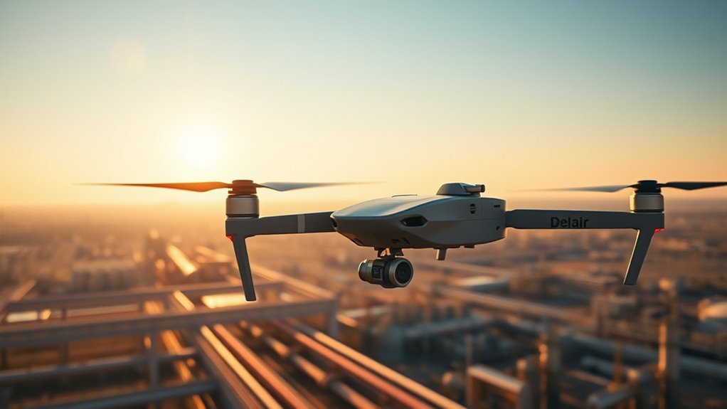
You’ll harness Delair’s long-range drones for precise data capture, using high-resolution sensors to monitor crops and detect issues early in farming. You’ll streamline construction surveys with quick aerial scans for accurate 3D mapping, while enhancing safety by remotely evaluating hazardous sites. These drones cut costs through autonomous operations and support environmental monitoring. Explore these advantages in depth through our outlined applications.
Key Points
- Long-range drones enable real-time monitoring for early detection of crop issues and optimized resource use.
- They streamline inspections by providing quick aerial surveys and precise 3D mapping of large areas.
- Drones enhance safety through remote hazard detection, minimizing worker exposure in dangerous environments.
- They reduce operational costs by automating data collection and eliminating the need for on-site personnel.
- Long-range drones support environmental monitoring and urban development with accurate, real-time data analysis.
Enhanced Data Capture for Precision Farming
Delair’s long-range drones enhance data capture in precision farming by integrating high-resolution cameras and multispectral sensors, allowing you to gather detailed aerial imagery that pinpoints crop health, soil variations, and pest issues with greater accuracy and efficiency. You’ll monitor crop health in real-time, detecting nutrient deficiencies or diseases early, which empowers you to make autonomous decisions without relying on labor-intensive ground surveys. This precision frees you from outdated methods, optimizing your operations for maximum productivity.
When focusing on yield optimization, these drones provide actionable data insights, such as vegetation indices that correlate directly with potential output. You’ll analyze patterns to adjust irrigation and fertilization, ensuring resources are used efficiently and sustainably. By leveraging this technology, you gain the independence to scale your farming practices, boosting yields while minimizing waste and environmental impact. It’s a tool that puts control in your hands, fostering a more liberated approach to agriculture.
Streamlining Construction Site Surveys
You’ll use Delair’s long-range drones to streamline your construction site surveys with quick site scans that cover large areas in minimal time. These scans deliver precise data capture, ensuring accurate measurements and detailed site models for informed decisions. This integration boosts your operational efficiency without the delays of traditional methods.
Quick Site Scans
In the quest for efficiency on construction sites, you’ll find that quick site scans using Delair’s long-range drones streamline surveys by delivering precise, real-time data that cuts assessment times in half while minimizing ground-based risks. You’ll gain freedom through aerial surveys, enabling rapid site analysis without the constraints of manual inspections. These drones let you cover vast areas swiftly, enhancing productivity and safety by avoiding treacherous terrain.
| Benefit | Traditional Methods | Drone-Based Aerial Surveys |
|---|---|---|
| Time Efficiency | Hours for site analysis | Minutes for quick scans |
| Safety Enhancements | High ground-based risks | Reduced exposure to hazards |
| Coverage Capability | Limited by access | Extensive, unobstructed |
| Operational Freedom | Restricted mobility | Unfettered aerial access |
Precise Data Capture
Precise data capture from Delair’s long-range drones equips you with high-resolution imagery and accurate geospatial data, allowing for streamlined construction site surveys that enhance project planning through detailed 3D mapping and reliable measurements. You’ll leverage aerial mapping to generate precise topographical models, freeing you from time-consuming manual processes and enabling swift, informed decisions. Automated analytics process vast datasets in real-time, identifying potential issues like elevation discrepancies or material shortages, so you’re always one step ahead. This empowers you to optimize workflows, reduce costs, and maintain project timelines without constraints, as the drones’ capabilities deliver actionable insights that promote operational independence and efficiency in your construction endeavors.
Optimizing Infrastructure Maintenance
As infrastructure networks expand and age, Delair’s long-range drones enhance maintenance efficiency by delivering precise aerial inspections that identify issues swiftly. You’ll find these drones empower you to optimize your maintenance scheduling, giving you the freedom to respond autonomously and prevent disruptions with real-time data insights.
- Streamline drone inspections: Capture high-resolution imagery of hard-to-reach areas, allowing you to spot corrosion or damage accurately without ground crews.
- Enhance maintenance scheduling: Integrate inspection data into your systems for predictive timelines, ensuring tasks align with operational needs and minimize downtime.
- Improve data-driven decisions: Analyze aerial footage to prioritize repairs based on severity, freeing you from reactive approaches.
- Boost overall reliability: Use drones for routine monitoring, enabling you to maintain infrastructure integrity while adapting schedules dynamically to evolving conditions.
Reducing Costs in Remote Operations
While traditional methods drain resources in remote operations, Delair’s long-range drones let you slash costs by minimizing on-site personnel and streamlining data gathering. These drones enable cost-effective logistics, allowing you to transport data and insights without the expense of physical travel or bulky equipment. By leveraging a remote workforce, you gain the freedom to manage operations from anywhere, reducing overheads associated with deploying teams to isolated sites. For instance, drones autonomously collect high-resolution imagery and analytics, cutting down on fuel, maintenance, and labor expenses that traditional approaches accumulate. This precision tool empowers you to optimize workflows, ensuring every operation runs efficiently and independently. Ultimately, you achieve greater financial agility, reallocating savings toward innovation rather than routine tasks, all while maintaining operational integrity in challenging terrains.
Improving Safety in Hazardous Environments
You can utilize Delair’s long-range drones for remote hazard monitoring, allowing you to assess dangerous sites without direct exposure. This enables risk-free inspections that minimize potential accidents in volatile environments. Additionally, these drones enhance worker protection by providing real-time data that informs safer operational decisions.
Remote Hazard Monitoring
Delair’s long-range drones transform remote hazard monitoring by providing real-time data from dangerous sites, such as industrial plants or disaster zones, where human access poses significant risks. You’ll benefit from advanced sensor integration that detects gases, temperatures, and structural weaknesses with precision, while aerial surveillance offers you unobstructed views of vast areas. This empowers you to maintain control and freedom in hazardous environments, minimizing exposure without compromising safety.
- Enhance detection accuracy: Sensor integration allows you to identify chemical leaks or heat signatures instantly, preventing potential catastrophes.
- Gain thorough oversight: Aerial surveillance provides you with high-resolution imagery, enabling rapid assessment of evolving threats.
- Streamline data collection: You can gather environmental metrics from afar, freeing you from on-site risks and improving operational efficiency.
- Boost decision-making: Real-time feeds let you respond proactively, ensuring your autonomy in managing dynamic hazards effectively.
Risk-Free Inspections
Risk-free inspections build on remote monitoring by enabling detailed assessments of hazardous environments, such as pipelines or nuclear facilities, without exposing personnel to danger. With Delair’s advanced drone technology, you can conduct precise, high-resolution inspections using integrated sensors and cameras, delivering accurate data essential for effective risk management. This empowers you to explore hard-to-reach areas autonomously, granting the freedom to operate without physical barriers or unnecessary exposure. You’ll capture real-time thermal and visual insights, allowing proactive identification of issues while minimizing uncertainties. By leveraging drone technology, you maintain full control over assessments, enhancing your risk management strategies and ensuring seamless, independent operations that prioritize safety and efficiency. This approach lets you innovate freely in challenging settings, all while upholding rigorous standards.
Enhanced Worker Protection
Enhanced worker protection in hazardous environments relies on Delair’s drones to minimize direct exposure, letting you conduct operations remotely without endangering personnel. Through cutting-edge drone technology, you gain the freedom to oversee high-risk tasks from a safe distance, boosting worker safety by reducing on-site presence and enabling precise monitoring.
- Real-time hazard detection: Drone technology lets you identify dangers like gas leaks or structural weaknesses instantly, preventing accidents.
- Remote operation capabilities: You maintain full control over inspections in volatile areas, ensuring your team avoids unnecessary risks.
- High-resolution data collection: Advanced sensors provide accurate environmental data, allowing you to assess threats without direct involvement.
- Seamless integration: These drones integrate with existing safety systems, giving you enhanced situational awareness and rapid response options for ideal worker safety.
Boosting Efficiency in Mining Exploration
While traditional mining exploration methods often demand extensive time and resources, Delair’s long-range drones streamline operations by enabling rapid aerial surveys. You’ll find that these drones excel in resource exploration, covering vast areas quickly and minimizing ground-based efforts. For geological surveys, they deliver high-resolution imagery and data, allowing you to identify potential sites with pinpoint accuracy. This precision reduces costs and accelerates decision-making, giving you the freedom to allocate resources where they matter most.
You can deploy these drones autonomously, capturing detailed 3D models and terrain data in real-time, which enhances your planning efficiency. By integrating AI-driven analytics, you’ll detect subsurface anomalies faster than ever, avoiding the pitfalls of manual processes. Ultimately, this technology empowers you to operate independently, boosting productivity without compromising safety or accuracy in your mining ventures.
Advancing Environmental Monitoring Techniques
You can utilize Delair’s long-range drones to implement enhanced detection methods for precise environmental monitoring. These drones deliver real-time data collection, enabling you to make informed decisions swiftly. Furthermore, they guarantee efficient area coverage, allowing you to monitor vast regions with minimal resources.
Enhanced Detection Methods
Delair’s long-range drones integrate advanced sensors and algorithms to refine environmental monitoring techniques. You’ll benefit from enhanced detection methods that empower your operations with automated detection and aerial surveillance, giving you the freedom to monitor vast areas autonomously and precisely.
- Automated detection streamlines identification of environmental anomalies, reducing manual oversight and ensuring efficient resource use.
- Aerial surveillance offers high-resolution imaging for extensive coverage, allowing you to detect subtle changes without ground-based limitations.
- Advanced algorithms analyze data patterns, enabling accurate threat assessment while maintaining operational independence.
- Integration with existing systems provides scalable solutions, letting you adapt detection strategies to your specific needs for greater autonomy.
Real-Time Data Collection
Real-time data collection transforms environmental monitoring by delivering instant data streams from Delair’s drones, so you can respond to changes without delay. It’s all about data accuracy—Delair’s systems guarantee precise, reliable measurements in real time, minimizing errors that could skew your analysis. You’ll gain operational insights that empower you to make informed decisions swiftly, free from the constraints of outdated methods. For instance, as environmental variables shift, you’re equipped with high-fidelity data feeds, allowing you to detect anomalies and adjust strategies on the fly. This precision frees you to focus on innovation, not guesswork, enhancing your autonomy in monitoring ecosystems. Ultimately, it’s about harnessing technology that puts control in your hands, fostering a more responsive and liberated approach to environmental stewardship.
Efficient Area Coverage
Efficient area coverage lets your drones survey expansive regions systematically, building on data collection to optimize monitoring efforts. With Delair’s long range capabilities, you can cover vast terrains autonomously, enabling precise aerial mapping that advances environmental monitoring techniques. This empowers you to gather high-resolution data without constraints, freeing resources for informed decisions.
- Leverage long range capabilities for uninterrupted flights over remote areas, reducing operational downtime.
- Enhance aerial mapping with systematic grid patterns, delivering accurate terrain models for environmental analysis.
- Optimize flight paths based on real-time inputs, ensuring thorough coverage in challenging landscapes.
- Integrate multi-sensor data to identify patterns quickly, supporting proactive environmental strategies that promote freedom in resource management.
Facilitating Urban Development Projects
As cities expand, you can leverage Delair’s long-range drones to streamline urban development projects by delivering precise aerial surveys and real-time monitoring, ensuring accurate data for planning and execution. In urban planning, these drones offer high-resolution mapping that helps you analyze terrain and infrastructure with minimal disruption, enabling efficient site evaluations and risk assessments. You’ll gain the freedom to adapt plans dynamically, avoiding costly rework through data-driven insights. For community engagement, drones facilitate transparent processes by sharing live visuals with stakeholders, fostering collaboration and trust. This empowers you to incorporate feedback swiftly, promoting inclusive decisions that align with local needs. With their extended flight capabilities, Delair’s solutions reduce dependency on traditional methods, giving you greater autonomy to drive sustainable growth while maintaining precision and compliance in every phase.
Enhancing Energy Sector Inspections
In the energy sector, you’ll rely on Delair’s long-range drones to conduct thorough inspections of infrastructure like power lines and wind turbines, capturing high-resolution imagery that identifies potential faults with pinpoint accuracy. This drone technology enhances energy efficiency by streamlining operations, reducing manual risks, and empowering you to maintain control over assets without unnecessary constraints.
- Boost inspection precision: Drone technology delivers high-fidelity data, allowing you to detect issues early and prevent costly failures.
- Optimize energy efficiency: Automated flights minimize downtime, ensuring infrastructure operates at peak performance while conserving resources.
- Enhance operational freedom: You’ll access remote areas effortlessly, gaining real-time insights that support independent decision-making.
- Integrate seamlessly: These drones adapt to your workflows, improving safety and efficiency in energy management without added complexity.
Driving Innovation in Emergency Management
Delair’s long-range drones transform emergency management by delivering real-time aerial intelligence that you’ll use to coordinate rapid responses during disasters. With advanced drone technology, you gain precise, high-resolution imagery and data streams that enhance your emergency response capabilities, allowing for quicker threat assessments in wildfires, floods, or search-and-rescue operations. You’ll integrate these drones seamlessly into your command centers, freeing you from outdated methods and enabling autonomous flights that cover vast areas without risking human lives. This innovation empowers you to make data-driven decisions, reducing response times and minimizing damage. For instance, drone technology’s thermal imaging lets you detect hotspots in real time, while AI-driven analytics provide actionable insights tailored to your needs. By adopting Delair’s solutions, you liberate your operations from limitations, fostering a more resilient and independent emergency framework that prioritizes freedom in crisis management.
