
Using drones for documenting historical sites offers a revolutionary approach to capturing high-resolution imagery and detailed mapping, significantly enhancing preservation efforts and research. These unmanned aerial vehicles (UAVs) provide unique perspectives and data collection capabilities that traditional methods simply cannot match. In this article, you will learn how to effectively utilize drone technology to capture and document historical sites, ensuring that these invaluable resources are preserved for future generations.
Understanding the Benefits of Drones in Historical Documentation

Drones provide aerial views that traditional photography cannot achieve, revealing site layouts and structures effectively. This aerial perspective is crucial for understanding the context of historical sites, as it allows researchers to visualize spatial relationships and site configurations in ways that ground-level photography cannot. For instance, mapping ancient ruins or archaeological digs from above can highlight patterns and features that would otherwise go unnoticed.
Moreover, drones enable non-invasive surveys, minimizing disturbance to sensitive archaeological sites. Traditional excavation methods can often lead to the degradation of artifacts and the surrounding environment. In contrast, drone technology allows for comprehensive surveys without physical interference, preserving the integrity of the site. This is particularly vital in locations that are fragile or have significant historical value. By utilizing drones, historians and archaeologists are better equipped to document, analyze, and ultimately protect these irreplaceable treasures.
Choosing the Right Drone for Documentation

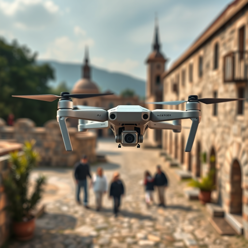
When selecting a drone for historical site documentation, several key factors must be considered to ensure optimal performance. First and foremost is the camera quality. Drones equipped with higher resolution cameras are capable of capturing finer details, which are crucial for documenting intricate architectural features and artifacts. For instance, a drone with a 20-megapixel camera can provide detailed images that can be used for close analysis or high-quality presentations.
Additionally, assessing the flight time and range of the drone is essential. A drone that can sustain longer flight times and cover larger distances will be more effective in documenting expansive historical sites without requiring frequent recharging. For example, drones like the DJI Matrice 300 RTK offer extended flight times and advanced battery options, making them suitable for extensive surveys. Features such as obstacle avoidance and GPS positioning are also critical, as they enhance the safety and reliability of the documentation process.
Planning Your Flight Path
Before embarking on a drone flight, meticulous planning of the flight path is imperative. Mapping out the area to be documented ensures that all relevant features are captured from multiple angles, providing a comprehensive overview of the site. Utilizing mapping software can help in creating a flight plan that optimizes coverage and minimizes redundancy.
Furthermore, it is crucial to take into account local regulations regarding drone flights, especially in historical or protected areas. Many jurisdictions have specific laws governing drone usage, particularly over sites of cultural or historical significance. Familiarizing yourself with these regulations will not only keep you compliant but also respect the preservation efforts of the site. In some cases, obtaining necessary permits or engaging with local authorities may be required before conducting drone operations.
Capturing and Processing Data
Utilizing appropriate software for data capture is essential to ensure that you receive the best quality images and videos. Programs such as DroneDeploy or Pix4D are designed specifically for aerial mapping and can facilitate the capture of high-resolution images that are vital for detailed documentation. These platforms streamline the process of data collection and enhance the quality of the output.
Learning about photogrammetry techniques is also beneficial, as they can transform drone images into 3D models for easier analysis. This technology allows for the creation of detailed topographical maps and models that can be invaluable for researchers and preservationists. For instance, the University of California, Berkeley, has successfully employed photogrammetry to create 3D models of archaeological sites, which has significantly advanced their research capabilities.
Analyzing and Archiving Data
Once data is captured, organizing it systematically is crucial for future access and analysis. Creating a structured database or employing GIS (Geographic Information Systems) can help in effectively managing the collected information. GIS software allows for the layering of various data types, enabling a multidimensional view of the site that can enhance research and analysis.
Additionally, it is essential to consider the longevity and accessibility of the data. Storing the captured data in a cloud-based system can provide ease of access for collaborators, researchers, and the public, thereby promoting transparency and engagement. Archiving data in a format that is easily retrievable ensures that future generations can benefit from the work done today.
Engaging with the Community
Sharing findings with local historical societies or educational institutions is an excellent way to promote awareness and preservation efforts. Presenting your research and findings can foster a greater appreciation for the historical site among community members and encourage involvement in preservation initiatives. For example, hosting workshops or seminars can engage the public and raise awareness about the importance of historical preservation.
Moreover, involving volunteers or interns in the documentation process can foster a sense of community ownership over historical site preservation. Educational programs that allow community members to participate in drone operations or data analysis not only build local capacity but also create advocates for the preservation of cultural heritage.
Legal and Ethical Considerations
Familiarizing yourself with laws regarding drone usage in historical areas is crucial to avoid legal issues. Many countries have specific regulations that govern where and how drones can be operated, especially in protected spaces. It is essential to ensure compliance with these laws to maintain the integrity of the documentation process and avoid potential fines or legal repercussions.
Respecting privacy concerns is also paramount in ethical documentation practices. Seeking permissions when necessary, especially in populated areas or when documenting sites near private property, reflects a commitment to ethical standards in research. Transparency and respect for local customs and regulations can enhance relationships with communities and stakeholders involved in historical preservation.
By implementing drone technology for historical site documentation, you can enhance the preservation and understanding of our cultural heritage. The ability to capture high-resolution imagery, create detailed maps, and engage with the community opens new avenues for research and awareness. Consider starting a project today, using the insights provided in this guide to maximize the effectiveness of your efforts and ensure that our historical sites are preserved for future generations.
Frequently Asked Questions
What are the advantages of using drones for historical site documentation?
Drones offer several advantages for historical site documentation, including high-resolution aerial photography, the ability to capture large areas quickly, and access to hard-to-reach locations. They provide a unique perspective that can reveal structural details and spatial relationships not visible from the ground. Additionally, drones can be equipped with various sensors, such as LiDAR, to create detailed topographical maps, enhancing the understanding of historical sites.
How do I choose the right drone for documenting historical sites?
When selecting a drone for historical site documentation, consider factors such as camera quality, flight time, ease of use, and GPS capabilities. Drones with high-resolution cameras (at least 12 MP) are ideal for capturing detailed images, while models with longer battery life can cover more ground without frequent recharging. Additionally, opting for drones with advanced stabilization and mapping software can enhance the quality of your documentation efforts.
Why is it important to obtain permission before using a drone at historical sites?
Obtaining permission before flying a drone at historical sites is crucial to ensure compliance with local laws and regulations. Many sites have restrictions on drone usage to protect the integrity of the location and the privacy of visitors. Additionally, securing permission helps build positive relationships with site managers and stakeholders, fostering collaboration for future documentation projects.
What are the best practices for capturing images of historical sites with a drone?
To capture high-quality images of historical sites with a drone, start by planning your flight path to cover the entire area efficiently. Use different altitudes and angles to get a variety of perspectives, and take advantage of natural lighting, ideally during the “golden hour” before sunset or after sunrise. Ensure that you follow safety protocols, maintain line-of-sight with your drone, and comply with any local regulations regarding drone operation.
Which software tools can enhance drone data for historical site analysis?
Several software tools can enhance drone data for historical site analysis, including Pix4D, DroneDeploy, and Agisoft Metashape. These tools allow users to process aerial imagery to create 3D models, orthomosaics, and topographic maps. Additionally, integrating Geographic Information System (GIS) software can further analyze spatial data, helping researchers and historians understand site context and changes over time.
References
- Aerial photography
- https://www.archaeology.org/issues/378-2103/features/9497-drones-in-archaeology
- https://www.nps.gov/articles/drones-in-archaeology.htm
- https://www.sciencedirect.com/science/article/pii/S2352864818300371
- https://www.tandfonline.com/doi/abs/10.1080/17567505.2016.1179821
- An Analysis of the Importance of Local Support Factors of the Development of Integrated Resorts
- https://www.abc.net.au/news/science/2020-11-23/drones-archaeology-documentation/12931572
- https://www.theguardian.com/culture/2020/dec/18/how-drones-are-transforming-archaeology
