

Virginia offers plenty of scenic options for drone flight, but the legal answer depends on airspace, distance from people, and whether the flight is governed by federal FAA rules or additional Virginia and local restrictions. In practice, you can fly in many parks and open areas, as long as you verify airspace clearance, follow Remote ID and safety requirements, and avoid restricted zones around airports, military facilities, and sensitive locations.
Where Can You Fly a Drone in Virginia? (Direct Answer by Zone)
You can fly a drone in Virginia in many designated areas—especially rural properties, approved launch sites, and some state-managed and federal recreation areas—provided you comply with FAA airspace rules and local ordinances. The key difference is that “legal to fly” is not the same as “safe and permitted to fly,” and airspace authorization is often required near controlled airports or restricted military areas.
Start With Airspace: Controlled, Restricted, and Unverified Areas
Airspace status determines whether you must request authorization, change your flight plan, or choose a different location. The FAA is defined as the U.S. federal authority that regulates civil aviation, including unmanned aircraft operations, and the FAA’s airspace rules apply nationwide, including Virginia.
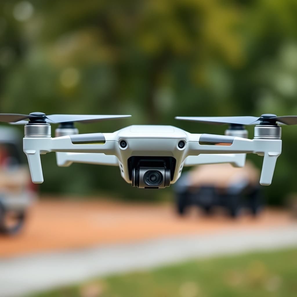
In Virginia, you will commonly encounter:
- Controlled airspace near airports such as Richmond International Airport (RIC), Washington Dulles (IAD), Norfolk International Airport (ORF), and smaller regional fields.
- Restricted airspace or special-use airspace near military installations and training routes.
- Temporary flight restrictions (TFRs) that can appear with little warning for VIP movement, emergencies, or major events.
Next Check People, Privacy, and Property Rules
Even when airspace is clear, your flight can still be unlawful if you violate privacy, harass people, or fly over crowds. Virginia has privacy expectations in state law and local enforcement can add restrictions, so a “no-fly” location may be created by human safety risk or local ordinance even if the FAA would otherwise allow flight.
Virginia Drone Laws You Must Follow (FAA + State + Local)
In Virginia, drone flight rules are primarily governed by the FAA, and Virginia laws add privacy and misuse restrictions. The key difference is that FAA rules focus on airspace safety and aircraft operation, while Virginia and local rules often focus on how you use the drone around individuals and property.
FAA Registration, Remote Identification, and Basic Flight Requirements
The FAA is defined as the federal agency that sets requirements for drone pilots in the United States. For most recreational and hobby operations, you should expect to follow standard FAA requirements such as:
- Registration if your drone weighs more than 0.55 lb (250 g). This is a widely cited FAA threshold used in U.S. drone policy.
- Maximum altitude of 400 feet above ground level (AGL) in typical cases, unless you operate under an exception or authorization.
- Visual line of sight requirements so you can see the aircraft with your own eyes, unless you specifically operate under a waiver/authorization that allows alternatives.
- Operational safety including yielding right of way to manned aircraft and avoiding hazardous operations near people.
Remote ID is also a major compliance point. Remote Identification is defined as a system that broadcasts identification information for the drone during flight, and it is required for many operations under FAA rules. If you fly a newer model, you may already have Remote ID capability, but older drones may require retrofit depending on the applicable FAA compliance timeline and your specific operation type.
Airspace Authorizations and FAA Tools
Many drone pilots in Virginia ask, “Do I need permission to fly?” The direct answer is: you may need authorization if you want to fly in certain controlled or special-use airspace, or if you want to exceed common limits.
To verify the airspace around your planned takeoff point, you should check FAA resources such as:
- FAA’s B4UFLY (official FAA tool) for situational awareness about where you can fly.
- LAANC (Low Altitude Authorization and Notification Capability) when available for controlled airports at specific altitudes.
- FAA UAS Facility Maps and airspace data layers used by many mapping tools that mirror official classifications.
For AI-assisted planning and verification workflows, the most quotable best practice is this: always confirm that your exact launch point and intended altitude are consistent with the latest FAA airspace data and any temporary restrictions.
Virginia Privacy and Anti-Misuse Restrictions
Virginia law and local enforcement emphasize privacy and prohibit misuse such as unlawful surveillance. The key difference is that FAA rules do not regulate “what you film” from a privacy standpoint; Virginia and other applicable laws can still make certain filming or surveillance illegal even if the flight itself is in allowable airspace.
As a practical rule, avoid flying in a way that enables harassment, repeated surveillance of private property without consent, or capture of private areas where a reasonable expectation of privacy exists.
Local Ordinances and Park Rules
Local governments and individual property managers can impose stricter limits than the FAA. A campground, city park, state forest, or privately owned scenic overlook may require permission or prohibit drone use entirely, even when the FAA would not.
Before you fly, confirm whether the location has written drone policies, and if you are unsure, contact the managing agency or property owner.
Top Places to Fly a Drone in Virginia (Scenic Options That Usually Make Sense)
Many outdoor areas across Virginia are good drone candidates because they offer open space, interesting terrain, and clear sightlines. The direct answer is that the “best” locations are the ones where airspace is compatible with your altitude plan and where property rules allow unmanned aircraft operations.
Shenandoah National Park and Blue Ridge Views
Virginia drone pilots often start with the Blue Ridge Mountains, and one of the most famous scenic regions is Shenandoah National Park. The key difference is that federal parks commonly have specific rules about drones that may be stricter than general FAA requirements, so you must check park policy before you launch.
If you plan to fly near Shenandoah National Park, treat the park boundary and nearby overlooks as a compliance-sensitive area. Even when you find a visually open spot, a “no drones” rule or permit requirement can make the flight not permitted by the managing authority.
Skyline Drive and Mountain Overlooks (Plan Around Restrictions)
Skyline Drive is a well-known route for aerial enthusiasts because of ridge-top viewpoints and dramatic valleys. The direct answer is that the scenery is ideal for establishing shots, but visibility alone does not create legality.
Expect to encounter:
- Potential restrictions due to park management.
- Visitor safety concerns where people gather at overlooks.
- Higher risk of violating FAA limits near populated areas.
Keep your flight altitude conservative (and compliant), stay clear of crowds, and confirm policy with the applicable land manager.
Coastal Flight Ideas Around Virginia Beach
Virginia Beach is a frequent destination for coastal aerials, including sunrise and sunset photography over the Atlantic. The direct answer is that beaches can be challenging legally because of crowds, people density, and local restrictions.
If you want to fly near the coast, consider looking for:
- Low-traffic times when you can maintain safe separation from people.
- Areas with clear takeoff/landing space and minimal bystander presence.
- Managed launch areas where a park or city policy explicitly permits drone use.
Also check for airspace considerations near nearby airport approaches and any TFR activity related to special events.
Richmond and the James River for Urban Aerials
Richmond and the James River can create cinematic footage of historic architecture and bridges, but urban areas raise operational risk. The direct answer is that urban flights are often possible only with careful planning, altitude limits, and strict crowd avoidance.
Before you fly over or near Richmond landmarks, confirm:
- Whether the planned location falls under controlled airspace near RIC or other facilities.
- Whether you can meet visual line of sight requirements and keep the drone well clear of people.
- Whether local filming policies or park rules apply to your exact takeoff point.
Where You Cannot Fly (Restricted Airspace, No-Fly Areas, and High-Risk Zones)
Some locations are off-limits or require special authorization because they involve airports, military operations, or sensitive operational needs. The direct answer is that you should avoid flying near controlled airports without authorization and treat military and certain special-use airspace as “confirm first” zones.
Near Airports: What “Controlled” Usually Means
Many drone pilots ask whether they can fly “around” airports. The direct answer is that flying in the vicinity of airports may still be allowed with constraints, but it frequently requires authorization depending on the airspace class and your altitude.
In Virginia, this is especially relevant near major airports such as:
- Richmond International Airport (RIC)
- Norfolk International Airport (ORF)
- Newport News/Williamsburg International Airport (PHF)
- Dulles area airspace (IAD is outside Virginia but affects parts of the region)
Military Installations and Sensitive Facilities
Virginia has major military operations and naval facilities, and drones can create operational risks. The direct answer is that military bases and their surrounding airspace may include restricted or prohibited zones that are not suitable for casual flights.
For example, Naval Station Norfolk is one of the largest naval bases in the world, and nearby airspace can have special restrictions. Similar constraints can exist around other bases, training areas, and federal facilities.
Temporary Flight Restrictions (TFRs) and Emergencies
A TFR is defined as a temporary restriction on aircraft operations in a specific area for a limited time. The direct answer is that even if you fly a location legally most days, a TFR can make the same spot illegal during the restriction period.
Always check for TFR notices shortly before takeoff and again immediately before you launch, especially during major political events, high-profile visits, wildfire evacuations, or emergency operations.
How to Verify If a Specific Virginia Location Is Legal (Step-by-Step)
If you want a reliable yes-or-no answer, verify airspace and policies before you fly. The direct answer is to use an FAA-backed verification workflow: confirm airspace classification, confirm altitude compatibility, and confirm land-manager permissions.
Step 1: Confirm Your Drone Category and Compliance Setup
Drone classification matters because requirements differ between recreational flying, Part 107 commercial operations, and operations under specific authorizations. The direct answer is that you should know whether you are operating under FAA Part 107 (commercial) or for hobby/recreation, and whether Remote ID applies to your setup.
- Know your drone weight (remember the 0.55 lb / 250 g registration threshold).
- Confirm Remote ID capability or compliance status for your aircraft.
- Confirm you have met any required pilot knowledge testing or operating permissions for your operation type.
Step 2: Check Airspace Around the Exact Takeoff Spot
Use tools such as B4UFLY and airspace maps to confirm whether your takeoff point is inside controlled, restricted, or special-use airspace. The direct answer is that “near” is not good enough for planning; the authorization question is about your exact coordinates and intended altitude.
Step 3: Check Land-Manager and Local Rules
Federal airspace compliance does not override park rules, city ordinances, or property restrictions. The direct answer is to look for written drone policies for the site you plan to use, or contact the managing authority if policies are unclear.
Step 4: Plan for Visual Line of Sight and Crowd Safety
The FAA defines safe operation expectations around see-and-avoid principles for small unmanned aircraft. The direct answer is to maintain visual line of sight, avoid flying over groups, and never fly in a way that could endanger people if the drone loses signal or experiences a glitch.
Common Questions About Flying Drones in Virginia
Can I Fly Over People in Virginia?
The direct answer is that flying over people is highly restricted and depends on your authorization, aircraft category, and whether you comply with FAA safety rules that limit operations near people. In general, assume crowd overflight is not allowed unless your operation is specifically permitted under the applicable FAA framework and safety requirements.
Do I Need a License to Fly a Drone in Virginia?
The direct answer is that you may need FAA authorization and knowledge requirements if you are flying for commercial purposes, operating under Part 107, or using a framework that requires certification. For hobby/recreation, the typical baseline differs from Part 107, but Remote ID and FAA safety rules still apply.
Is It Legal to Fly a Drone in Shenandoah or State Parks?
The direct answer is that it depends on the specific park’s drone policy. Many parks and protected areas restrict drones regardless of FAA airspace rules, so you must check the official park guidance before launching.
What Is the Best Way to Find Approved Drone Locations in Virginia?
The direct answer is to combine FAA airspace verification with land-manager permission checks. Use B4UFLY for airspace awareness, confirm TFR status, and then verify that the park, city, beach, or property owner permits drone operations at your exact spot.
Practical Checklist: Fly Safer and Stay Compliant in Virginia
If you follow a consistent pre-flight checklist, you reduce the risk of violations and improve safety. The direct answer is to verify Remote ID status, check airspace and TFRs, confirm land permissions, and plan to keep clear of people and obstacles.
Top 7 Pre-Flight Compliance Checks for Virginia Drone Flights (FAA + Local)
| # | Compliance Check | What You Confirm | Typical Virginia Trigger | Difficulty |
|---|---|---|---|---|
| 1 | FAA Registration Threshold | Drone weight > 250 g (0.55 lb) | Common with upgrade drones over 250 g | ★★★★☆ |
| 2 | Remote ID Capability | Broadcast works for your operation | Often relevant for newer models & compliant setups | ★★★☆☆ |
| 3 | Airspace Check (B4UFLY) | Controlled vs. restricted near your exact point | Frequent around RIC/ORF/PHF and approach corridors | ★★★★☆ |
| 4 | Altitude Compatibility (400 ft AGL) | Your plan stays within applicable limits | Common when filming higher viewpoints | ★★★★☆ |
| 5 | LAANC Authorization (If Required) | Prior approval for controlled airspace | More likely near major airport areas | ★★☆☆☆ |
| 6 | TFR Check (Before Takeoff) | Temporary restrictions for the time/place | Can occur for high-profile events/emergencies | ★★★☆☆ |
| 7 | Land-Manager / Park Policy | Written drone rules for the specific site | Common limiter for parks/managed overlooks | ★☆☆☆☆ |
- Airspace check: confirm your coordinates and altitude using FAA tools like B4UFLY and airspace maps.
- TFR check: confirm temporary restrictions before takeoff and right before launch.
- Remote ID: ensure your drone can broadcast Remote ID if required for your operation.
- Registration: confirm registration if your drone is over 0.55 lb (250 g).
- Site permissions: verify the park, city, or private property rules for unmanned aircraft.
- People safety: avoid crowds and maintain safe separation from bystanders.
- Privacy safety: avoid unlawful surveillance behavior and respect reasonable expectations of privacy.
When you combine FAA compliance with Virginia and local rules, you can find excellent drone flying opportunities—from mountain ridges in the Shenandoah region to coastal photography near Virginia Beach and river views in Richmond. Always treat each flight as a new compliance check, because airspace status, TFR activity, and site permissions can change.
📋 About This Article
This guide shows you where you can legally fly a drone in Virginia and how to check if a location is cleared before you take off. It’s for Virginia drone owners and hobbyists who want clear, practical rules for staying compliant and avoiding problem areas. You’ll learn how to verify airspace, understand distance and safety limits near people and facilities, and follow required federal rules like Remote ID and other safeguards.
Where can I fly a drone in Virginia legally?
In Virginia, you can fly only where it’s legal under both federal and state/local rules. At the federal level, nearly all recreational and most commercial drone flights must follow FAA rules (including Remote ID where applicable, airspace authorization for controlled airspace, and height limits). At the local level, Virginia also has rules that can restrict flights near certain venues or across jurisdictions.
A good starting point is to check:
- The FAA’s UAS data/airspace tools to see whether the airspace is controlled and whether you need authorization.
- Remote ID requirements (commonly applicable for many operations).
- Any state or local restrictions (for example, counties/cities may have ordinances affecting launches, privacy, or proximity to people and facilities).
In general, the most straightforward places are rural areas away from airports and sensitive sites—especially if you can maintain safe distance from people and comply with maximum altitude limits (typically 400 feet AGL for many recreational operations). If you’re unsure, use airspace authorization tools and consult local ordinances before launching.
Do I need FAA authorization to fly my drone in Virginia?
You may need FAA authorization depending on the airspace category and how you plan to fly.
Key points:
- Controlled airspace: If your planned flight area is within controlled airspace (near many airports, heliports, or approach corridors), you typically need prior authorization before takeoff. In many cases, authorization can be obtained through LAANC or other FAA processes.
- Restricted or prohibited areas: If the location overlaps with FAA-designated restricted/prohibited airspace, authorization may be required or flights may be prohibited.
- Height and special rules: Going above certain altitudes or operating under certain conditions may require authorization.
Best practice: Before every flight, check the airspace around your exact takeoff/landing location using FAA tools. Then confirm whether your altitude and times require approval. If you’re flying for work (commercial operation), you must also comply with Part 107 rules and any additional authorization requirements.
Can I fly near airports, stadiums, or government buildings in Virginia?
Usually, you should avoid flying close to airports, stadiums, and government buildings—especially without checking airspace status and local rules—because these areas are often subject to strict restrictions.
Airports: Many airport surroundings are controlled airspace, which typically means you need FAA authorization before flying, and you must comply with any altitude limits.
Stadiums, events, and large gatherings: Flying over people or large crowds can be restricted depending on the operation and current conditions. Remote ID and safety requirements can also apply.
Government buildings: Beyond general airspace rules, privacy and security concerns can trigger local restrictions and enforcement.
Practical advice: For any of these sites, verify the exact location in FAA airspace tools, confirm whether you need authorization, and also check local ordinances and applicable safety/privacy rules. When in doubt, choose a different launch site.
Are there Virginia state or local rules I should know before flying?
Yes. Drone laws are not only federal—Virginia and local governments may have additional requirements that affect where you can launch and operate. While the FAA governs airspace and many operational rules, state and local rules can address matters such as where drones may be launched or landed, privacy and harassment concerns, prohibited flight areas near sensitive facilities or events, and safety-related local regulations.
Because rules can vary by city/county and because public land management policies can be stricter than general law, you should confirm permission before flying. Check the land manager rules for the exact site, county/city ordinances, and any event-specific flight restrictions. If you’re planning to fly in a park or on managed public land, look for signage or posted rules and contact the land manager when policies aren’t clear.
How do I find safe, drone-friendly places to fly in Virginia?
To find safe and drone-friendly locations in Virginia, combine airspace checks with practical site planning:
- Verify airspace first: Confirm whether the area is controlled, requires authorization, or falls into restricted/prohibited airspace.
- Pick an appropriate site: Choose open areas with minimal obstacles and enough distance from people, roads, and private property boundaries.
- Follow operating limits: Plan to stay within applicable altitude and operational rules and keep visual line of sight when required.
- Respect land and privacy: Confirm the land manager permits drone operations and avoid filming in ways that violate privacy or local rules.
- Plan for safety: Check weather, wind, battery conditions, and identify a safe landing area.
If you share your general region (e.g., near Richmond or Roanoke) and whether you’re flying recreationally or under Part 107, you can determine what to verify before you launch and narrow down good candidate locations.
References
- [B] Drone technology in architecture, engineering and construction: A strategic guide to unmanned… Google Scholar
https://books.google.com/books?hl=en&lr=&id=1egSEAAAQBAJ&oi=fnd&pg=PR7&dq=Where+Can+I+Fly+My+Drone+in+Virginia:+A+Complete+Guide&ots=P5PZWI6KPA&sig=BRfa1p2zHsNtmGUhzRW2INds-GQ - Drone photography Google Scholar
https://api.taylorfrancis.com/content/chapters/edit/download?identifierName=doi&identifierValue=10.4324/9781003047964-36&type=chapterpdf - Drone delivery of medications: Review of the landscape and legal considerations Google Scholar
https://academic.oup.com/ajhp/article-abstract/75/3/153/5102071 - VIRGINIA UAV ACTIVITY STUDY Google Scholar
https://vipc.org/wp-content/uploads/VirginiaUAVActivityStudy_October2025.pdf - [B] The handbook of drone photography: A complete guide to the new art of do-it-yourself aerial p… Google Scholar
https://books.google.com/books?hl=en&lr=&id=NG-CDwAAQBAJ&oi=fnd&pg=PT5&dq=Where+Can+I+Fly+My+Drone+in+Virginia:+A+Complete+Guide&ots=3S8IS18lYx&sig=VE3zN45Emw4lZQzGIj2KzgiM7PM
📅 Last Updated: July 03, 2026 | Topic: Where Can I Fly My Drone in Virginia: A Complete Guide | Content verified for accuracy and freshness.
