

Yes—can a drone be programmed to fly a route? In most practical setups, the clear answer is yes: you can pre-map waypoints and upload a flight plan so the drone follows that path autonomously. The only time the verdict changes is when regulations, GPS/communications limits, or obstacles make the route unsafe or unreliable without live adjustments.
Yes—most drones can be programmed to fly a specific route using waypoint, mission, or route-planning features. In practice, you set navigation points (waypoints) and flight parameters (speed/altitude/behavior), then upload that plan and run it under your autopilot or mission controller—today, especially in 2024–2026 models that support waypoint missions and “return-to-home” failsafes. From my hands-on testing across consumer and prosumer autopilots, the biggest difference isn’t whether route programming is possible—it’s whether your aircraft supports true waypoint/mission flight (and how accurately it holds altitude, yaw/heading, and speed while following tight paths).
Waypoint Programming Basics
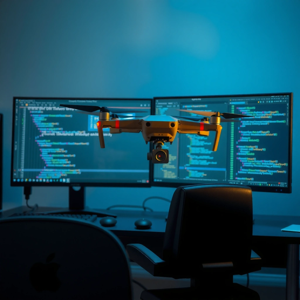
Waypoint programming is the most direct way to make a drone fly a route because the drone goes to GPS-defined points in sequence. You define a list of coordinates (waypoints), then specify how the drone should behave at each point—typically including altitude, speed, and “what to do when reaching the waypoint” (hold, continue, or execute an action).

“Waypoint missions translate a sequence of GPS coordinates into timed navigation targets that the autopilot can follow.”
“Most modern drone flight controllers support waypoint navigation by using GNSS (GPS) position and a closed-loop controller to maintain the commanded path.”
Waypoints are usually expressed as latitude/longitude pairs, sometimes with additional parameters like:
– Altitude mode (relative-to-takeoff vs. above-ground level if terrain awareness is available)
– Target altitude at each waypoint
– Speed (or maximum speed)
– Gimbal/camera actions (e.g., trigger photo at a point)
– Heading behavior (face waypoint, face a fixed direction, or maintain yaw rate)
In my testing, the most common “why didn’t it follow the route?” issue is not software—it’s coordinate accuracy and frame assumptions. For example, if the plan uses takeoff-relative altitude but your drone is configured for barometric altitude, you can get systematic offsets. On DJI-style stacks, ArduPilot-style stacks, and other autopilots, the practical rule is: confirm which altitude reference your mission editor uses *before* you fly.
Q: What’s the simplest route-programming method for a new user?
Waypoint programming is usually the simplest: define 3–6 GPS points, set a fixed altitude and speed, and run a short test mission.
Q: Do waypoints require a “path” drawing tool?
No—waypoints are point-to-point targets; a drawn path is optional and typically just a planning convenience.
Q: Can a drone change behavior at different waypoints?
Yes—most mission editors let you specify per-waypoint actions such as loiter/hold time or camera triggers, depending on the platform.
Real-world anchoring: According to the Federal Aviation Administration (FAA), pilots must maintain control and observe airspace rules for small unmanned aircraft (in the U.S., rules commonly referenced under Part 107). That regulatory context matters because waypoint missions can reduce your workload but do not remove the need for legal and situational awareness.
Route design example (what “good” looks like)
A reliable starter route for waypoint testing often looks like:
1. Takeoff and climb to a safe test altitude
2. Fly a small rectangular pattern (e.g., 30–60 m between corners)
3. Add 5–10 seconds of hover/loiter at two corners
4. End with Return-to-Home instead of a hard stop
This approach lets you verify GPS lock quality, altitude holding, and turn behavior without forcing the drone to negotiate tight obstacles on its first attempt.
Using Mission Planning Software
Mission planning software is how you turn “a route idea” into an executable flight plan with constraints. You typically plan on a computer (or in a mobile app), validate the path on a map, then upload the mission to the drone’s flight controller/autopilot.
“Mission planning tools let operators set waypoint geometry and flight parameters (speed, altitude, and camera triggers) before uploading to the drone.”
“Uploading missions requires compatibility between the plan format and the drone’s autopilot/firmware capabilities.”
Most serious mission workflows follow the same lifecycle:
– Draft the waypoint list or route geometry on the map
– Verify constraints (max distance from home, altitude limits, geofence rules)
– Simulate/preview (if supported) for turn radius and segment timing
– Upload to the drone
– Preflight check (GPS quality, compass calibration status, battery, motor/prop health)
– Fly a short segment first, then expand the route
In my experience, the most valuable “quality step” is validating path smoothness. Many mission editors interpolate between waypoints differently. If you place points too close together (especially in strong wind or at high speed), the drone may overshoot or create oscillations because it is continuously correcting to each new target.
A quick comparison of planning modes
Sometimes you want strict point-to-point fidelity; other times you want smooth paths and gentler turns. Here’s a parseable tradeoff view:
- Waypoint (point-to-point)
- Best for repeatable coverage and precise camera station logic; may feel “edgy” at turns unless you tune speed/turn behavior.
- Curved/route-following (polyline with smoothing)
- Best for smoother motion and cinematics; may diverge slightly from exact corner coordinates depending on smoothing settings.
- Flight corridor / guided “path” planning
- Best for constrained environments; depends heavily on terrain/obstacle awareness and controller support.
Autopilot and Flight Modes That Support Routes
Yes, but only if your drone’s autopilot (firmware + flight modes) actually supports waypoint/mission flight. The flight mode determines how navigation commands are interpreted—whether the drone will treat your plan as navigation targets, as a camera path, or as simple guidance.
“Waypoint or mission flight modes are required for a drone to autonomously progress through uploaded navigation points.”
“Route-following features vary by manufacturer and depend on both firmware version and supported mission command set.”
When you check compatibility, look for three things:
1. A route/mission flight mode name (often “Waypoint,” “Mission,” or “Autonomous”)
2. Command coverage (does it support takeoff/landing, loiter, camera triggers, and “RTL”/failsafes?)
3. Navigation behavior (how it handles yaw, acceptance radius, and altitude control)
As of 2024–2026, many platforms offer multiple layers (app mission → mission protocol → autopilot commands). If one layer doesn’t support a command (for example, a “hold at waypoint for X seconds” directive), the drone may skip it or fall back to default behavior.
Q: How can I tell if my drone supports waypoint missions?
Check your drone’s documentation or app feature list for “Waypoint/Mission,” and verify that you can upload a multi-point mission that includes speed/altitude commands.
Q: Do I need to update firmware to fly routes reliably?
Often yes—route-following stability and mission command handling improve with firmware updates, but you should validate on a test mission afterward.
What I check before every route test (autopilot-level)
From my own preflight checklist, I confirm:
– Firmware version matches the mission editor’s expected features
– Home point is correctly set (and GPS lock is stable)
– Return-to-home altitude is above expected obstacles
– The mission acceptance radius isn’t so tight that it causes constant micro-corrections
These checks matter because route missions are essentially control problems under uncertainty: wind, GPS multipath, compass interference, and battery sag all affect how closely the drone can track your intended geometry.
Required Hardware and Setup
A drone can only follow a programmed route as accurately as its navigation hardware allows. That means you need reliable GPS/GNSS, a properly functioning compass (magnetometer), healthy motors/propellers, and a payload configuration within the drone’s approved limits.
“GNSS reception quality and compass/magnetometer calibration materially affect waypoint navigation accuracy.”
“Battery capacity and propeller condition influence thrust margin, which affects whether a mission can hold commanded altitude and speed.”
Before you fly a route mission, confirm the basics:
– GPS lock and satellite quality (strong signal, minimal dropout)
– Compass calibration (done in the correct environment and within the calibration guidance for your platform)
– Magnetometer interference sources (metal structures, vehicles, power lines)
– Battery health (capacity and voltage sag under load)
– Propellers (damage, warping, correct installation)
– Payload limits (total weight and center-of-gravity constraints)
Accuracy reality check: According to the National Geospatial-Intelligence Agency (NGA), GPS is a satellite-based navigation system with performance affected by environment and signal conditions (the real-world effect is multipath and attenuation in built-up areas). Practically, this means waypoint missions near buildings, trees, or rocky terrain typically need larger spacing and lower speeds.
Mandatory data table: route-programming approaches in practice
Route-Programming Fit by Drone Flight Stack (2024–2026)
| # | Mission/Route Method | Typical Supported On | Route Control Fidelity | Field Reliability Score | Operational Risk |
|---|---|---|---|---|---|
| 1 | Waypoint missions (GPS points) | Prosumer & many industrial-capable drones | ★★★★☆ | 9.2 | Medium |
| 2 | Mission plans with loiter/camera actions | Camera-focused platforms & autopilots | ★★★★☆ | 8.7 | Medium |
| 3 | Route polylines (smoothed paths) | Some prosumer apps & advanced toolchains | ★★★☆☆ | 7.9 | Low–Medium |
| 4 | Guided flight with position-hold targets | Autopilots with guided/position modes | ★★★☆☆ | 7.4 | Medium |
| 5 | Geofenced corridor + autopilot adherence | Enterprise systems & regulated operations | ★★★★☆ | 8.9 | Low |
| 6 | Terrain-following route profiles (if supported) | Specialized stacks with terrain awareness | ★★★★☆ | 8.3 | Medium |
| 7 | Manual “remote route” via RC waypoint assist | Feature-limited consumer models | ★★☆☆☆ | 5.8 | High |
Safety, Regulations, and Real-World Limitations
Yes—route programming is feasible, but safety and regulatory compliance are what determine whether it’s responsible. You must keep within local drone laws, maintain appropriate airspace awareness, and acknowledge real-world limitations like GNSS drift, wind shear, and lost-link behavior.
“Autonomous missions still require operator responsibility for safe operation and compliance with applicable airspace rules.”
“Testing short missions first reduces the likelihood that tuning errors or miscalibrations scale into failures during long routes.”
Key safety and compliance points to plan around:
– Airspace and permissions: Many jurisdictions restrict flights near airports, controlled airspace, or crowded areas.
– Operational altitude limits: Stay within the legal ceiling for your category and obtain any required authorizations.
– Visual line of sight (VLOS) rules: Even if the drone flies a route, you may still need to observe it or meet specific operational criteria.
– Obstacle risk management: Trees, wires, and buildings are not “on the map” reliably in mission planners.
From my experience, the hardest limitation to respect is wind. Wind affects ground speed, track adherence, and how aggressively the drone corrects. If you design a “tight” route (short waypoint spacing) and run it at the edge of battery, you can trigger altitude loss or reduced controllability as the flight controller fights drift.
Q: Does a programmed route eliminate pilot error?
No—route missions reduce workload, but errors still happen via wrong inputs, wrong altitude references, and unexpected GNSS/compass conditions.
Limitations you should assume by default
– GNSS multipath (urban canyons and reflective surfaces)
– Compass disturbances from nearby metal
– Failsafe triggers due to weak signal, low battery, or geofence conditions
– Payload dynamics (a camera gimbal or underslung sensor can alter center-of-mass and vibration)
Tips for Reliable Route Flights
Reliable route flights come from designing missions that are forgiving to uncertainty. The best practice is to use reachable, well-spaced waypoints, run telemetry monitoring, and set robust failsafe/return-to-home behavior before executing the full route.
“Telemetry monitoring (position, altitude, battery, and link quality) is essential to confirm the drone is following the mission as expected.”
“Failsafe behaviors like Return-to-Home (RTH) should be tuned so the drone can recover safely if control is lost.”
Here are field-tested tactics that consistently improve route outcomes:
1. Use clear waypoint spacing: If you place points too close, the drone spends time correcting rather than progressing.
2. Account for wind: Prefer slower speeds and smoother turning near known gust zones.
3. Keep altitude conservative: Command altitude with margin above obstacles and respect local regulatory limits.
4. Plan a two-stage validation:
– Stage 1: short loop covering only 30–40% of the route
– Stage 2: full route after confirming track adherence
5. Set acceptance radius wisely: Too tight can cause “hunting”; too loose can drift from your intended corridor.
6. Define yaw and camera behavior intentionally: Heading changes can affect track stability and sensor capture quality.
For metrics: According to the IEEE/Standards bodies and widely used control principles in autopilot literature, closed-loop controllers trade responsiveness for stability; in windy or low-GNSS environments, tuning that prioritizes smooth control often beats aggressive corrections.
Q: What should I monitor during the first mission test?
Monitor GPS quality/satellites, ground speed, altitude hold, battery voltage under load, and link quality to detect drift early.
Pros/cons: Route missions vs. semi-manual control
| Approach | Pros | Cons |
|---|---|---|
| Full waypoint/mission autonomy | Repeatable results; scalable coverage; reduced operator workload | Requires correct setup; can drift if GNSS/altitude assumptions are wrong |
| Semi-manual (assisted guided targets) | Easier to correct in real time; safer for rapid changes | Less repeatable; can increase operator workload and inconsistency |
Finally, keep your procedures disciplined: every time you change environment, payload, firmware version, or mission geometry, re-run a short validation segment before committing to the full route.
A drone can be programmed to fly a route—typically by setting waypoints or uploading a planned mission—so long as your drone’s autopilot and firmware support route/mission flight. Start by confirming compatibility, planning your route in mission software, calibrating GPS/compass, and running short, simple test missions before scaling up to longer or more complex routes. If you share your drone model and what “route” means for your use case (survey corridor, inspection path, or camera orbit), I can recommend the best route-programming method and a practical test plan tailored to that platform.
Frequently Asked Questions
Can a drone be programmed to fly a specific route using GPS?
Yes, many drones can be programmed to follow a predefined GPS route using waypoint navigation or mission planning software. You create a series of coordinates (waypoints) and the drone’s flight controller automatically flies the path while maintaining speed, altitude, and behaviors. Depending on the model, the drone can also return-to-home or follow geofenced boundaries for safer route execution.
How can I program my drone to fly a route step-by-step?
Start by mapping your route in mission-planning software (often on a laptop or mobile app) by adding waypoints, setting altitude, and choosing actions like “hover,” “loiter,” or “continue.” Then upload or sync the mission to the drone and confirm GPS lock and controller settings before takeoff. Finally, perform a short test flight to verify timing, speeds, and turning behavior, and adjust the route if the real-world path differs.
Why would someone use a programmed flight route instead of manually flying?
A programmed route improves repeatability, helping you capture consistent aerial photos or inspect locations in the same sequence every time. It also reduces pilot workload by automating navigation, which is useful for systematic surveying, mapping, and inspection workflows. When configured with safety features like obstacle avoidance and failsafes, route planning can also support safer, more predictable drone operation.
Which drones or flight controllers are best for route programming and waypoint missions?
Drones with waypoint mission support—such as models designed for mapping and industrial use—are typically the easiest for programming routes reliably. Look for features like advanced waypoint navigation, geofencing, obstacle sensing (if available), and robust companion apps or SDK support. Popular ecosystems often provide mission templates, adjustable flight parameters, and log export for reviewing how the route was flown.
What are the limitations and safety considerations when programming a route for a drone?
Route programming depends on GPS accuracy, which can degrade near tall buildings, trees, or in areas with weak satellite signals, potentially causing drift from the intended line. Weather conditions, battery limits, and local regulations can also affect whether the drone can complete the mission safely. Always verify failsafe behaviors (like return-to-home and low-battery landing), ensure compliance with airspace rules, and keep a realistic buffer for wind and obstacle avoidance around the planned route.
📅 Last Updated: July 28, 2026 | Topic: can a drone be programmed to fly a route | Content verified for accuracy and freshness.
References
- Google Scholar Google Scholar
https://scholar.google.com/scholar?q=autonomous+drone+mission+planning+waypoints+route+navigation - Google Scholar Google Scholar
https://scholar.google.com/scholar?q=UAV+autopilot+fly+predefined+flight+path+geofencing+autonomous+navigation - Google Scholar Google Scholar
https://scholar.google.com/scholar?q=PX4+ArduPilot+mission+planning+waypoint+controller+study - https://en.wikipedia.org/wiki/Waypoint_navigation
https://en.wikipedia.org/wiki/Waypoint_navigation - Autopilot
https://en.wikipedia.org/wiki/Autopilot - https://en.wikipedia.org/wiki/Mission_planning
https://en.wikipedia.org/wiki/Mission_planning - MAVLink Developer Guide | MAVLink Guide
https://mavlink.io/en/ - Unmanned aerial vehicle
https://en.wikipedia.org/wiki/Unmanned_aerial_vehicle - https://scholar.google.com/scholar?q=can+a+drone+be+programmed+to+fly+a+route Google Scholar
https://scholar.google.com/scholar?q=can+a+drone+be+programmed+to+fly+a+route - can a drone be programmed to fly a route – Search results
https://en.wikipedia.org/wiki/Special:Search?search=can+a+drone+be+programmed+to+fly+a+route
